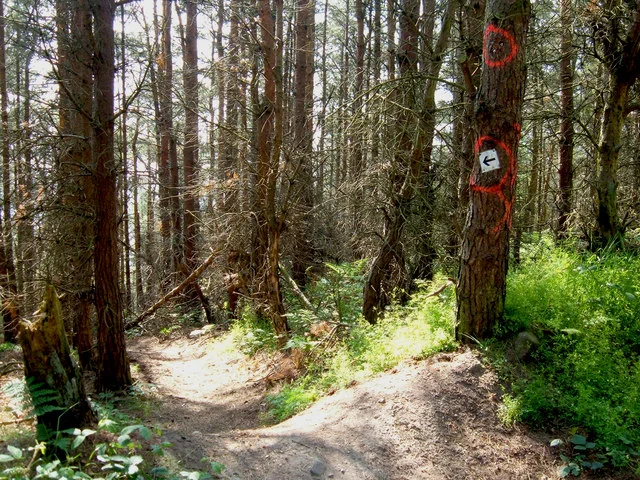
Stainburn is a compact forest riding destination west of Harrogate, where the short distances conceal a substantial technical challenge. Its official network pairs two red choices with Warren Boulder, a black route involving rocky ground, narrow singletrack and steep climbing as well as descending. Choose it for deliberate practice and repeated attempts at terrain that suits your skills. A three-kilometre black can demand more concentration than a much longer, smoother ride, so plan the session by difficulty rather than the odometer.
The forest has two arrival areas with different purposes. Norwood Edge gives access to the mountain-bike trails, maintained by SingletrAction volunteers alongside Forestry England. Stainburn Moor is the suggested starting point for a more relaxed woodland visit on foot. That distinction helps mixed groups organise the day: somebody wanting a quiet walk need not follow riders into the specialist technical network, and cyclists can go directly to the correct trailhead.
Stainburn Forest mountain bike trails and grades
Norwood Loop
Red · 2 km
A short flowing singletrack circuit through the trees, returning through clearfelled ground with Washburn Valley views. Follow red arrows on square discs. Use it to learn the forest’s riding character before choosing a more committing technical line.
This faster descent leaves the red loop and meets the black climb at the bottom. Follow the red downhill and black uphill arrows. Decide how you will return before dropping in: an easier-coloured descent does not remove the technical climbing connection.
Narrow, rocky singletrack with varied surfaces, steep climbs and descents makes this an experienced-rider choice. The volunteer builders highlight named challenges including The Slab, Hovis Corner and Cascade. Take time to inspect unfamiliar features instead of expecting a simple flowing circuit.
SingletrAction’s official information separates Norwood Loop, Descent Line and Warren Boulder. Use Norwood Edge for MTB access, not the separate walking car park.
Start at Norwood Edge and use the red loop as a considered first circuit. Ride conservatively enough to notice traction, braking points and the route junctions. The Descent Line is an optional extension, with a return involving the black climb, so make that decision while you still have energy. A rider new to mountain biking should choose a gentler venue first rather than treating Stainburn’s short red distance as a beginner introduction.
Experienced visitors can make Warren Boulder the main objective and work on one technical section at a time. The builders describe the return climb, Don’t Push Me, as part of the challenge, so save concentration for the uphill as well as the descent. Keep anyone inspecting an obstacle clear of the riding line, and let other riders pass before another attempt. Repetition is useful here when it improves control; stopping before fatigue spoils accuracy can make a better session than another full lap.
Where is Stainburn Forest?
For mountain biking, use Norwood Edge Car Park, grid reference SE 236523. Forestry England directs drivers from the A59 onto the B6451 towards Otley, through Bland Hill, with the car park about two kilometres farther on the right. Official directions →
For mountain biking, use Norwood Edge Car Park, grid reference SE 236523. Forestry England directs drivers from the A59 onto the B6451 towards Otley, through Bland Hill, with the car park about two kilometres farther on the right. The forest postcode is LS21 2RA. Select the actual car-park location rather than just the forest name, because Stainburn Moor has its own separate approach for walkers. Keep the trail entrance and access routes clear when unloading bikes.
Parking charges now apply, with RingGo and pay-by-phone available. Older accounts describing a free riding stop should not determine your arrival plan. Have a way to pay and allow a few minutes to sort parking before riding. Forestry England publishes twenty-four-hour access throughout the year; that is an access statement, not a guarantee that every individual feature is usable in every weather condition.
Harrogate station offers a rail arrival option for the town base, followed by a separately planned journey to Norwood Edge. Northern accepts bicycles subject to available space, so check the operator’s cycling guidance alongside your train. Include the road transfer and return journey in the plan; do not expect a train or confirmed bicycle-carrying bus to deliver you directly to the forest.
SingletrAction identifies two pump tracks beside the trail network, giving riders a place to practise momentum and turns before tackling the longer routes. The mountain-bike trails are the focus of the visit, so bring food, water and the repair items needed for your own bike. Arrange the post-ride meal away from the trailhead. Supporting the volunteer group’s work is also part of using this forest responsibly: report a damaged feature through its contact channel rather than altering it yourself.
Rocky terrain and steep technical sections put a premium on accurate braking when the ground is damp. Use the opening red lap to judge grip, then choose whether Warren Boulder fits the conditions and your confidence that day. The red loop’s clearfelled return and the forested sections offer different exposure, so carry a layer when stopping to inspect or discuss features. In shorter daylight, a focused session on familiar terrain is more realistic than exploring every possible connection.
Harrogate is the useful town base for a meal after riding. The Fat Badger on Cold Bath Road offers food in its restaurant, bar and beer garden, letting a group choose a full meal or a more relaxed pub stop. Allow time to change from wet or muddy kit before heading into town. Agree the meeting point before the forest visit if some companions are spending the day elsewhere, rather than expecting everyone to regroup at an unnamed trailhead café.
RHS Garden Harlow Carr, on the outskirts of Harrogate, provides a substantial non-riding outing. Its gardens make a different kind of outdoor day from technical forest practice, and the RHS publishes visitor information and tickets for planning the trip. Leave a separate block of time for it rather than squeezing a paid garden visit into the last few minutes after riding. A companion can enjoy the garden while cyclists practise at Stainburn, then meet for food in town.
Some links are affiliate links — if you book, we may earn a small commission at no extra cost to you.
Displayed distances are straight-line estimates using OpenStreetMap contributors (ODbL), not road journeys. Ask the property about secure bike storage and wet-kit arrangements before booking.
RIDE PREPARATION
Kit for this ride
Consider what suits the route, forecast and your own experience.
Norwood Edge serves the mountain-bike network. Stainburn Moor is a separate starting point suggested for a quieter woodland walk, so choose the right location when planning arrival.
How long is Warren Boulder?
Forestry England currently publishes 3 km. SingletrAction’s older description says 4 km; this guide uses the land manager’s current route figure. Either way, the black-grade technical demands matter more than its short length.
Is the Descent Line an independent easy loop?
No. It leaves the red loop and reaches the black climb at the bottom. Understand the return connection before taking the descent and keep enough energy for that climb.
Is parking still free?
Forestry England now states that charges apply, with RingGo and pay-by-phone available. Follow the parking instructions on arrival rather than relying on older free-parking descriptions.
Is Stainburn a good complete-beginner trail centre?
The official riding routes are red and black, including steep rocky sections. Build basic off-road confidence elsewhere first; use the pump tracks and red options within your ability when visiting.
Develop braking, cornering, climbing and technical riding through deliberate practice, with sensible progression for roots, rocks, steeps, wheel lifts and jumps.