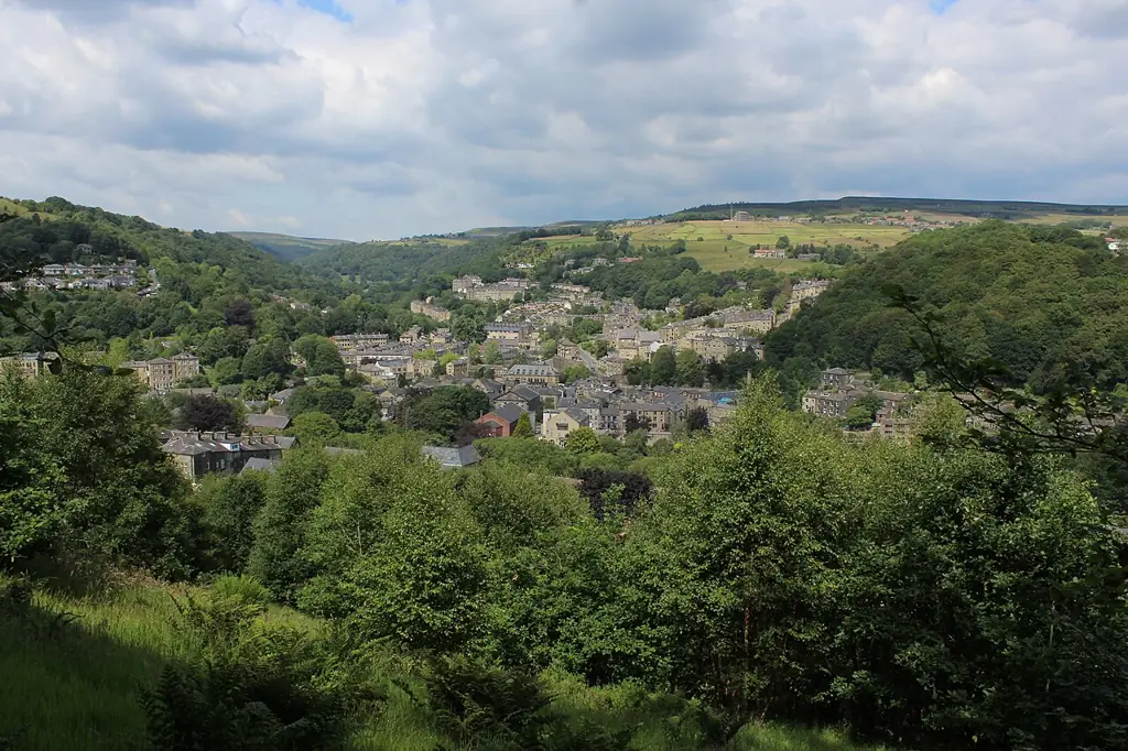
Hebden Bridge puts Calderdale’s steep bridleways and packhorse tracks within reach of a town base. Ride the Mary Towneley Loop for a longer South Pennine journey, or choose Hebden Dale MTB and the Great Descents Ride for valley climbs and technical natural descents. The council-partner publisher names Ragley, Blue Pig and Mini Stoodley in its mapped outings; use those complete itineraries and current access information.
OS Explorer OL21, South Pennines, covers Hebden Bridge and Todmorden, alongside Burnley and Keighley. Use its contours and rights-of-way markings to plan the climb as carefully as the descent. This is independently navigated shared riding, with roads and woodland connections. Match the effort and terrain to your least experienced rider and carry your own supplies.
Calderdale (Hebden Bridge): classic mountain bike routes
Mary Towneley Loop
75 km / 47 miles
The National Trails leaflet describes a physically challenging circular route through steep-sided South Pennine valleys, with grass tracks, stone setts, causeways, aggregate paths and quiet roads. It recommends considering an anticlockwise direction for mountain biking. This is the full regional loop, not a short circuit within Hebden Bridge; organise a suitable start, return and overnight plan if splitting it over days.
Cycle Calderdale’s published route takes in Walshaw, Widdop, Blackshaw Head and Ragley, with a tarmac approach, technical climbing and a connection to the Pennine Bridleway. Its route information identifies the Calder/Aire Link at Clough Foot and Gorple Lower Reservoir. Carry the complete route information and current access mapping: the description dates from 2014, so it is a planning reference, not a live assurance about every surface or sign.
MTB Great Descents Ride: Ragley, Blue Pig and Mini Stoodley
20.3 km
Cycle Calderdale’s mapped outing starts at Stubbing Wharf and links Ragley’s loose rock with the Blue Pig descent by Heptonstall. Blue Pig has stepped drops and a road crossing before further rocky obstacles. Later, Mini Stoodley descends a packhorse track and joins a rutted stone bridleway towards Hardcastle Crags. These are demanding natural descents, suited to experienced riders with controlled braking and a willingness to walk features. Follow the complete route, not an improvised woodland shortcut; the account dates from 2015 and current signs and restrictions take precedence.
The council-partner route page maps Hebden Dale MTB and supplies its route download. Plan public bridleways and the return connections, with current local closures considered separately.
Begin with a manageable permitted section and a clearly mapped way back into town. Download route information before leaving your accommodation, and identify places where you can shorten the ride without improvising through private land. Share the plan with someone who knows when you intend to return. For a group visit, agree that nobody disappears down a descent before the others know the next meeting point.
On unfamiliar stone tracks, choose speed that leaves room for a controlled stop and for other users. A packhorse route is a shared path, not a private downhill run. Leave space between bikes, stop beyond the riding line when regrouping and give horses and walkers time to pass. Walking a difficult section is a useful route decision when tired legs or slippery ground make the intended line unsuitable.
Where is Calderdale (Hebden Bridge)?
Calderdale (Hebden Bridge) is reached from Hebden Bridge. Use the official map and route-specific starting point. Official directions →
Hebden Bridge has a railway station listed by Northern, making a train-based visit worth considering. Plan the actual service and bicycle arrangements before travelling, and leave enough time for the onward journey to your accommodation or route start. Consult current station notices when access support matters: lift or toilet availability can change. Do not build a fixed itinerary around an assumed connection after a demanding ride.
If driving, select appropriate public parking for the chosen starting point and follow the signs and payment conditions there. Keep residential entrances, narrow lanes and farm access clear when unloading. A town-centre start and a hilltop start create different return arrangements; everyone should understand where the vehicle is before setting off. Avoid treating a pub’s parking as public trail parking without permission from the business.
Nearby planning base. This marker identifies a nearby riding base, not a trail entrance. Official coordinate source
Facilities
Pack water, food, tools and a spare way to deal with a puncture. These routes do not provide a staffed base at each junction, and an extra climb can use the energy saved for the return. Keep a map accessible alongside your downloaded route, and carry clothing for a stop in worse weather. A phone battery should cover navigation and a call for help, not just the outward climb.
For overnight riders, Hebden Townhouse says it can help arrange bicycle storage by prior contact. IOU Hostel separately offers bookable bicycle storage and a cleaning station, with its own conditions for e-bike charging; bikes and charging are not allowed inside the hostel. These are property services for a stay, not a promise of a public wash facility beside every route. Arrange what you need directly with the operator.
Plan a shorter circuit when daylight is limited or the forecast makes exposed riding unattractive. The Mary Towneley leaflet warns that conditions can range from torrential rain to hot sunshine; take a forecast for the hills as well as the town. If wet ground threatens control or makes progress unusually slow, return by a known permitted option before tiredness compounds the problem.
Access needs the same attention as weather. In England, open-access land does not automatically allow cycling: use public bridleways, byways or expressly permitted routes. Stay on the line authorised for bikes and observe temporary closures. The Pennine Way and Pennine Bridleway are different trails, so the familiar Pennine name is not enough to establish cycling rights on a proposed connection.
Camping and places to stay near Calderdale (Hebden Bridge)
A base in Hebden Bridge
Hebden Bridge offers overnight choices including the White Lion, Hebden Townhouse and IOU Hostel, with self-catering options at Hardcastle Lodge and Widdop Gate Barn in the surrounding area. Choose the location around your planned start and how the party will travel after riding. Ask directly about bicycle storage, arrival and any specific accessibility needs; a room booking alone does not settle those arrangements.
Non-riders can plan a separate visit to Hardcastle Crags and Gibson Mill. The National Trust identifies the Weaving Shed Café, woodland walks and toilets, with opening arrangements to consult before travelling. Its published woodland trails are walks and must not be repurposed as bike descents. A café visit there is a separate visitor plan, not evidence that every woodland path permits cycling.
Some links are affiliate links — if you book, we may earn a small commission at no extra cost to you.
Displayed distances are straight-line estimates using OpenStreetMap contributors (ODbL), not road journeys. Ask the property about secure bike storage and wet-kit arrangements before booking.
RIDE PREPARATION
Kit for this ride
Consider what suits the route, forecast and your own experience.
Is Hebden Bridge a dedicated mountain-bike trail centre?
No. It is a town base for a wider natural riding region. Plan permitted routes, climbing and navigation yourself, using the official or council-partner information linked here.
How long is the Mary Towneley Loop?
The National Trails leaflet gives 75 km, or 47 miles, for the complete circular route. It involves steep valley climbs and is different from a short local Hebden Bridge outing.
Are Hebden Dale and Great Descents current route descriptions?
Cycle Calderdale still publishes them, but the descriptions date from 2014 and 2015. Compare their mapped routes with current access, closures and conditions before relying on them.
Can I cycle anywhere on the surrounding open moors?
No. Open-access status alone does not grant cycling rights in England. Use bridleways, byways or landowner-permitted routes, and follow any signs restricting a particular path.
Can companions walk at Hardcastle Crags during my ride?
The National Trust publishes woodland walking routes and Gibson Mill visitor information. Arrange transport and a meeting time separately; walking directions should not be used as an assumed mountain-bike route.