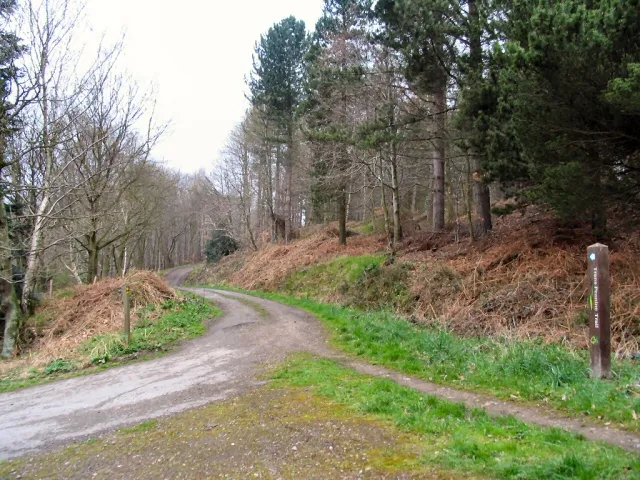
Wharncliffe Woods offers a demanding woodland mountain-bike outing on Sheffield’s northern edge. The steep setting suits riders who enjoy reading natural terrain and making their own route choices, with the ability to turn back when a section does not suit them. Its appeal is the combination of riding and a substantial forest landscape close to the city. Choose the day around the group’s experience, rather than assuming a familiar destination name guarantees an easy introduction.
Forestry England explicitly says there are no official waymarked, maintained trails here. That changes how a first visit should work: you need a navigable plan, a clear return and the judgement to assess what is ahead. A line used by other riders is not a published graded route. Treat the woodland as a place for considered exploration, with walking and horse riding also part of the setting, rather than expecting signed laps to organise the whole day for you.
Wharncliffe Woods mountain bike trails and grades
Natural mountain-bike trails
Forestry England describes challenging natural riding and says there are no official waymarked, maintained mountain-bike trails. No named maintained loop, distance or colour grade is published. Choose terrain to match your experience and do not construct unauthorised features.
Forestry England states that Wharncliffe has no official waymarked, maintained mountain-bike trails. Use its visitor information for access and its link to neighbouring Greno Woods; do not treat informal lines as a mapped official network.
On a first visit, make orientation the priority. Establish the Woodhead Road starting point and decide how you will recognise the route back before riding away. Keep the initial exploration short enough that you can retrace a known approach if the terrain becomes unsuitable. Do not let a group disappear down a line before everyone has had a chance to assess it. This is particularly useful when riders have different levels of confidence and the available route has no published grade to settle the decision.
Experienced visitors can enjoy the challenge of natural riding while keeping the session deliberate. Inspect an unfamiliar section, identify where you will stop and give the following rider space to make an independent choice. The absence of maintained, marked routes means you cannot transfer expectations from a purpose-built coloured loop. For a complete newcomer or a child expecting gentle signed cycling, choose an outing with clearer route guidance first; familiarity with a bike is different from being comfortable navigating steep woodland.
Neighbouring Greno Woods is separately managed by Sheffield & Rotherham Wildlife Trust. Its visitor page describes bridleways and three downhill trails, including Steel City. Treat Greno as a separate destination with its own access information; its managed trails do not change Wharncliffe’s ungraded status.
Where is Wharncliffe Woods?
Use the Forestry England car park on Woodhead Road, just north of Grenoside, with postcode S35 8PR. Parking is free. Official directions →
Use the Forestry England car park on Woodhead Road, just north of Grenoside, with postcode S35 8PR. Parking is free. Set the meeting point at that entrance rather than merely naming the woods, particularly if companions are approaching from different parts of Sheffield. Prepare your route before unloading, and avoid beginning with everyone already riding while one person is still deciding where the group should go. Keep the access clear when waiting or getting bikes ready.
If combining riding with a meal or a separate walk, agree the sequence before starting. A companion at a different access point should not be expected to find an unwaymarked riding line as a meeting place. Use a specific return time and recognise that navigation, inspection and regrouping may take longer than the actual riding. The free parking is convenient, but it should not encourage a much longer circuit than the group can comfortably retrace or complete.
Wharncliffe’s visitor information provides access and parking details rather than a serviced cycling-hub package. Bring your own food, drinks and the equipment needed to finish the planned outing, and organise any essential comfort stop before entering the woods. Do not build the day around finding a café, hire desk or washing station at the car park. If a particular facility is essential to someone’s participation, settle that requirement before making the forest your meeting point.
There are no designated accessible parking spaces according to the land manager. That matters when planning a mixed group, and the steep riding setting requires a separate assessment from simply reaching the car park. Forestry England also asks riders not to construct unauthorised features. Enjoy the existing landscape without changing it, and keep a route choice flexible enough that walking a section or finishing early remains a practical option for everybody.
The hillside contains streams and old quarry workings, so woodland conditions deserve attention rather than a fixed expectation from an earlier visit. In damp weather, leave more time for inspection and shorten the plan if confidence drops. In autumn, give yourself daylight for navigating back, even though the woods have continuous access. A late start is less forgiving when the route is unfamiliar. Carry away food packaging and avoid fires or disposable barbecues; a break should leave the woodland as you found it.
Grenoside is a practical local base for a meal after riding. The Red Lion on Penistone Road has its own food menus and reservation service, making it a specific choice for a group reunion. The kitchen’s hours differ from the bar’s, so book around a realistic riding finish and allow time to change beforehand. Specify Penistone Road when arranging the meeting rather than relying on a similar pub name. Choosing the meal first also gives non-riding companions a clear destination beyond the woods.
For a non-riding nature visit, Wharncliffe Heath Local Nature Reserve includes heathland, mixed woodland, ponds and part of Wharncliffe Crags. The Heathlands Trust manages it with the Forestry Commission and asks visitors to protect grazing livestock and vulnerable vegetation. Plan a walk as its own activity instead of using it as an assumed bike-route extension. Keep dogs under control and take time to look at the landscape; the reserve offers a different perspective on the area from a focused riding session.
Some links are affiliate links — if you book, we may earn a small commission at no extra cost to you.
Displayed distances are straight-line estimates using OpenStreetMap contributors (ODbL), not road journeys. Ask the property about secure bike storage and wet-kit arrangements before booking.
RIDE PREPARATION
Kit for this ride
Consider what suits the route, forecast and your own experience.
Are Wharncliffe’s bike trails officially waymarked?
No. Forestry England explicitly says there are no official waymarked, maintained trails. Bring a clear navigation and return plan rather than expecting signed laps.
Is there a published blue or red loop?
The operator does not publish named coloured loops for Wharncliffe’s natural riding. Choose from the actual terrain and your experience, not an assumed colour grade.
Where should I park for this visit?
The land manager identifies the free Woodhead Road car park just north of Grenoside, using postcode S35 8PR. There are no designated accessible parking spaces.
Can riders build or change trail features?
Forestry England asks riders not to build unauthorised features. Riding access does not give permission to alter the woodland or construct obstacles.
Does the woodland have a daily closing time?
Forestry England publishes 24-hour access, seven days a week. Plan an unfamiliar riding visit around daylight rather than treating access hours as a judgement of suitable conditions.
Develop braking, cornering, climbing and technical riding through deliberate practice, with sensible progression for roots, rocks, steeps, wheel lifts and jumps.