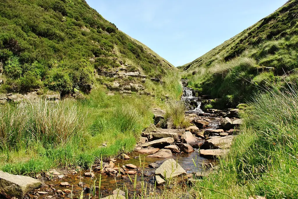
Ride Jacob’s Ladder’s rocky bridleway, follow the cycle-legal line across Rushup Edge, or choose Hayfield Highs and the Upper Derwent reservoir routes. The Dark Peak combines demanding packhorse tracks with gentler valley outings. Hayfield, Edale and Fairholmes offer distinct starts; choose your ride first. This is natural countryside riding, with shared paths and navigation, so the route determines the day’s difficulty.
Jacob’s Ladder is Edale Bridleway 19. Rushup Edge’s Kinder Loop follows the bridleway beside the footpath, using its gates. OS Explorer OL1 covers the Dark Peak; add OL24 for the White Peak. Follow the chosen itinerary and current access notices: nearby summit paths have different rights.
Peak District: classic mountain bike routes
Jacob’s Ladder, Edale
Jacob’s Ladder is an established mountain-bike challenge, recorded as Edale Bridleway 19 in official access-forum notes. Cycling UK offers it as a tougher Great North Trail alternative. Plan the approach and return, allow for pushing, and keep to the bridleway. The status record is not a current surface or closure report.
The official Kinder Loop links Rushup Edge with Ladybower via Edale on steep, stony bridleways and road sections. Its guide identifies the split from the footpath: pass through the gate to the right of the wall and follow the bridleway. Use the complete sheet around Mam Tor, keeping summit footpaths separate.
National Trails publishes this circuit around Hayfield, Chinley and Rowarth, using Pennine Bridleway sections. Download its route sheet and identify road links and return options. It is a natural mountain-bike outing, without trail-centre colour grading. OS Explorer OL1 is the relevant sheet.
The National Trust’s named ride circles the three reservoirs. Use its complete itinerary to distinguish cycle routes beside the water from walking paths onto the moors. The distance applies to this published ride, not every reservoir variant. Carry OS Explorer OL1.
This National Trust cycling option links the two valleys. It is a separate ride from the three-reservoir circuit; combining them changes the demands. Establish your start, road connections and finish from the published information, using OS Explorer OL1.
Derbyshire’s former-railway trail links Hayfield and New Mills; the Hayfield–Birch Vale section forms part of the Pennine Bridleway. It offers gentler riding. The council identifies the section west of St George’s Road in New Mills as unsuitable for cyclists: turn before it.
Choose a named regional itinerary and its own map. OS Explorer OL1 covers the Dark Peak; Jacob’s Ladder and Rushup Edge need the appropriate bridleway/byway route.
For an experienced visitor, Hayfield Highs gives a defined circuit; the Jacob’s Ladder alternative demands more technical confidence. Download the selected itinerary and mark regrouping points and return options on OL1. Natural routes can involve pushing, gates and navigation stops. Allow time to establish your position whenever the line becomes unclear.
For novice or family groups, ride the cycle-suitable Sett Valley section as an out-and-back. Experienced visitors can choose a National Trust valley itinerary. Natural routes carry no trail-centre grade: distance alone does not establish difficulty.
Where is Peak District?
Choose your actual starting point before opening the satnav. Hayfield suits Hayfield Highs and the Sett Valley Trail; Fairholmes serves the Upper Derwent cycle-hire base. Official directions →
Choose your actual starting point before opening the satnav. Hayfield suits Hayfield Highs and the Sett Valley Trail; Fairholmes serves the Upper Derwent cycle-hire base. The hire centre gives its address as Fairholmes car park, Derwent, Bamford, S33 0AQ. Its car park is managed by Severn Trent Water and uses pay-and-display machines. Read the tariff on arrival; no single parking price applies across this whole region.
Edale has a railway station and village refreshments, with the main pay-and-display car park and toilets at the bottom of the village managed by High Peak Borough Council. A rail arrival still needs a cycle-legal connection to your chosen ride. Around Castleton and Rushup Edge, follow the council’s current parking restrictions and marked bays. Keep gateways and passing places clear when loading bikes.
Nearby planning base. This marker identifies a nearby riding base, not a trail entrance. Official coordinate source
Facilities
Fairholmes has cycle hire, a refreshment kiosk, toilets including accessible facilities, picnic tables and ranger services. The hire team also offers repairs and servicing. Reserve a suitable hire bike and ask about your intended route; a bike selected for an easy reservoir outing is not automatically the right choice for more demanding riding elsewhere in the Peaks.
Derwent hire requires photo identification, proof of address and card payment; accessible bikes need advance arrangement because availability is limited. The operator reports no mobile signal or wi-fi in the valley, so arrange payment and download information beforehand. These facilities belong to that base, not every moorland junction or village. Carry food, water and the spares required to get your own bike home.
Bike hire at Peak District
Derwent Cycle Hire operates at Fairholmes, with repairs and servicing. Bring photo identification, proof of address and a payment card; accessible bikes need advance arrangement.
Natural riding here needs an outdoor plan as well as a mechanical one. The National Trust warns of unpredictable weather, muddy or slippery ground and patchy mobile reception. Carry an offline map and a means of navigating if your phone stops working. Tell someone your route and return plan. In short daylight, reduce the itinerary early enough to finish with a comfortable margin.
Access rules: ride public bridleways, restricted byways and other routes with established cycle rights or permission. Open-access moorland does not create a general cycling right, and a public footpath is not automatically a bike route. Follow temporary closure signs and remain on the legal line. Give people and horses room, close gates as found, and avoid widening a muddy track into its surrounding vegetation.
Hayfield is the practical base for a Hayfield Highs visit; Edale makes sense when the planned ride and onward travel suit the Hope Valley. Edale’s official visitor information identifies food and refreshments in the village and near the station. Pick accommodation around the route start, and arrange bike storage directly with the host before committing to several days of riding.
For a non-riding outing near the Sett Valley end, Derbyshire County Council points visitors towards the Torrs Riverside Park and Millennium Walkway in New Mills. Explore these on foot: the trail’s western cycling limitation still applies. Do not plan an ordinary drop-in visit to Edale’s Moorland Centre; the National Park says there is no public access without a prior appointment.
Some links are affiliate links — if you book, we may earn a small commission at no extra cost to you.
Displayed distances are straight-line estimates using OpenStreetMap contributors (ODbL), not road journeys. Ask the property about secure bike storage and wet-kit arrangements before booking.
RIDE PREPARATION
Kit for this ride
Consider what suits the route, forecast and your own experience.
Is the Peak District good for beginner mountain bikers?
There are gentler options, including the cycle-suitable part of the Sett Valley Trail. Choose that kind of outing first; an upland route with a similar distance can require substantially more preparation.
How long is Hayfield Highs?
National Trails describes the circuit around Hayfield, Chinley and Rowarth as 27 km. The route includes Pennine Bridleway sections; use its official sheet to understand the complete itinerary.
Can I cycle anywhere on Kinder Scout?
No. Open-access land does not provide general cycling permission. Use routes with cycling rights or the landowner’s permission; a walking itinerary across Kinder is not automatically suitable or lawful for a bike.
Can I hire a bike in the Upper Derwent Valley?
Yes. The National Park’s Derwent hire centre is at Fairholmes. Book ahead and bring the required identification, proof of address and payment card. Arrange accessible bikes directly with the centre.
Which map should I bring for the Dark Peak?
OS Explorer OL1 covers the Dark Peak area. Combine it with the chosen official route sheet and current closure information; a map title alone does not identify your complete ride.