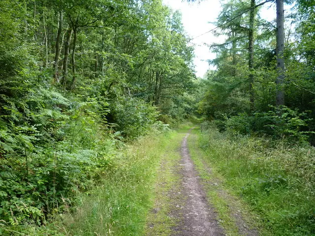
Eastridge Woods is a hilltop mountain-bike destination near Habberley in Shropshire, with a red cross-country route and black downhill riding identified by Forestry England. Revelation is the named starting point for riders who enjoy technical woodland terrain: rocks, roots, mud and demanding climbs lead into tight descents. The trails were developed with the Eastridge Trail Partnership. Expect a compact woodland riding day that depends on your own preparation and current trail signs.
The official riding page does not present a beginner progression network. Arrive already comfortable with challenging off-road surfaces and make the day's plan around the least confident rider. A short published distance can conceal a tiring combination of climbing, repeated braking and slow technical sections. Leave room for inspection, walking and recovery between runs; the useful measure of a successful first visit is staying in control on unfamiliar ground.
Eastridge Woods mountain bike trails and grades
Revelation Trail
Red — hard · 8.4 km / 5.2 miles
Forestry England describes Revelation as a hard route with rocks, roots, mud, tough climbs and steep, tight descents. Its natural surface requires attention throughout the lap. Start at a controlled pace and choose a line you can stop within, especially where visibility is restricted. Walk an unfamiliar feature if its exit is unclear. The published length applies to Revelation itself; any extra forest-road climbing or repeated sections add to the outing.
The land manager lists three downhill trails, with unsurfaced ground, steep descents, tight turns, berms and jumps. It does not name them individually on the current public page, so use the authorised trail signage to identify your chosen run. This is a separate decision from riding the red route. Inspect unfamiliar take-offs and landings without obstructing another rider, and establish the return climb before committing to repeated descents.
Choose Revelation for an initial outing if red technical riding is already within your experience. Read the entry information, establish the route direction and give the group time to settle into the surface. Stop in a clear place when regrouping and leave room for others to pass. The first lap should reveal where you need to slow, push or pause before you decide whether another circuit is sensible.
Experienced downhill riders should still start with inspection and a conservative first run. Forestry England advises full-face helmets and body armour on these trails. Bring protection suitable for the planned riding, and ensure it fits without restricting movement or vision. Protective equipment does not make a jump or steep turn manageable if you cannot judge the approach and exit. There is no obligation to ride every feature in a visit.
Where is Eastridge Woods?
Use Forestry England's Eastridge Woods destination at Habberley, Shrewsbury, SY5 0TP. Its directions approach from Shrewsbury on the A488 towards Minsterley, then use Callow Lane and the signed local route. Official directions →
Use Forestry England's Eastridge Woods destination at Habberley, Shrewsbury, SY5 0TP. Its directions approach from Shrewsbury on the A488 towards Minsterley, then use Callow Lane and the signed local route. The final approach includes a narrow lane, so drive slowly and leave space for oncoming users. A postcode alone is not enough to identify the most suitable parking approach; use the land manager's directions as well.
The official visitor page identifies a small free car park on the eastern side of the wood. Park within the designated area and leave room for bikes to be unloaded safely. If it is full, choose another lawful arrangement without blocking a gate, lane or residents' access. Make a return plan while everyone is together, particularly when several drivers or companions will be leaving at different times.
Approximate trail-area pin. This marker identifies the riding area; follow the official arrival directions to its entrance. Official coordinate source
Facilities
Plan this as a self-supported forest visit. The official page confirms parking and riding access but does not advertise a trailhead café, hire service or bike wash. Organise food, toilet stops and any equipment hire separately before arrival. Carry essentials instead of making the riding day depend on an unverified service being available beside the car park.
The woodland also welcomes walkers and horse riders. Forestry England identifies a Ride Shropshire horse-riding route on the perimeter forest roads and the Shropshire Way passing through the wood. Slow at shared connections and keep entrances and exits clear. Do not assume a walking route is a bike-return line, or that a track visible beyond the signed network is an authorised mountain-bike trail.
Forestry England permits access from dawn until dusk throughout the year. The small car park on the east side of the woodland is free; keep gateways and narrow access lanes clear.
Forestry England publishes woodland access from dawn until dusk throughout the year. That describes access hours, not a promise that every trail is available in every condition. Read any temporary notices when arriving and respect closed sections. If a barrier interrupts the intended route, use an authorised alternative or shorten the day; an online route record does not override an on-site restriction.
The downhill trails are explicitly unsurfaced and change with weather and season. Set the pace from the surface in front of you, leaving extra room to brake when grip is uncertain. Wet roots, mud and leaf cover deserve a deliberate first run. Stop if control is deteriorating through fatigue, and finish with enough daylight to return through the woodland and pack safely.
Eastridge is included in the Stiperstones nature-reserve landscape. Keep riding to the authorised network, take litter home and leave vegetation and trail features alone. Forestry England prohibits barbecues, campfires and stoves in the forest. Bring food that needs no flame and support the partnership's maintained routes through considerate use.
Shrewsbury is a useful overnight base when the group also wants town restaurants and a separate evening outing. Lion + Pheasant publishes hotel accommodation on Wyle Cop; arrange bicycle storage directly before booking. Confirm the transport between town and the forest independently, especially if travelling by rail. A town hotel address does not imply a straightforward traffic-free ride to the trailhead.
For companions, Snailbeach Lead Mine offers a separate local heritage visit. Shropshire Mines Trust publishes surface information and guided underground visits, with buildings and tours dependent on its volunteer opening programme. Arrange a tour in advance when required and use its latest visiting information. Agree a meeting place away from the downhill exits, so a non-riding outing can run at its own pace.
Some links are affiliate links — if you book, we may earn a small commission at no extra cost to you.
Displayed distances are straight-line estimates using OpenStreetMap contributors (ODbL), not road journeys. Ask the property about secure bike storage and wet-kit arrangements before booking.
RIDE PREPARATION
Kit for this ride
Consider what suits the route, forecast and your own experience.
Forestry England gives 8.4 km, or 5.2 miles, for the red route. Extra climbing, repeat laps and road connections are separate from that figure, so plan the whole outing accordingly.
Are the downhill trails suitable for beginners?
The official grade is black, severe. Riders need experience appropriate to steep technical descents and jumps. Choose a different destination if the group needs a beginner trail; protective equipment does not replace the necessary skills.
Is there a confirmed blue route?
The current Forestry England riding page lists Revelation and the black downhill trails. This guide does not recommend a blue route without current land-manager confirmation; older online descriptions may not represent the available network.
Do I need a full-face helmet?
Forestry England advises full-face helmets and body armour on these trails. Bring suitable protection and inspect unfamiliar features before committing to them, even when you regularly ride comparable grades elsewhere.
Is the car park free?
The land manager currently identifies a small free car park east of the wood. Spaces are limited by its size. Park considerately and avoid obstructing lanes, gates or neighbouring properties.
Develop braking, cornering, climbing and technical riding through deliberate practice, with sensible progression for roots, rocks, steeps, wheel lifts and jumps.