
Green Loop
Green · 4 km
The official map presents this as the introduction to Glenlivet’s trails. Choose it when a shorter opening ride will help the group settle in and decide how much more cycling to add.
Official route information →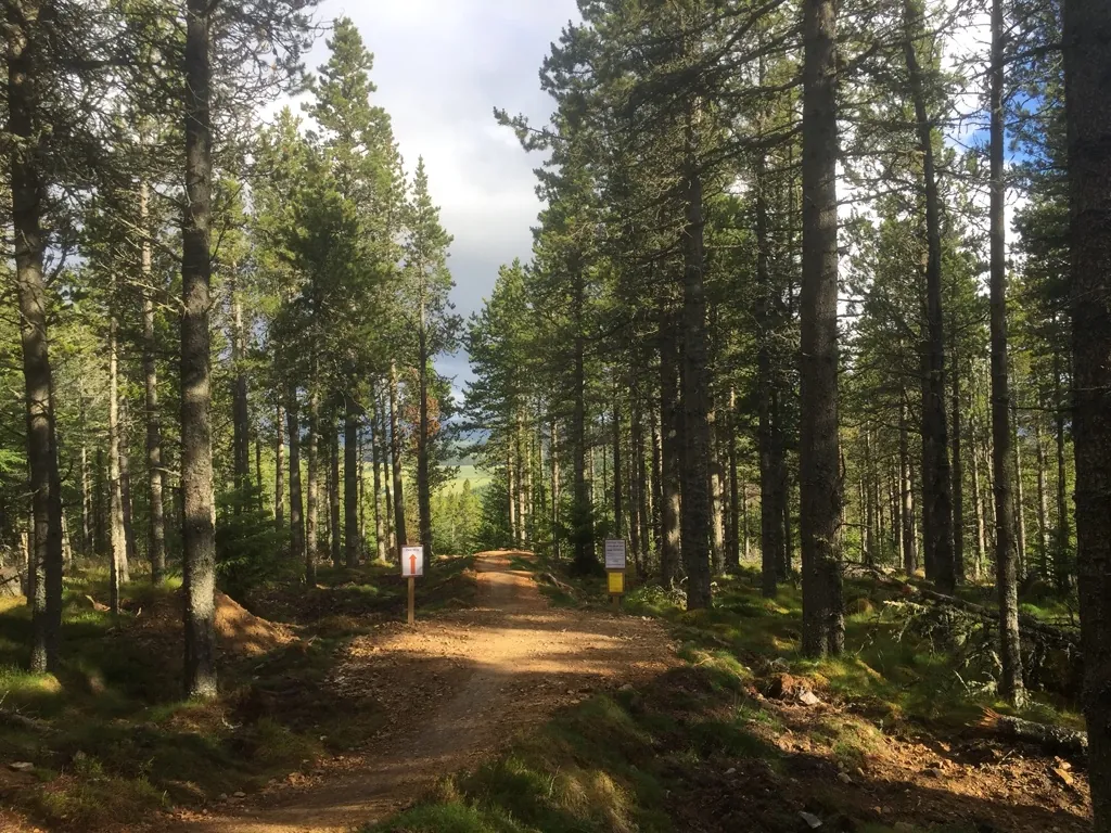
Glenlivet Estate, Moray
Bike Glenlivet combines cross-country loops, short flowing trails and freeride riding on the Glenlivet Estate in the Cairngorms National Park. It is a destination where a family can choose an introductory circuit while experienced riders head for a longer hill ride or a dedicated jump session. The café hub, pump track and skills area give the group a clear place to start and regroup.
The distinction between those activities matters. A long red cross-country outing towards Carn Daimh asks different questions from repeating blue berms close to the café, while the orange freeride trails require the skills and commitment to tackle jumps and gaps. Decide which experience you want before choosing a route. Tomintoul provides a nearby village base for meals and a separate heritage visit, extending the trip beyond the riding hub.
Green · 4 km
The official map presents this as the introduction to Glenlivet’s trails. Choose it when a shorter opening ride will help the group settle in and decide how much more cycling to add.
Official route information →Blue · 9 km
This is the established novice-to-intermediate loop. Give yourself time to learn the route rather than automatically adding every nearby blue section to a first outing.
Official route information →Blue · 5.5 km
The map describes a more challenging blue combination of berms and rollers. It offers a focused option when practising turns is the purpose of the session.
Official route information →Red · 22 km
The mapped cross-country loop combines climbing and singletrack descent, with optional black features. The operator describes the red riding reaching Carn Daimh, making it the substantial hill outing.
Official route information →Orange · 2.5 km
The map’s loop links berms, jumps and rollers for experienced riders. This loop distance includes the riding connection; it is not a claim that every individual freeride descent is 2.5 km.
Official route information →The operator grades Upper Mini DH red and Lower Mini DH black. Assess the progression between them as a deliberate increase in difficulty, rather than continuing downhill without considering the next section.
Official route information →The estate map separates green and blue loops, the longer red outing and freeride areas; start from the signed trail hub.
For a first visit, take a map from the café or photograph the copy outside. Start with the green loop or a blue choice matched to the whole group, then use the hub to decide whether to add another ride. The skills area is intended to introduce the demands of different grades. That gives a more controlled way to gauge confidence than selecting the longest circuit immediately.
Experienced cross-country riders can make the red loop their main outing, allowing time and energy for the climb towards Carn Daimh and the return. Riders seeking short repeats can instead explore the operator’s blue flow options, including Barrel Run and Underthinker, or suitable Mini DH sections. The Orange and Keiran’s Line are for experienced jump riders. Inspect the features before attempting them and keep the group’s cross-country and freeride expectations separate.
Bike Glenlivet is reached from Tomintoul. Use AB37 9AR alongside the official entrance directions. Official directions →
The trail centre is off the B9136, about 4.5 miles from Tomintoul. The estate advises following the brown tourism signs as you approach and warns that the postcode alone may not take satellite navigation to the hub. Use Glenlivet Bike Trails, Kirkmichael, AB37 9AR, together with the mapped entrance when organising the last part of the drive.
The operator currently lists parking at £3 for two hours or £5 for a full day, paid by cash or card. Trail use is free, and parking revenue supports maintenance and development. An hour is free for café users. Choose a ticket that allows for both the ride and regrouping time, particularly for the long red loop. Arrange any onward travel before heading into the network.
Find the planning area on a map →The hub has a café, toilets, pump track and skills area; the official map also identifies bike wash. Hire includes adult hardtails, children’s bikes and full-suspension e-bikes, with helmets included. Booking ahead helps secure the right type and size. A hire session and a café visit have seasonal operating hours, even though the trails and toilets are available all year. The café carries a small selection of bike spares, useful for a minor problem without assuming a full workshop service.
Bike Glenlivet hires adult hardtails, children’s bikes and full-suspension e-bikes, with helmets included. Half-day and full-day sessions have defined collection and return times.
Riding is free; parking is £3 for two hours or £5 all day, paid by cash or card. Café and hire sessions have their own seasonal hours.
The operator explicitly keeps the trails and toilets open 24/7 throughout the year, subject to weather. The hill-going red route needs a different weather judgement from a short loop around the hub. Hand-dug trails are described as often wet and wild, so do not assume they behave like the constructed flow trails after rain. In winter, plan food and equipment independently of seasonal café and hire services. Daylight and conditions should determine the length of your outing.
Tomintoul is the natural village base. The Clockhouse Restaurant on the Square advertises lunch, dinner, coffee and home baking, with contemporary Scottish food. Its published operation is seasonal, from April through October, so arrange a reservation around the actual date of your trip. The trail-centre café suits meeting during the riding day; a village meal works well once everyone has finished and the bikes are stored.
For a non-riding visit, the Tomintoul and Glenlivet Discovery Centre in the village square explores local history and heritage and holds an archive of records and oral histories. It opens seasonally. The estate’s separate visitor centre at the end of Main Street offers countryside information, with a short woodland path, ponds and wildlife hides nearby. Choose one of these outings for companions who want a different pace from the trails.
Some links are affiliate links — if you book, we may earn a small commission at no extra cost to you.
Displayed distances are straight-line estimates using OpenStreetMap contributors (ODbL), not road journeys. Ask the property about secure bike storage and wet-kit arrangements before booking.
RIDE PREPARATION
Consider what suits the route, forecast and your own experience.
Yes. The official loop map gives a 4 km green introduction. It is a useful starting point before deciding whether the group wants an established blue loop or a longer outing.
The current official map gives 22 km, with climbing, singletrack descent and optional black features. Allow for a substantial cross-country ride rather than treating it as a short session beside the café.
The operator reserves The Orange and Keiran’s Line for experienced riders because of jumps and gaps. Start with the introductory or blue options and use the skills area to assess progression.
Yes. The operator offers full-suspension e-bikes for full-day hire as well as conventional adult and children’s bikes. Reserve the required size and confirm seasonal availability before travelling.
The trails and toilets are open throughout the year, weather permitting. Café and hire services are seasonal, so bring the food and equipment needed for a ride outside their opening periods.
Cairngorms, Highlands
Fochabers / Ordiequish / Winding Walks
Cairngorms & Moray
Cairngorms & Moray
Cairngorms & Moray
Set up mountain-bike fit, pedals, gearing, suspension and dropper controls using the right manuals, then test changes safely on familiar terrain.
Validate GPX routes, prepare offline maps and power, protect shared ride data and plan safe decisions and emergency contact away from the trailhead.
Book the right uplift, riding pass, hire bike and coaching session, check equipment and carriage rules, and plan a controlled first bike-park day.
Trail conditions change — check the official page before you travel.
Open official site →