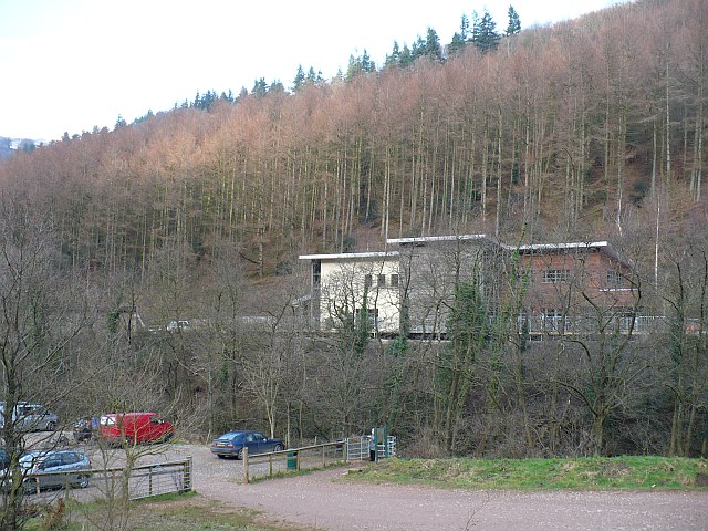
Cwmcarn puts proper hillside mountain biking within reach of the South Wales valleys. Its reds wind through wooded slopes and onto open ground with Bristol Channel views, while the downhill routes demand a different level of commitment. The attraction is the combination: a single visitor-centre start gives access to sustained cross-country riding and advanced descents, rather than a collection of interchangeable short laps. Expect to earn your riding on the pedal-powered routes.
Natural Resources Wales now lists five named trails, including blue-graded Pwca alongside Twrch, Cafall, Pedalhounds and Y Mynydd. Choose by your off-road experience rather than your enthusiasm for descending. The red routes involve substantial climbing and technical surfaces; the black and extreme options are further steps in difficulty. The forest is also a visitor destination with walking routes and a café, so companions can have a separate day without following bikes onto singletrack.
Cwmcarn Forest mountain bike trails and grades
Pwca
Blue
The moderate option in the current land-manager trail list. Make this your starting point if red-grade riding is beyond your present experience, and use the information panel at the visitor-centre car park to identify the waymarked route. A blue grade still calls for mountain-bike handling; it is not a promise of a flat family path.
The linked official trail leaflet gives a shorter distance than some older descriptions. Almost the whole circuit uses purpose-built singletrack through broadleaf and conifer woodland and open ridges. Flowing stretches alternate with tighter technical riding, and steep wooded side slopes make accurate line choice more important than simply carrying speed.
A substantial cross-country outing with steep climbs and technical descents. The map names Hideout, Rocky Valley, Heartbreak Ridge and Powderhouse among its sections. Its remoter setting is part of the appeal, but allow enough energy for the return rather than treating the first descent as the whole objective.
An optional linear trail accessed from Cafall, following an old hand-built line down the valley’s steep north side. Roots, rocks, stumps and drops lead into a fast final jump section. Its severe grade requires more advanced skills and equipment than the red circuit. The leaflet strongly advises larger-travel bikes, full-face helmets and body armour.
NRW classifies this downhill trail as extreme. The council description includes berms, jumps, rock steps and two upper runs that merge. It is a specialist choice rather than a red-trail progression made on impulse. The bottom section is currently closed for bridge repairs; that restriction overrides older maps and descriptions.
Twrch and Cafall are distinct XC circuits, with downhill riding a separate route choice. This leaflet maps Twrch; use the operator page for the other trail leaflets and current restrictions.
For a first visit with limited trail experience, choose Pwca and read the current route board before setting off. Experienced red riders can use Twrch as their introduction: its published 440 metres of climbing still deserves a proper time allowance. Ride unfamiliar technical sections conservatively, particularly where the singletrack crosses steep slopes. Learning the route is a worthwhile first-lap goal.
Fit, confident cross-country riders should consider Cafall for the more demanding outing. Carry food, drink and clothing for time away from the visitor centre, and leave Pedalhounds optional until you reach its junction in good shape. Downhill riders should establish exactly what is accessible on Y Mynydd before planning repeated runs; do not assume a mapped finish is available during the bridge closure.
Where is Cwmcarn Forest?
Approach from the M4 corridor and follow signs for Cwmcarn Forest rather than relying on the final satnav instruction: the council warns that navigation systems can lead into a housing estate. Start at the visitor-centre car park and its trail information panel. Official directions →
Approach from the M4 corridor and follow signs for Cwmcarn Forest rather than relying on the final satnav instruction: the council warns that navigation systems can lead into a housing estate. Start at the visitor-centre car park and its trail information panel. The published parking tariff is £1 for two hours or £3 all day, making the longer ticket a sensible choice for a red circuit with preparation and a break.
Crosskeys is the nearest railway station; the council describes the visitor centre as roughly a fifteen-minute walk away. Plan that connection and check cycle carriage with your train operator before travelling with a bike. The convenient bus stops are on Silver Street, on Twyncarn Road in Pontywaun, along the main approach. The forest-drive admission is a separate visitor product, not the valley-floor parking tariff.
The visitor centre provides maps and local information, and NRW lists toilets and picnic space. Raven’s Café is operating a limited menu of hot drinks, cakes, toast and teacakes, so bring a riding lunch if those will not cover your day. Its published opening is 9.30am–4pm Saturday to Thursday and until 3.30pm Friday. The centre closes over Christmas and New Year; plan supplies independently of an early or late arrival.
Visitor-centre parking costs £1 for two hours or £3 all day. The centre normally opens 9am–5pm, with a winter Friday 4.30pm close and Christmas/New Year closure. Forest Drive admission and hours are separate from parking for a ride.
Twrch is described by the council as an all-weather route, but that describes its riding surface rather than guaranteed access. Wet roots and tight sections deserve slower entries, while the open ridge stretches can feel very different from the sheltered car park. Cafall’s remote hillsides make changing weather a practical concern. In winter, shorten ambitions when daylight is limited and carry a layer for a mechanical stop after a sweaty climb.
Use Raven’s Café at the valley-floor visitor centre for a drink and cake after riding. Its current restricted offering is useful for a short stop, but do not schedule a full hot meal around the older general café description. Bringing sandwiches also keeps a longer Cafall day flexible: you can eat when you need to rather than rushing the final technical sections to reach a counter.
For a non-riding outing, choose the one-mile Nantcarn Walk around the stream and lake. The council notes uneven surfaces and two kissing gates, so it is not an uncomplicated pushchair circuit. The gentler Bluebell Walk is 1.2 miles, with woodland, ponds and valley views; May flowers or autumn leaves give companions a reason to linger while the riding group is on the hillside.
Some links are affiliate links — if you book, we may earn a small commission at no extra cost to you.
Displayed distances are straight-line estimates using OpenStreetMap contributors (ODbL), not road journeys. Ask the property about secure bike storage and wet-kit arrangements before booking.
RIDE PREPARATION
Kit for this ride
Consider what suits the route, forecast and your own experience.
The current linked leaflets give Twrch as 13.4 kilometres with 440 metres of climbing, and Cafall as 15 kilometres with 560 metres. Twrch is shorter on those measures, but both require proficient off-road skills and enough stamina for the climbs.
Is Y Mynydd fully open?
The land manager currently lists its bottom section as closed for bridge repairs. Follow the access instructions on site and plan only the permitted riding; an old downhill map does not cancel the closure.
Must I ride Pedalhounds when doing Cafall?
No. Pedalhounds is an optional black-grade branch, not a compulsory part of the red experience. Stay with the red route if the harder trail is outside your ability or you have already spent your energy on the climb.
Can I get to the forest without driving?
Crosskeys station provides a rail approach, with a walking connection to the visitor centre described by the council. Silver Street bus stops also serve the entrance road. Check the journey and any bike restrictions before choosing your service.
Can I rely on the café for a riding lunch?
Its current notice restricts the menu to drinks, cakes, toast and teacakes. Carry a more substantial lunch for a long ride, especially if you expect to spend several hours on Cafall.
Develop braking, cornering, climbing and technical riding through deliberate practice, with sensible progression for roots, rocks, steeps, wheel lifts and jumps.
Plan bike reservations, station access, car-rack limits, ferry boarding and flight packaging, including e-bike battery restrictions and car-free trail connections.
Official links
Trail conditions change — check the official page before you travel.