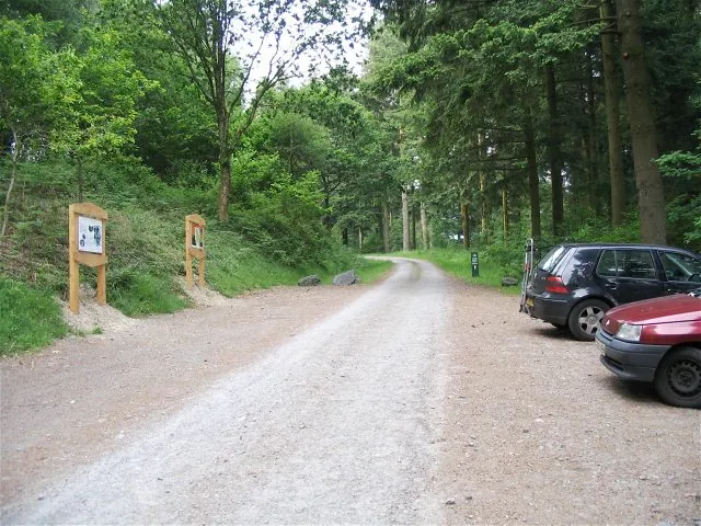
Access note: Most of the mountain-bike trail remains closed after storm damage. NRW currently permits a temporary 2 km loop reaching the final singletrack descent from the car park; follow its temporary arrows. The waterfall walking trail is closed.
Cwm Rhaeadr is a compact mountain-bike destination in the upper Tywi Valley, north of Llandovery. Its full red route combines a forest-road ascent with singletrack descending across a rocky ridge. The woodland setting and views towards the valley and waterfall give this short ride a character of its own. It suits riders who enjoy a concentrated technical outing and want time afterwards for a picnic or a town visit, rather than choosing from a large menu of graded trails.
The current visit is more restricted: storm damage has closed most of the mountain-bike route, with the final descent available through a temporarily signed two-kilometre loop. Plan around that shorter outing rather than assuming the original circuit is rideable. The forest also offers an accessible woodland walk, so a mixed group can have separate cycling and walking plans. Keep those plans distinct: an accessible walking surface says nothing about the difficulty of the red singletrack.
Cwm Rhaeadr mountain bike trails and grades
Temporary mountain-bike loop
2 km
Follow the temporary arrows from the car park along the forest road to the reopened final singletrack descent. This is the currently advertised riding option; the full route’s distance and climbing figures do not describe this diversion.
The published full circuit climbs on forest roads before a brief technical section and a largely descending return. Rock steps and faster flowing sections give it variety. Most is currently closed, so retain these figures for the original route rather than using them to plan today’s loop.
The panel shows the full red route, but most remains closed after storm damage. Ride only the currently signed two-kilometre loop to the reopened final descent.
For a first visit, read the car-park panel and identify the temporary route before rolling away. The short loop is a useful way to sample the available final descent without treating a closure as an invitation to explore farther uphill. Ride the first descent at a controlled pace, noticing where you need to brake before the rocky ground. A short distance can still involve demanding surfaces, particularly for somebody whose previous riding has been mostly gravel roads.
Experienced riders should make the session fit what is open. Repeating an available section can be worthwhile when you have a clear technique goal, such as judging braking points or keeping a smooth line through rock steps. Leave recovery time between attempts rather than converting every lap into a timed run. The original route’s forest-road climb and concentrated descending make it appealing, but the closed upper circuit is not a substitute for the signed diversion.
Where is Cwm Rhaeadr?
Natural Resources Wales places the forest six miles north of Llandovery. From town, follow signs for Cilycwm and then towards Llyn Brianne Reservoir; the car park is on the left after about two miles. Official directions →
Natural Resources Wales places the forest six miles north of Llandovery. From town, follow signs for Cilycwm and then towards Llyn Brianne Reservoir; the car park is on the left after about two miles. Use the operator’s map pin or grid reference SN 765 422. The postcode SA20 0NT covers a broad area and may lead you away from the actual entrance. Free parking is provided, but overnight parking is prohibited.
NRW identifies Cynghordy as the nearest railway station. Treat a rail visit as a journey requiring a separately planned connection to the forest, not as a station-to-trailhead service. Transport for Wales carries bicycles free but warns that space may be unavailable at busy times. Confirm the journey arrangements before choosing a departure, and leave enough time after riding to reach the station without rushing a final technical descent.
The car park and picnic area are the practical centre of the visit. Tables stand among tall conifers, providing a place to eat and regroup before travelling back down the valley. There are no staff on site, so arrive with the equipment and supplies your group needs for its outing. Mountain Bike Wales points visitors towards Cilycwm and Llandovery for refreshments and accommodation. Plan that village or town stop rather than depending on a staffed visitor centre beside the trail.
Free parking is available, with no overnight parking permitted. Most of the full mountain-bike route remains closed after storm damage; the signed two-kilometre loop reaches the reopened final descent.
This is woodland riding with rocky descending, so judge grip on the ground rather than taking a short published distance as a promise of an easy winter session. After rain, leave more space before rock steps and avoid rushing the first lap. Spring bluebells and the mix of conifers and native broadleaved trees give walkers another reason to visit. In colder months, a brief ride and a picnic or town stop can make a more realistic day than a long sequence of laps.
Llandovery is the useful base for food after the forest. The Castle Hotel on Kings Road serves breakfast, lunch and dinner, with tea and cakes also advertised. Its bar makes it a practical named option for a group finishing a short ride. Agree the food plan before leaving town so nobody expects refreshments during the forest session. If you are returning by rail, include the meal and transfer time when deciding how long to spend riding.
For a non-riding outing, Discover Carmarthenshire publishes a Llandovery town walk starting near the castle. It runs just over five kilometres and suggests allowing two hours, passing through the town and its riverside history. The castle ruins, market-town streets and connection with the cattle drovers give the walk a different focus from the forest. Bring outdoor footwear for the sections crossing fields and choose a shorter town stroll if the group wants a gentler finish.
Some links are affiliate links — if you book, we may earn a small commission at no extra cost to you.
Displayed distances are straight-line estimates using OpenStreetMap contributors (ODbL), not road journeys. Ask the property about secure bike storage and wet-kit arrangements before booking.
RIDE PREPARATION
Kit for this ride
Consider what suits the route, forecast and your own experience.
No. NRW currently describes most of the mountain-bike route as closed following storm damage. The available option is a temporarily arrowed 2 km loop reaching the final descent.
Does the 210 m climb apply to the diversion?
No. That figure belongs to the published full red circuit. NRW has not supplied an ascent figure for the temporary loop, so plan it by the current trailhead directions instead.
Can companions walk to the waterfall?
The Waterfall Trail is currently closed. Choose another walking plan rather than promising waterfall access; the forest’s accessible Woodland Walk and a Llandovery town outing offer alternatives.
Is the Woodland Walk completely level?
No. NRW describes a compacted-stone accessible path with a long climb and rest points, starting at the upper car park. Choose it with the person’s comfort and mobility needs in mind.
Can I sleep in the forest car park?
No. Parking is free for the visit, but NRW prohibits overnight parking. Book accommodation or an appropriate overnight site separately.
Plan bike reservations, station access, car-rack limits, ferry boarding and flight packaging, including e-bike battery restrictions and car-free trail connections.
Official links
Trail conditions change — check the official page before you travel.