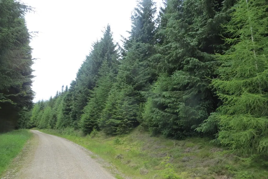
Drumtochty Forest near Auchenblae offers a community-supported natural riding network within a working forest. Its appeal is technical descending and the chance to explore woodland terrain, with riders sharing the wider forest with walkers and horses. Arrive with a route plan and a realistic view of your ability; this is a different outing from following a continuously waymarked trail-centre loop.
Forestry and Land Scotland’s Mearns plan describes the Aberdeenshire Trail Association’s permission to maintain adopted mountain-bike trails. For the September 2026 Drumtochty Tartan Enduro, the organiser also reports work with ATA and FLS under a Trail Stewardship agreement. That partnership supports the riding community, but it does not make every visible track an adopted route or guarantee that yesterday’s race layout is open today.
Drumtochty Forest mountain bike trails and grades
Drumtochty 2026 Tartan Enduro route
DoonThaBrae’s published race map brings together named descents with uphill transfers. Use it as evidence of the documented event circuit, not as permanent waymarking. Race layouts change; follow current forestry signs and the association’s advice when planning an ordinary visit.
This appears as Stage 1 on the organiser-linked September 2026 map. Discuss the present approach and exit with a knowledgeable local guide before building it into a ride. A familiar-sounding name does not establish an easy starting descent.
The same published event map names Lockdown as Stage 3. Treat its place in the race as context, not a promise of fixed difficulty or current condition. Begin any unfamiliar descent with enough time and space to assess the line.
Stage 5 used this named line in the organiser’s route. Choose it only within a locally informed plan that accounts for the return and any operational restrictions. The event name is useful for discussing a ride; it is not a substitute for navigation.
The land-manager plan contains woodland maps and identifies the retained Drumtochty Glen car park. It is not a public mountain-bike route map and does not establish permission for every line on an app.
For a first Drumtochty day, ask a local coach or guide to shape the ride around your experience. Tell them which skills are comfortable and which conditions make you hesitant. Natural descents can change markedly with moisture and repeated use, so a successful ride begins with a suitable choice of terrain, not a target number of tracks.
Build the first session around a manageable section and a clear return. Leave room to stop somewhere visible and away from the riding line when inspecting a feature. If a trail looks beyond your control, choose another option or walk safely without obstructing others. Do not let a faster rider behind you decide how quickly you enter unfamiliar terrain.
Keep transfers and descending lines separate in your plan. An old race map may show a sequence that made sense with marshals and temporary signs but is less obvious during an ordinary visit. Establish where a descent exits and how you regain the access road before starting. Never assume another group is heading to your car park.
Where is Drumtochty Forest?
The land manager’s plan identifies the Drumtochty Glen car park near the castle as a retained recreation facility. Use current signs at the entrance and leave access for forestry vehicles, residents and other visitors. Official directions →
The land manager’s plan identifies the Drumtochty Glen car park near the castle as a retained recreation facility. Use current signs at the entrance and leave access for forestry vehicles, residents and other visitors. Drumtochty Castle is a private event venue: its wedding parking and any temporarily permitted race field are separate arrangements, not additional everyday forest parking.
Laurencekirk has a railway station, but it is not the forest trailhead. Arrange the final connection and the return separately if travelling by train, including the operator’s current bicycle rules. For a driving visit, settle the meeting point with everyone beforehand and keep that location available offline. A village or forest name alone can leave a group at different entrances.
Approximate trail-area pin. Approximate forest-area point read from the official FLS map, accurate to about 300 metres. It is not a car park or arrival point. Official coordinate source
Facilities
Plan a self-sufficient forest session. Bring water, food, suitable clothing and the repair essentials for your own bike, then organise café, toilet and mechanical stops around the wider day. Keep medication and emergency contact information accessible. A comfortable lunch arrangement later in Stonehaven should not leave you without drinking water during the ride.
Support the trail community through the association’s published channels or an organised dig if that interests you. Maintenance happens through agreements with the land manager; visitors should not reshape a feature, clear an alternative riding line or move operational barriers. Report a problem with a clear location and description so that the appropriate people can assess it.
The recent enduro organiser describes Drumtochty’s riding in terms of roots and loam. Approach damp roots deliberately and allow grip to set the pace, particularly after a long climb or when tired. Start with a conservative descent before deciding how much riding to add. A previous dry-weather visit is not a reliable description of the next one.
This remains a production forest, with the land manager describing continuing clearance and restructuring after storm damage. Follow closures, diversions and workers’ instructions, even when a saved route appears to go straight through. Plan an alternative outing if the intended sector is unavailable. Keep the daylight return achievable without relying on speed through an unfamiliar final descent.
Auchenblae is the nearby village anchor, while Stonehaven provides a coastal base for a longer break. The Ship Inn on Shorehead has a restaurant and overnight rooms by the harbour. Arrange a meal around the day’s actual finish and ask the property about bicycle storage before booking; a room reservation does not itself establish secure storage for riding equipment.
For companions, Dunnottar Castle is a separate coastal outing near Stonehaven. Its access guide matters because the cliff-top setting and historic structures bring practical limitations. The operator can close at short notice for conditions such as high winds, snow or ice, so keep another activity available. Coordinate transport before heading into the forest, particularly if the party shares one car.
Some links are affiliate links — if you book, we may earn a small commission at no extra cost to you.
Displayed distances are straight-line estimates using OpenStreetMap contributors (ODbL), not road journeys. Ask the property about secure bike storage and wet-kit arrangements before booking.
RIDE PREPARATION
Kit for this ride
Consider what suits the route, forecast and your own experience.
Is Drumtochty a continuously waymarked trail-centre circuit?
Plan it as a natural forest network with a locally informed itinerary. The documented Tartan Enduro route supplies named event lines, but race tape and temporary arrows do not provide permanent public waymarking. Use an offline map and follow current forestry information.
Does ATA maintenance mean every track is adopted?
No. FLS describes permission to maintain adopted trails identified through work with ATA. That is distinct from endorsing every visible or digitally mapped line. Follow the land manager’s signs and current advice about the area you intend to ride.
Can I copy the September enduro route for a normal visit?
It provides useful event context and names, but a normal ride needs its own access, navigation and conditions plan. Do not assume the race field, temporary signage or event services remain available. A guide can help select an appropriate shorter outing.
What should I do when meeting horses?
Slow down early, communicate calmly and give the rider time to respond. Be prepared to stop and let the horse pass with space. Scotland’s responsible-access guidance asks cyclists to respect other users; descending speed is your decision, not their problem to solve.
Is the castle car park available for riders?
Use the signed forest recreation parking and respect private event arrangements. Castle wedding parking and specially agreed race camping fields are separate permissions. Leave entrances and access roads clear, and do not turn an old event instruction into an everyday parking rule.
Develop braking, cornering, climbing and technical riding through deliberate practice, with sensible progression for roots, rocks, steeps, wheel lifts and jumps.