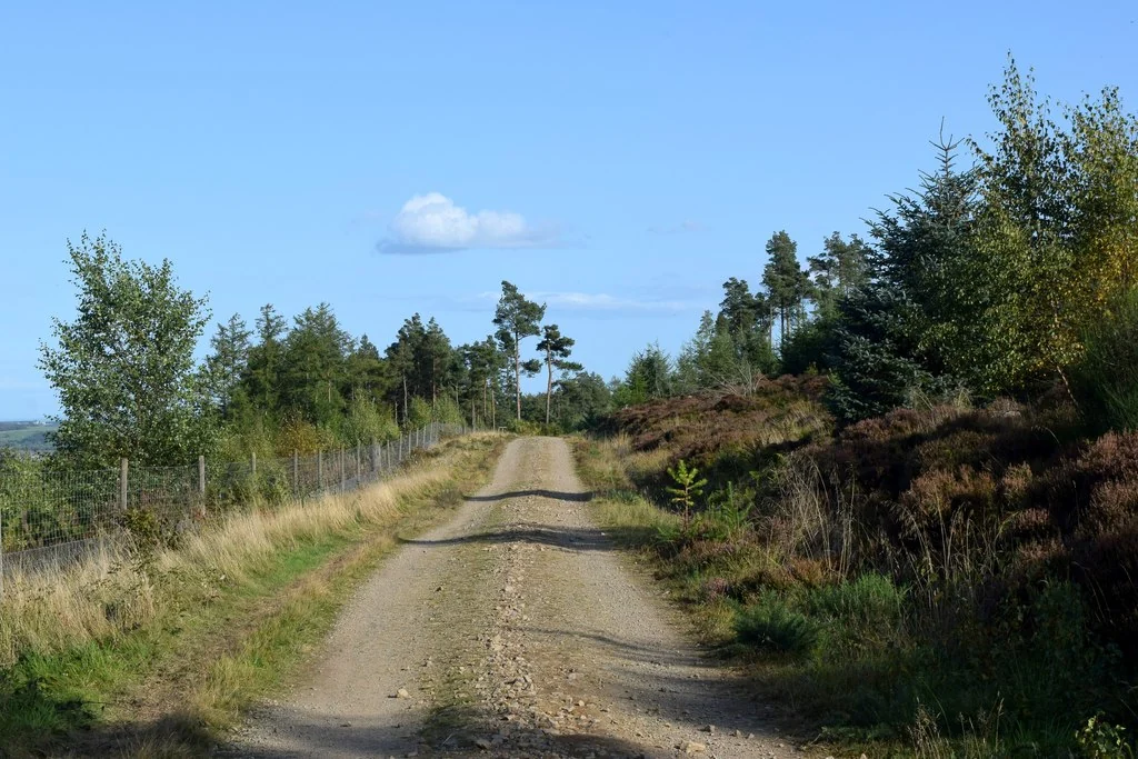
Kirkhill Forest is a convenient woodland riding stop on the north side of the A96 between Dyce and Blackburn, close to Aberdeen. Its official mountain-bike fun park sits near the car park, making it useful for a short skills session without a long approach. Forest roads and broader tracks allow a different kind of outing around the same hillside, with Tappie Tower giving the area its best-known viewpoint.
This is a modest forest destination, not an uplift park with a staffed commercial base. Forestry and Land Scotland promotes the fun park for practising skills before moving to more demanding places such as Moray Monster Trails. Choose Kirkhill for repetition, a local ride or a useful first taste of forest terrain, and build the session around the surfaces and features actually open on the day.
Kirkhill Forest mountain bike trails and grades
Mountain bike fun park
The land manager identifies the purpose-built practice area close to the car park. Begin with the simplest features and learn the direction of travel before joining other riders. Work on balanced movement, looking ahead and measured braking, with enough room to stop safely. The current FLS page does not assign it a colour grade or publish a measured lap distance.
The forest’s broad-track network provides a way to add climbing and exploration around a skills session. Use the FLS map to stay orientated and give walkers and horse riders generous space. The final approach to the tower is a smaller path; leave the bike safely aside or walk it where appropriate, without treating the viewpoint access as a downhill trail.
FLS publishes this named 5.9-kilometre walking route, with a fairly steep climb and some uneven gravel. It is a useful separate way to visit the 19th-century folly and its views towards the North Sea and Bennachie. The walking distance and strenuous classification are not presented here as an official mountain-bike loop length or colour grade.
The FLS route card maps the forest entrance, car park and walking-track layout. It is not a graded mountain-bike map; consult the separate cycle-route information and leave room for other forest visitors.
Start at the fun park, well within the limits of your existing skills. Ride slowly enough to understand each feature and repeat an easy sequence before adding speed. Let children practise stopping and controlling their approach, and agree a meeting point away from the riding line. A successful first session can be short: consistency is a better aim than exhaustion.
If the group wants a longer outing, add an out-and-back on the mapped forest roads and return to the familiar car-park area. Carry the FLS map offline, remember the junctions you use and turn around before the climb takes too much energy. Riders seeking a formal selection of graded mountain-bike loops should plan a separate visit to an officially graded centre.
Confident visitors can use the same practice area for a focused skills session. Pick one movement, allow an unhurried approach and rest when repetitions stop feeling accurate. The forest’s appeal is its convenience and the ability to combine a little climbing with practice, so there is no need to invent a long route simply to justify the visit.
Where is Kirkhill Forest?
Kirkhill’s entrance is on the north side of the A96 between the Dyce roundabout and Blackburn village. Official directions →
Kirkhill’s entrance is on the north side of the A96 between the Dyce roundabout and Blackburn village. FLS says the forest entrance is opposite the turn-off signposted Kirkton of Skene; AB21 0TU is the nearest postcode. Use the official directions link, which identifies the car-park area, and follow the road layout instead of making an unsafe last-minute turn.
The land manager publishes free parking at this car park. Leave room for other vehicles and horse boxes, and unload bikes without blocking the access or forest-road entrance. If travelling without a car, plan the whole journey through the local transport information and choose a safe final approach; an airport or town address is not the forest trailhead.
Approximate trail-area pin. Forest planning point. Follow FLS directions to the visitor car park. Official coordinate source
Facilities
The published facilities are parking, trails, mountain biking and a viewpoint. Pack water, food, a spare tube and basic tools before arrival. Do not base the session on finding a café, rental counter, toilet block or a repair service at the forest entrance. Keep your essentials with you when the group leaves the car park.
The wide tracks are also used by walkers and horse riders. Slow down early, make your presence known politely and leave space for a horse to pass calmly. Stay on established routes, respect temporary work signs and keep any pause out of the path. The forest is a shared place, and the fun park does not give cyclists priority everywhere else.
The land manager lists free parking at the A96 entrance. Follow current forest-operation notices; a skills area and mapped forest tracks do not provide staffed-centre opening hours.
FLS notes that parts of the Tappie Tower route can be wet after rain. That is a useful reminder to plan for changing woodland surfaces, including slippery roots and uneven gravel on the paths you use. Choose slower practice laps after wet weather and stop before fatigue affects braking or balance.
Autumn and winter shorten the useful riding day, while wind can affect trees and exposed higher ground. Carry a warm layer for pauses and leave a clear return plan with someone if riding alone. Observe closures following forestry work or severe weather. A short ride near Aberdeen is still an outdoor outing that needs daylight and appropriate clothing.
Dyce is the practical nearby base for an overnight stay, with airport-area hotels and services alongside the town. Aberdeen gives a wider choice of evening meals and a useful non-riding day. Choose the property for the whole trip, ask directly about bike storage and avoid leaving bikes displayed on a vehicle while eating or visiting the city.
The Dunavon in Dyce offers accommodation and restaurant service, making it one possible post-ride meeting point. For time off the bike, Aberdeen Art Gallery is a separate city visit. Kirkhill can fit around a travel day or form a quieter contrast to a longer Aberdeenshire riding weekend, without promising the facilities or scale of a larger trail centre.
Some links are affiliate links — if you book, we may earn a small commission at no extra cost to you.
Displayed distances are straight-line estimates using OpenStreetMap contributors (ODbL), not road journeys. Ask the property about secure bike storage and wet-kit arrangements before booking.
RIDE PREPARATION
Kit for this ride
Consider what suits the route, forecast and your own experience.
FLS promotes the mountain-bike fun park as a place to practise before more demanding riding. Choose features that match your current control and keep sessions short enough to remain accurate. Children still need supervision and enough space around other riders.
How long is the official mountain-bike loop?
The current FLS pages do not publish a measured mountain-bike circuit. The named Tappie Tower Trail is a 5.9-kilometre walking route. Use the fun park for practice and the forest map to choose additional established tracks without assuming a fixed bike-loop distance.
Is parking free?
Yes. The land manager’s current visitor-information page says there is no charge at Kirkhill’s car park. Follow the entrance signs and park considerately, leaving working access and space for horse boxes clear.
Can I hire a bike at the forest?
FLS does not advertise a rental facility at Kirkhill. Arrange any suitable hire before travelling and bring tools and water. A nearby town or airport hotel is not an assurance that bikes or repairs are available at the trail entrance.
Does Kirkhill have colour-graded trails?
The current land-manager description of the fun park does not publish a colour grade. Choose by the actual features and your skills. Do not copy a third-party blue, red or black rating into the official forest information.