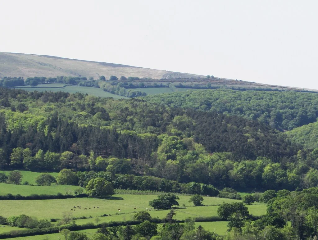
Exmoor is a rewarding natural-riding destination for riders who enjoy wooded valleys, open hills and a trip that can end beside the sea. Horner Wood and the wider Holnicote Estate offer a bridleway network beneath the moor; Webber’s Post is a useful starting area, and the Lorna Doone Valley brings another set of permitted riding links around Malmsmead. The National Park continues to promote off-road cycling on its bridleways, byways and other authorised tracks.
This is a region to explore with a route plan, not a trail centre with one graded circuit. Use Explorer OL9, Exmoor, and the National Park’s access information to connect your chosen legal lines. The classic appeal is the change between valley woodland and exposed higher ground. Keep that variety manageable: a sequence of sharp climbs and descents can make a compact-looking circuit a substantial day.
Exmoor: classic mountain bike routes
Horner Wood and the Holnicote bridleways
The National Trust expressly identifies bridleways and cycle trails across the Holnicote Estate, with Horner Wood as a useful woodland riding area. Plan a circuit from the current rights-of-way map that follows those legal connections. The Trust also publishes walking trails here, which are separate itineraries; do not turn a walking loop into a bicycle route by following its waymarks. Match the length and climbing to the group before leaving the valley.
Webber’s Post gives access to the Holnicote riding network with views towards Dunkery and Horner Wood. The Trust’s local directions identify a permitted bridleway to Horner. Use that named bridleway connection with a mapped return, avoiding the other footpath branches in its walking description. The published walking circuit is not offered here as a cycling loop. Look ahead at junctions and keep the descent controlled where another visitor may be coming uphill.
The National Trust confirms off-road cycling on the bridleways crossing the valley around Malmsmead, alongside cycling on its roads. Choose a legal line and return from Explorer OL9 or the access map. The valley’s literary walking routes are not automatically available to bikes, and the attractive riverside setting does not guarantee an easy family surface. Build a shorter ride if the group wants time at Malmsmead afterwards, instead of committing to an unfamiliar high crossing.
The access map helps connect legal bridleways and byways across Exmoor. This is a riding region with several possible bases, not a single waymarked trail-centre circuit.
For a first visit, choose a compact Holnicote outing with a route that stays within your navigation and climbing comfort. Start with the legal woodland connections around Horner, identify the exit from each climb and mark a shorter return. Leave time to stop at junctions. A familiar line back to the valley makes it easier to adjust the day when someone is finding the ground harder than expected.
Riders wanting a bigger day can add the approved higher connections around Webber’s Post once the weather and route are suitable. Do not turn a photograph of a summit path into access evidence. Ride the specific bridleways or confirmed permitted tracks on your map, and share them calmly. Carry your own tools, food and water; an Exmoor circuit becomes much less enjoyable when every decision depends on reaching the next shop.
Where is Exmoor?
The planning pin marks the National Trust car park at Horner, using the National Park’s published grid reference SS898455. It is a valley base for this part of Exmoor, not a pin for the entire park. Official directions →
The planning pin marks the National Trust car park at Horner, using the National Park’s published grid reference SS898455. It is a valley base for this part of Exmoor, not a pin for the entire park. Webber’s Post has a separate car park and different departure options. Follow each land-manager’s visitor directions and parking instructions; do not use a rural gateway as a convenient alternative start.
Porlock is a useful base for Holnicote riding, while Exford suits a more central stay. Malmsmead and the Lorna Doone Valley sit in another part of the park, so consider the transfer before booking several consecutive rides. If arriving without a car, arrange the last connection and bicycle carriage with transport providers. A bus serving a visitor village does not automatically accept a mountain bike or return at your chosen finish time.
Nearby planning base. Horner car park is a regional planning base. Its walking routes are separate from the cycling itineraries described here. Official coordinate source
Facilities
Webber’s Post is a remote starting area: the Trust points visitors towards Horner Wood for the nearest facilities. Do not expect a staffed café or workshop at every hilltop car park. Start supplied and use village services before the ride. At Malmsmead, the Trust identifies the independently run Buttery Tea Room and a picnic area; opening arrangements belong to the business, so lunch there should be an option, not essential to the itinerary.
The National Park’s business directory lists Exmoor Adventures for bicycle hire and guided activities. Arrange equipment directly and explain the route you intend to ride, including the group’s experience. Natural-riding hire does not come with a guarantee that every nearby track is suitable or authorised. Bring your own essential spares or agree the support provided by a guide. Bicycle storage at accommodation also needs a direct conversation.
The National Park specifically warns against hard skidding and riding excessively worn routes, especially when the moorland soils are wet. Use a light touch on the brakes, stay on the established legal line and avoid cutting around soft ground. A sheltered woodland track and an exposed moorland link can respond very differently to a wet week. Choose the ride for the conditions you find, with a shorter option ready.
Wind and low visibility make the higher connections more demanding. Take spare layers and an offline map, and leave daylight for the return. Walkers, horses, livestock and wildlife are part of the same landscape. Announce yourself gently, slow well before passing and give animals time to settle. Open-access shading on a map grants recreation on foot; it does not extend a general cycling right across Exmoor’s moorland.
Porlock offers an easy evening base for the northern riding area, with the Lorna Doone Hotel and Bay View among its stays. Porlock Weir adds a harbour setting, and Bossington Hall sits near Allerford. Exford’s White Horse is a more central option for a different itinerary. A non-riding afternoon can explore villages or the coast on foot; keep the walking trip and the bicycle route distinct and agree where everyone will meet.
Some links are affiliate links — if you book, we may earn a small commission at no extra cost to you.
Displayed distances are straight-line estimates using OpenStreetMap contributors (ODbL), not road journeys. Ask the property about secure bike storage and wet-kit arrangements before booking.
RIDE PREPARATION
Kit for this ride
Consider what suits the route, forecast and your own experience.
The National Park identifies bridleways, restricted byways and confirmed permitted tracks. Public footpaths and open-access land do not give a general right to cycle.
Are there official riding routes around Horner Wood?
The National Trust confirms bridleways and cycle trails across Holnicote. Build the ride on those lines; its named walking circuits are separate and are not automatically bicycle routes.
Can I ride from Webber’s Post to Horner?
The Trust’s route information identifies a permitted bridleway to Horner. Use the precise bridleway connection and a legal return, avoiding walking-only branches.
Which OS map should I use?
Explorer OL9, Exmoor, covers the riding areas described here. Combine it with current rights-of-way information and local closure notices.
Does Webber’s Post have a café?
The Trust describes it as a remote location with a car park, and points to Horner Wood for the nearest facilities. Carry supplies; refreshments are available in visitor villages and at Malmsmead’s independent tearoom.