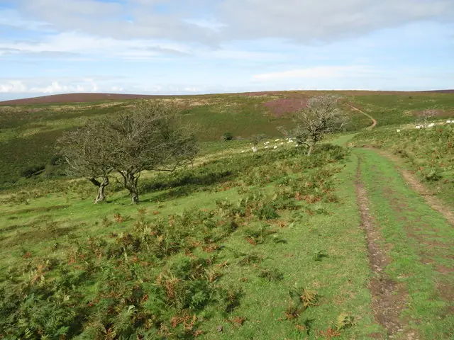
The Quantock Hills offer natural mountain biking from the Drove ridge to wooded combes on Somerset’s public bridleways and restricted byways. The published Quantock Hills Rides connect Aisholt Common, Seven Wells and Bicknoller Post; Weacombe Combe and Staple Lane provide named northern bridleway links. Choose a woodland outing or a longer ridge circuit around your group’s climbing and navigation experience.
Use OS Explorer 140, Quantock Hills & Bridgwater, recommended by the National Landscape team. Its rights-of-way markings distinguish the riding network from footpaths; blue and purple ground waymarkers identify bridleways and restricted byways. Great Wood is a contained forest starting point, while wider circuits have several entrances and road connections. Save your chosen route and allow time for gates and other countryside users.
Quantock Hills: classic mountain bike routes
Quantock Hills Rides: Aisholt Common, Seven Wells and the Drove
The British Horse Society’s published circuit starts at Lydeard Hill, with shorter branches through Aisholt Common and Great Wood. The longer itinerary reaches Bicknoller Post, then follows the Drove towards Halsway Post and Triscombe Stone. These ridge and combe connections give a natural cross-country day on its mapped bridleway network. Follow the selected branch instructions, including road links and the permissive opening section. Published kilometre and mile totals disagree, so measure your chosen circuit; confirm current permission on permissive sections before departure.
The National Trust specifically identifies cycling access through Weacombe Combe and up Staple Lane from West Quantoxhead towards Staple Plain car park. These are named legal riding links, useful when planning the northern part of the hills. They are not a recommendation to cycle the Trust's whole Staple Plain walking circuit. Establish the bridleway line and your return connection before leaving the car park, and descend at a speed that leaves room to stop for another visitor.
The National Landscape visitor guide identifies a family cycle route at Ramscombe. Use the forest's local visitor information to choose the cycling route and a suitable turnaround. Do not mistake the named Red Walk for a red-grade mountain-bike trail: the current Forestry England page describes it as a walking route. Forest roads can provide a practical introduction to countryside riding, but the description alone does not promise a flat or completely traffic-free children's circuit.
The BHS map follows public bridleways from Lydeard Hill, with an alternative joining point at Seven Wells. Other Quantock circuits require their own legal-access plan.
For an unfamiliar group, begin with a contained route whose return you understand. At Great Wood, locate the visitor information and any work notices before riding further into the forest. Let the first climb establish the group's pace. If someone is already struggling, a shorter outing with time for a picnic is a better day's riding than an ambitious circuit that finishes with an exhausted descent.
For the wider Quantock Hills Rides, save the route notes and an offline map before departure. Mark the chosen shorter or longer branch and agree where you can turn back. Carry tools for your own tyres and enough food and water for delays. At confusing junctions, stop together and identify the next legal link; a descent into the wrong combe can leave an unnecessary climb between you and the finish.
Where is Quantock Hills?
Great Wood's official entrance is on Adscombe Lane, Over Stowey, using TA5 1HN. Forestry England directs drivers from the A39 at Nether Stowey to the brown Ramscombe signs. Official directions →
Great Wood's official entrance is on Adscombe Lane, Over Stowey, using TA5 1HN. Forestry England directs drivers from the A39 at Nether Stowey to the brown Ramscombe signs. Parking is paid by card or contactless; cash is not accepted. Follow the site instructions and leave operational access clear. Do not use gateways or neighbouring properties as overflow spaces when the designated parking is busy.
For northern riding, use the National Trust's Staple Plain car park and its current visitor directions. For the British Horse Society circuit, plan around Lydeard Hill or the alternative joining point at Seven Wells. These starts are separate from Great Wood's main visitor entrance. If arriving by public transport, organise bicycle carriage and the final connection with the operator; a bus stop near a forest does not guarantee carriage of a full-size mountain bike.
Approximate trail-area pin. This marker identifies the riding area; follow the official arrival directions to its entrance. Official coordinate source
Facilities
Forestry England lists toilets and a picnic area at Great Wood. It also says there are no litter bins, so bring a bag and take everything home. The National Landscape's Ramscombe page identifies an independently operated café at the entrance to Great Wood. The café tag on this regional guide refers to that particular starting area, not refreshments beside every bridleway.
There is no single booking desk or standard set of visitor services across the Quantocks. Bring essential spares and arrange any bike hire separately. Finish with enough daylight to pack and travel safely. For a mixed party, Great Wood's walking options and picnic facilities can support a separate outing, provided everyone knows the meeting point and nobody treats a walking waymark as a cycling instruction.
Forestry England currently schedules thinning work at Great Wood from summer 2026 to summer 2027. The forest remains available to visitors, but individual areas may close. Follow barriers and notices even when machinery is silent, and use an alternative permitted route. A saved itinerary cannot override a temporary closure; allow the day to change when a key connection is unavailable.
Plan ridge riding around wind, visibility and available daylight. In wet conditions, reduce speed before corners and avoid widening the route beside soft ground. Give walkers and horse riders time and space, and approach livestock calmly. The visitor guide identifies ponies grazing the common and asks visitors not to feed them. Keep the ride on the permitted network and leave wildlife, gates and grazing animals undisturbed.
Nether Stowey is a practical village base for Great Wood access. The Old House offers bed-and-breakfast and self-catering accommodation there; agree bicycle storage directly before booking. Holford's Combe House Hotel provides another verified overnight option. Choose the base around your route's starting side of the hills, instead of assuming every Quantock accommodation address is equally convenient for every circuit.
Some links are affiliate links — if you book, we may earn a small commission at no extra cost to you.
Displayed distances are straight-line estimates using OpenStreetMap contributors (ODbL), not road journeys. Ask the property about secure bike storage and wet-kit arrangements before booking.
RIDE PREPARATION
Kit for this ride
Consider what suits the route, forecast and your own experience.
Where may I legally mountain bike in the Quantocks?
The National Landscape team identifies bridleways and restricted byways as cycling routes. Use Explorer 140 and the blue or purple waymarkers. Open access land does not give a general right to cycle anywhere.
Is Great Wood's Red Walk a red mountain-bike trail?
No. Forestry England describes it as a walking route. Ramscombe has separately identified family cycling, so use the appropriate visitor information and do not transfer the walking trail's colour to mountain-bike difficulty.
How long are the Quantock Hills Rides?
The British Horse Society offers several branches, but its published distances conflict. Choose a specific version and measure it from the map before relying on a distance for your day's planning.
Can I still visit during forestry work?
Forestry England says Great Wood remains open during the scheduled thinning programme, with individual areas subject to closure. Follow the current signs and allow for a different route on the day.
Can non-riders join the trip?
Great Wood has walking options, toilets and a picnic area. Agree separate routes and a meeting time. Walking access and a named walking circuit do not automatically provide cycling access to the same itinerary.