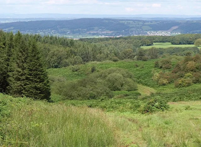
The Mendip Hills combine open bridleway riding around Black Down with woodland trails at Rowberrow Warren and a gentler cycle-path option on the Strawberry Line. The named links through Twin Brooks, the Limestone Link and Burrington Ham give riders a real countryside network to plan around. Rowberrow adds two authorised mountain-bike trail sequences maintained by Ride Mendips, letting a weekend mix natural climbing with a more concentrated woodland session.
This is a riding region spread across several starts, not one enclosed trail centre. Choose OS Explorer 141, Cheddar Gorge & Mendip Hills West, for the western rides here; the National Landscape also lists sheets 153 and 155 for wider coverage. Public footpaths and walking-route descriptions are not blanket cycling permission. Use the bridleway network and expressly authorised trails, giving walkers and horses priority.
Mendip Hills: classic mountain bike routes
Black Down: Twin Brooks and the Limestone Link
Not colour-graded
Ride Mendips identifies bridleways connecting Black Down with Rowberrow Warren, Burrington and Charterhouse, specifically naming Twin Brooks and the Limestone Link. Use these named links to build a route on the current rights-of-way map. The network has no published colour grade or one fixed circuit distance. Mark your chosen return before climbing, and keep the outing within the group’s navigation and fitness rather than following every inviting tyre line.
The local trail charity describes two bridleways descending towards Burrington village, with onward options through Burrington Combe and Link Lane. These are legal links for a planned natural ride, not a recommendation to cycle over the archaeological earthworks. Choose the mapped line and establish the return before descending.
Ride Mendips has landowner permission for two official sequences. The North East route includes Pump Track, Lumps & Bumps, Twins, The Chippy and Yeehaw; the South West uses Christmas Trees, Happy Valley, Pig Pen and Vicious Valley. Follow the published trail map and current signs. The charity reports its trails reopened after forestry work; barriers or a later notice still take precedence over a saved itinerary.
The dedicated cycle path links Yatton and Cheddar and provides a gentler alternative to the hill routes. Use its current route information to understand road links and crossings, especially with children or luggage. The National Trust identifies it as part of National Cycle Network 26.
Ride Mendips describes Black Down’s bridleway links and the two authorised Rowberrow sequences. Use the current woodland map and rights-of-way information to separate permitted cycling from walking-only paths.
Begin with a contained mapped route around Burrington or a short section of the Strawberry Line, depending on experience. Agree the starting point and turnaround so the first outing remains manageable. On the hills, use the first climb to judge the group’s pace and choose a return everyone understands.
Experienced riders can link Black Down’s permitted network with Rowberrow’s authorised trails, using the trail map to distinguish the two settings. Carry water, food and the tools for your own tyres. Study a technical feature before committing to it and allow room for another rider ahead.
Where is Mendip Hills?
The riding has several access points around Cheddar, Burrington and Rowberrow. Official directions →
The riding has several access points around Cheddar, Burrington and Rowberrow. Select parking that actually serves the chosen route and follow the land manager’s current arrival instructions. Do not park in forestry gateways, private driveways or places needed for local traffic. The regional map pin uses the National Trust’s published Mendip visitor coordinate around Cheddar Gorge as a planning anchor, not the entrance to every authorised trail.
For a car-free trip, plan the rail connection to the Strawberry Line or the onward road journey from a station, then confirm bicycle carriage with the train operator. A valley cycle path can be a useful approach, but it does not eliminate road crossings or provide a traffic-free connection to every hill start. If staying overnight, ask where luggage can be left before setting out with a lighter riding bag.
Nearby planning base. Cheddar Gorge is a regional planning anchor, not a Rowberrow trail entrance. Official coordinate source
Facilities
Cheddar provides practical town services before and after riding. At Rowberrow, treat the woodland trails as a self-sufficient session unless the actual visitor information says otherwise: bring food, water and essential spares. A named trail called Pump Track is part of the Rowberrow sequence; it is distinct from Cheddar’s separate asphalt pump track. Do not confuse their entrances or assume a shared set of facilities.
Ride Mendips says Cheddar Pump Track is free and open year-round, with enquiries directed to the parish council. It can give a mixed party a separate short riding option. For bike hire, repairs or coaching, arrange a real provider before travelling and explain your intended route. Hotel bicycle storage is also an individual arrangement, so ask directly instead of relying on a generic accommodation label.
The region has separate starts and landowners; there is no single ticket or centre timetable. Rowberrow trails remain subject to forestry notices, while Cheddar’s separate pump track is free and open year-round.
Use the current Ride Mendips trail information for Rowberrow operations. Forestry activity can change which lines are available, even after an earlier reopening announcement. Keep behind barriers and follow signs without attempting to bypass the working area through neighbouring woodland. Choose the valley cycle path or another permitted route when the main hill connection is unavailable; there is no obligation to complete the original plan.
After rain, slow down on natural surfaces and avoid widening muddy sections onto fragile ground. The open hills and sheltered woods may feel very different within one ride, so carry a spare layer and adjust the route for wind and daylight. Give walkers and horses time to pass, approach livestock calmly and close gates as requested. Keep archaeological sites and wildlife areas out of improvised technical lines.
The Bath Arms provides a Cheddar hotel base; Old Manor House offers bed-and-breakfast at Cross near Axbridge. For the eastern side, The Swan Hotel in Wells and Wookey Hole Hotel are real overnight choices. DoubleTree by Hilton Bristol South–Cadbury House provides another base at Congresbury, useful when considering the northern approach. These stays are spread around the region, so choose one against the actual riding starts.
Agree secure storage, drying space and meal times before booking. A separate walk, a visit to Wells or a relaxed Cheddar afternoon can suit non-riders without turning a walking-only path into part of the bike route. Leave time to clean and pack the bike before moving on.
Some links are affiliate links — if you book, we may earn a small commission at no extra cost to you.
Displayed distances are straight-line estimates using OpenStreetMap contributors (ODbL), not road journeys. Ask the property about secure bike storage and wet-kit arrangements before booking.
RIDE PREPARATION
Kit for this ride
Consider what suits the route, forecast and your own experience.
Ride Mendips has permission to maintain the North East and South West trail sequences at Rowberrow Warren. Use the published map and current signs; nearby unsanctioned lines are not included in that permission.
Is Black Down a colour-graded trail centre?
No. The named routes use the natural bridleway network. Choose the legal mapped connections and assess terrain and effort without assigning an invented colour grade.
Can I ride the whole West Mendip Way?
A walking-route name alone is not cycling permission. Use the current rights-of-way map to identify rideable bridleways and byways, with permitted alternatives where a section is a footpath.
What is the easiest alternative to hill riding?
The Strawberry Line gives a dedicated cycle-path option between Yatton and Cheddar. Use its current route information for crossings and any road connections before choosing a section.
Which OS map should I use?
Explorer 141 covers Cheddar Gorge and the western Mendips. The National Landscape also lists 153 and 155 for the broader area; select the sheets for the route you actually intend to follow.