
The Roller Coaster
Blue
A gradual shared fire-road climb reaches this blue choice. The forest descent ends with smaller turns and features; keep the first run measured.
Official route information →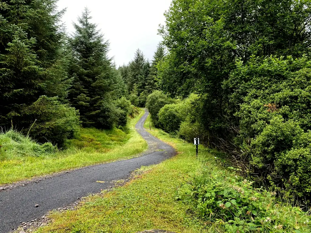
Sperrin Mountains, County Tyrone
Gortin Glen is a pedalling destination in the Sperrins, with blue and red trails that use the forest’s hills for flowing descents. Think of the climb as part of the outing rather than a small inconvenience between runs. For a group, the sensible plan is the ride everyone can complete comfortably, including the ascent and the return, not simply the descent that sounds most exciting. That choice leaves energy to enjoy the forest rather than spending the last section managing tired legs.
The forest park sits north of Omagh and combines riding with walking, a play park and visitor facilities. This makes it useful for companions with different plans, provided you agree on a meeting place and a realistic finish time. A short riding session and a long summit walk are different commitments even though they begin in the same park. Give each one its own time instead of assuming a non-rider will fill a whole afternoon waiting for another lap.
Blue
A gradual shared fire-road climb reaches this blue choice. The forest descent ends with smaller turns and features; keep the first run measured.
Official route information →Blue
Climbs towards Ladies View Point before descending through tight corners and short pedalling sections. Leave energy for the extra ascent.
Official route information →Red
Climbs towards Mullaghcarn, then descends through berms, switchbacks and open terrain before Sika’s Run adds rock drops and steep forest sections.
Official route information →Red
Branches from the blue approach into a forest descent beside the river. Follow the marked junction to enter your intended route.
Official route information →Use The Roller Coaster, Kelan’s Chase, The Mountain and Sika’s Run as distinct route choices, matching each grade and climbing commitment to the group. Follow current signs and closures, even where an older map shows a continuous connection.
Start with the blue options if you already handle off-road riding but are new to Gortin. Use the shared fire-road climb to settle into a sustainable pace rather than arriving at the junction exhausted. Pause to agree which route the group will take and who will lead. A first descent at a controlled pace gives you a useful view of the corners and features; a repeat can then feel more coherent without needing to change grade.
The red outing suits riders who can manage technical descents after climbing. Decide that from your current ability and fitness, not from what your strongest companion finds easy. Leave space between riders so that the first person’s line is a useful reference rather than a demand to follow immediately. If the group has different ambitions, separate deliberately at a known junction and arrange a meeting time. Avoid turning a shared ride into a last-minute negotiation when somebody is already tired.
Glen Park Road, Gortin, BT79 7SU, is the published MTB address, around six miles north of Omagh. Use the main forest car park and the cycling start, not the separate walking trailhead. Official directions →
The forest is on the B48 between Gortin and Omagh, approximately six miles north of Omagh. The official tourism listing gives Glen Park Road, BT79 7SU, and describes parking in the forest car park as free. Choose the main car park and identify the riding start before unloading a group’s bikes. Walking trails have their own trailhead, so a walker’s coloured marker is not automatically a mountain-bike route instruction.
Plan the arrival around daylight and the published gate hours. The council says gates open at 6:30am, closing at 6pm from October to March and 9pm from April to September. A late arrival is therefore a different proposition in winter. Include packing up and reaching the exit in your timing, rather than counting only the minutes on the trail. Agree your onward transport before leaving the car park, particularly when different riders intend to finish separately.
Find the planning area on a map →The council lists a café, toilets and a destination play park alongside the walking, horse and mountain-bike trails. Arrange a specific reunion point within that visitor area so companions have somewhere useful to go while riders are out. Bring what you need for the chosen ride instead of assuming the café supplies every trailside requirement. Its presence is helpful for a break, but should not be the reason to omit food or water for a longer session.
Walking and riding routes serve different purposes here. Keep to the appropriate marked network, especially around approaches shared with other users. If children are using the play park while another adult rides, make the supervision arrangement clear before anybody leaves. Gortin’s combination of facilities works best when each person has an actual plan, rather than one adult trying to combine a long ride with responsibility for companions remaining near the car park.
Plan this ride with your own mountain bike. The official visitor information describes rider facilities and access.
Council gate hours start at 6.30am, finishing at 6pm October–March and 9pm April–September. Trailhead parking is free; leave time to pack and reach the exit.
A wet visit is a reason to reduce pace and choose a manageable outing, especially where a descent includes rock drops or steep turns. Leave time for a first run that is slower than the one you imagined at home. In winter, the earlier gate closure should shape the entire visit, including any walking afterwards. The government’s forest information also asks visitors to observe displayed biosecurity measures because of larch disease in part of the forest. Clean equipment and follow the site’s instructions when moving between forests.
The council campsite is available on request to constituted groups holding £5 million public-liability insurance. It is not advertised as a general walk-up tourist campsite; use the council group-enquiry form. Official campsite information →
Omagh is the natural town base for this outing, while Glenpark Estate provides a named restaurant option in the area. It offers breakfast, lunch and dinner, recommends booking and says its menus change with seasonal produce. Contact it about the meal and service you want rather than assuming every menu is available throughout the day. It also invites guests to discuss dietary requirements. For a mixed riding group, book around the slower person’s finish so that a meal remains a relaxed end to the visit.
For a non-riding day, walk to Darach, the Guardian sculpture on Mullaghcarn’s summit. The council specifies the purple-marked Mullaghcarn Walking Trail from the walking trailhead between the main car park and amenity building. The out-and-back distance is 7.4 kilometres on gravel path and tarmac, so this is a proper walk rather than a quick look beside the café. Allow for the uphill journey and the return, and choose a shorter forest walk if that commitment does not suit your companions.
Some links are affiliate links — if you book, we may earn a small commission at no extra cost to you.
Displayed distances are straight-line estimates using OpenStreetMap contributors (ODbL), not road journeys. Ask the property about secure bike storage and wet-kit arrangements before booking.
RIDE PREPARATION
Consider what suits the route, forecast and your own experience.
The official mountain-bike listing describes blue and red trails. Choose from those published grades and their descriptions rather than treating the forest’s separately coloured walking routes as easier bike trails.
The council publishes a 6pm gate closure from October to March. Allow time to pack up and reach the exit rather than returning to the car park at the last moment.
The official local tourism listing describes parking in the Gortin Glen car park as free. Use the main visitor parking and observe the council’s seasonal gate hours.
Yes. Darach is reached on foot by the purple-marked Mullaghcarn Walking Trail. The council gives a total return distance of 7.4 kilometres, so allow time and energy for a summit walk.
The council lists a destination play park, café, toilets and walking routes. Plan supervision, meeting points and separate activities before riders leave; the facilities make a mixed visit possible but do not organise it for you.
Sperrin Mountains, County Tyrone
Fivemiletown, County Tyrone
County Londonderry
Develop braking, cornering, climbing and technical riding through deliberate practice, with sensible progression for roots, rocks, steeps, wheel lifts and jumps.
Plan mountain-bike rides around UK rain, ice, wind and heat, with seasonal trail care, tick precautions and conservative decisions at water crossings.
Plan solo rides, lead mixed-ability groups, find welcoming clubs and choose mountain-bike events with clear communication and realistic expectations.
Trail conditions change — check the official page before you travel.
Open official site →