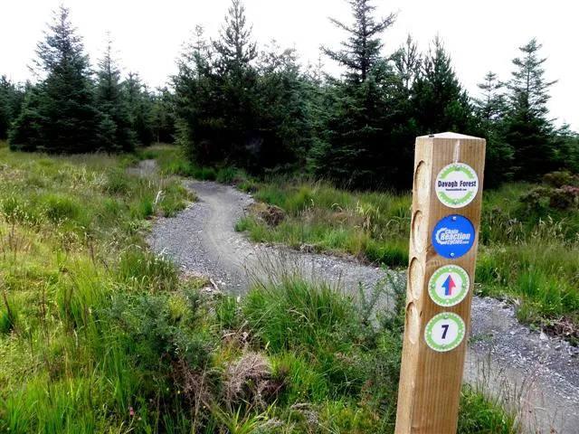
Access note: Harvesting diversions are in place. Golan and Sika Corner are closed during the works; Beleevna, Wolf’s Hill and Big Wig Jig remain closed longer term. Follow the signed diversion via waymarkers 31 → 27 → 26 → 9 → 5.
Davagh is a forest-riding destination in the Sperrins, with a rural setting north-west of Cookstown and a progression from gentle trails to a red circuit known for rock slabs. Choose it when you want woodland riding with technical character, rather than a town-centre skills stop. The trailhead’s pump track and skills park let riders make different choices before heading into the forest, while the surrounding hills give a longer visit a distinct sense of place.
The same landscape is also an accredited International Dark Sky Park, making Davagh unusual as a mountain-bike weekend destination: an afternoon ride can sit alongside a separately booked observatory visit. Keep the two plans independent. Forestry harvesting is currently diverting the riding network, and several named sections remain closed. A trip should be built around the signed routes that are available, rather than a promise to ride every slab seen in older videos.
Davagh Forest mountain bike trails and grades
Green Trail
Green: Easy
The gentlest option begins on broad forest roads, then enters woodland and follows Davagh Water back towards the trailhead. Walkers may use it in the opposite direction, so expect shared use rather than treating the riverside section as a dedicated downhill track.
Climbs from the upper car park before mixing woodland and open hillside. The return brings flowing riding and rocky sections, giving established beginners a technical step beyond the green route. Follow the signed blue arrows and current diversion rather than an old unaltered circuit.
The longer red route climbs towards Beleevnamore Mountain before its technical descending options. Rock drops and slabs are part of its identity. Current harvesting and longer-term section closures mean the published full-loop distance is not a measured distance for the diverted ride.
Individual features are graded at the trailhead, including rock rolls, drops, boardwalk and switchback practice. Inspect each line’s grading rather than assuming everything in a skills area is a beginner feature.
A dedicated area of rollers and berms for practising body position and carrying momentum. Use short sessions here to assess confidence before choosing one of the forest routes.
Green, blue and red riding share the forest, with the red circuit adding rock-slab challenges. Follow the council’s current diversion waymarkers; this information page is not a downloadable riding map.
For a new mountain biker, begin on the pump track or appropriate skills-park features, then choose the green trail if you want a gentler forest outing. Ride the shared riverside portion with enough space to meet walkers coming the other way. A confident blue-trail rider can consider the blue route for more variety, but keep the first visit exploratory: rocky sections can ask for more precise handling than the broad-road start suggests.
Experienced riders can aim for the available red riding while keeping the current harvesting restrictions central to their plan. The council’s signed mountain-bike diversion runs through waymarkers 31, 27, 26, 9 and 5. Golan and Sika Corner are closed during the work; Beleevna, Wolf’s Hill and Big Wig Jig have continuing long-term closures. Do not follow an old route line through a barrier to recover a missing descent. Leave enough margin for a shorter ride followed by an observatory booking or town meal.
Where is Davagh Forest?
The council lists the mountain-bike trailhead on Davagh Road, County Tyrone, with postcode BT79 8JH. The forest has parking and an upper-car-park start for parts of the network. Official directions →
The council lists the mountain-bike trailhead on Davagh Road, County Tyrone, with postcode BT79 8JH. The forest has parking and an upper-car-park start for parts of the network. Arrange your group’s meeting point at the cycling trailhead rather than simply saying “Davagh”: the observatory uses a different postal address, 155 Davagh Road, BT79 8JQ. Its official driving guidance uses signs from the A505 Cookstown–Omagh road.
Plan the final rural connection before leaving your accommodation. If you intend to use a taxi or other transfer, agree bicycle carriage and a collection time directly with the provider; do not assume a standard passenger booking accommodates muddy bikes. Keep the return arrangement flexible enough for diversions to shorten or change the ride. Download the map while you have a connection and identify the route back to your actual parking area.
The current council record lists changing facilities, toilets, parking, picnic space and a bike wash. Pack lunch if you want to regroup at the trailhead rather than drive into town between rides. Arrange any hire or mechanical support before your trip, and bring the kit needed to handle a minor problem yourself. The skills park and pump track are separate practice areas; use the feature-specific grading to choose a suitable warm-up rather than treating their presence as a reason to attempt every obstacle.
After rain, adjust your ambitions on the rock features before committing to a whole technical lap. A shorter daylight window makes the practice areas and a modest forest outing easier to combine with an evening plan than an unhurried full red circuit. The observatory warns that severe weather may change events or restrict access to the forest. Keep a town-based fallback for a poor forecast, and do not equate a confirmed indoor booking with guaranteed access to every forest trail.
Cookstown is a practical base for meals and accommodation around a Davagh visit. The Royal Hotel on Coagh Street has the Windsor Restaurant and Squires Lounge, with table reservations and options for dietary requirements. Choose a meal time that leaves room for changing after the forest and travelling back into town. If staying overnight, ask your accommodation about secure bike storage and somewhere to dry kit; those arrangements are worth confirming separately from the room itself.
For a non-riding activity, book an OM exhibition guided tour or an observing event through the observatory’s own programme. The exhibition offers a different way to explore the solar system, while clear-night observing uses the park’s low light pollution. Advance booking is required for the exhibition tours. Do not make a clear sky the only measure of a successful visit: choose the event for its actual format and keep time for the interpretive experience even if cloud limits the view. Cycling and night-sky activities need their own sensible clothing and timing plans.
Some links are affiliate links — if you book, we may earn a small commission at no extra cost to you.
Displayed distances are straight-line estimates using OpenStreetMap contributors (ODbL), not road journeys. Ask the property about secure bike storage and wet-kit arrangements before booking.
RIDE PREPARATION
Kit for this ride
Consider what suits the route, forecast and your own experience.
Current harvesting diversions and longer-term section closures interrupt the network. The published 16 km describes the full circuit rather than today’s diverted distance.
Which sections are closed during harvesting?
The council identifies Golan and Sika Corner, alongside closed waymarker sections. Beleevna, Wolf’s Hill and Big Wig Jig remain closed longer term.
Is the green trail shared with walkers?
Yes. Official tourism guidance permits walkers in the opposite direction, so approach blind sections with room to meet other users.
Does Davagh have a bike wash?
Yes. The current council facilities list includes a bike wash, changing facilities and toilets at the trailhead.
Can I combine riding with an observatory visit?
Yes, by booking the chosen OM activity separately and allowing for the ride, changing and travel between meeting points. Severe weather may affect either plan.