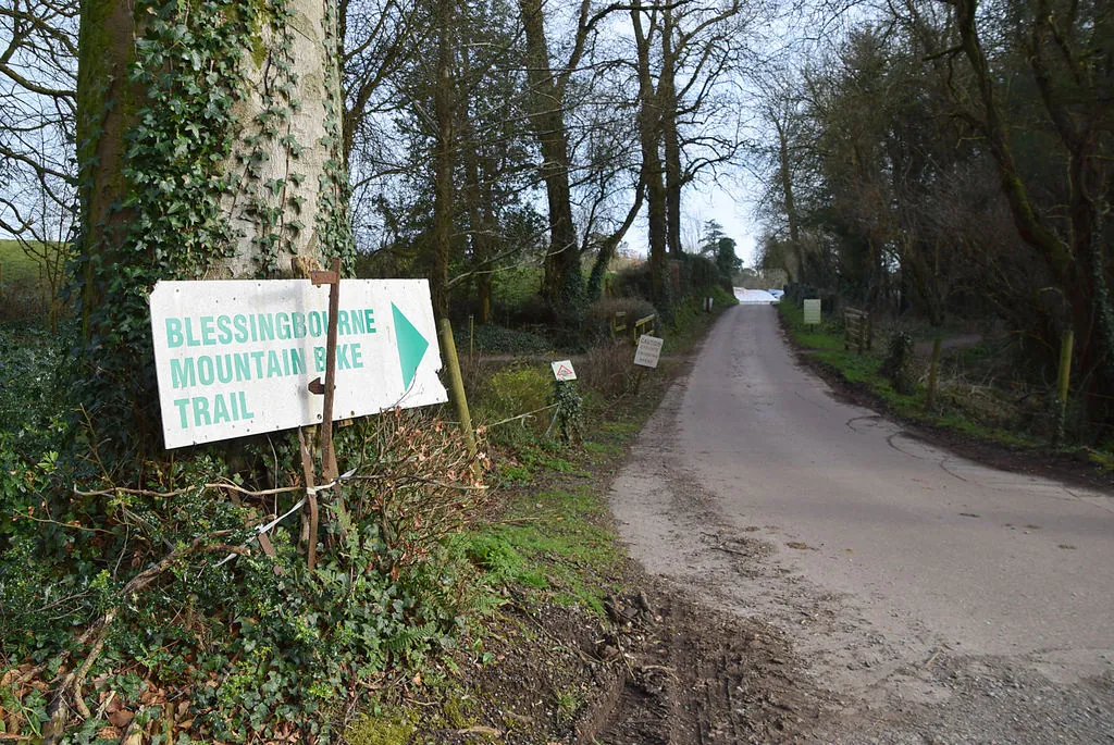
Blessingbourne is a compact woodland riding destination on a private country estate beside Fivemiletown, in County Tyrone’s Clogher Valley. A flowing blue route and a more technical red route make it useful for groups who want different levels of challenge from the same base. The estate advertises a 13 km network overall; choose a signed route rather than treating that total as a single compulsory circuit.
The riding sits among estate woods, private lakes and a working farm, with self-catering accommodation available on site. That setting suits an unhurried family outing or a short break built around repeat rides. Experienced riders can concentrate on technical features while less confident companions choose the blue trail or a separate woodland walk. Keep the activity choices distinct so nobody has to follow a harder mountain-bike line simply to stay with the group.
Blessingbourne mountain bike trails and grades
Blue Trail
Blue · 4 km
The local tourism authority describes a flowing woodland route with twists, turns and swooping sections, suitable for families and mixed abilities. Start here to learn the estate’s riding rhythm. A controlled first lap helps you judge whether another blue lap or a progression to the red is the better use of your time.
The red route adds log rides, rock drops, table tops and berms, with optional black-grade features for riders seeking a harder challenge. Choose those options individually after assessing them. The red circuit already offers a technical outing, so there is no need to select a black feature to make the ride worthwhile.
The estate map labels sections including Roller Coaster, Berming Rubber and Snake’s Trail, with numbered waymarkers and direction arrows. Use those numbers and signs to understand where you are in the network. Section names are useful landmarks, but they should not replace the signed grade when deciding what to ride.
The mapped network combines blue and red woodland riding with optional harder features, a skills area and numbered waymarkers. The pump track’s storm closure remains separate.
Begin with the blue trail and let the least confident rider establish the pace. Its short published distance makes it practical to complete a circuit, regroup and decide what comes next without committing everyone to the red route. Give turns and swooping sections a measured first pass, then repeat familiar terrain if that feels more productive than increasing the difficulty. Plan the visit around the woodland trails while the pump track is closed.
For experienced riders, make the red route the main session and focus on a few technical decisions rather than rushing through every feature. Log rides, rock drops and table tops call for different skills, so assess each on its own terms. Optional black features should remain optional within the group. A second controlled lap can be a better progression than following another rider onto a line you have not inspected.
Where is Blessingbourne?
Blessingbourne is reached from Fivemiletown. Use BT75 0QS alongside the official entrance directions. Official directions →
The estate’s address is Murley Road, Fivemiletown, County Tyrone, BT75 0QS. It is just off the A4 Belfast–Enniskillen road, making Fivemiletown the useful reference point for arrival. Allow a little time to locate the entrance, sort out access and consult the trail map before riding. This is a working private estate, so use the designated parking and follow estate signs rather than unloading at an arbitrary woodland access.
For a group booking or a visit depending on hire, speak to the estate before travelling. Confirm the access arrangements for your party and bring coins if using the barrier described by the local tourism listing. Organise the final journey to Murley Road alongside accommodation and meal plans. A town-centre meeting point alone does not settle how every rider and bicycle reaches the estate entrance.
The estate map identifies toilets, a fresh-water tap, picnic space and bike wash at the trailhead facilities. The estate also describes a skills area. Its dedicated hire page restricts bike hire to residents, with bikes and helmets offered in booked three-hour sessions from Tuesday to Sunday. A day visitor should therefore bring a bike or make another confirmed arrangement. Pre-booked group catering is different from expecting a drop-in café during an ordinary ride.
Bike hire at Blessingbourne
Blessingbourne’s bike hire is for residents only, in booked three-hour Tuesday–Sunday sessions with helmets. Day visitors need their own bicycle or a separate confirmed arrangement.
The estate publishes seasonal riding hours on its contact page. Access is through the private-estate entrance; arrange any group visit or resident hire with the estate in advance.
Blessingbourne publishes seven-day trail opening, from 9 am until late in spring, summer and autumn, and 9 am to 5 pm in winter. Choose a winter start that leaves time for the return to the trailhead before that earlier finish. Woodland shade and wet technical features favour a measured reconnaissance lap. The estate map warns that farming and woodland operations can require temporary changes, so obey barriers and direction signs encountered on the ride.
Fivemiletown is the straightforward food base. The Valley Hotel Restaurant on Main Street is listed by Visit Mid Ulster, giving your group a specific place to arrange an off-site meal after the bikes are packed away. Staying in the estate’s self-catering accommodation makes a different plan possible: ride, return to your apartment and organise food around your own timing. Decide that arrangement before splitting into separate riding groups.
Non-riders can choose the estate’s woodland and lakeside walking routes. Blessingbourne also advertises its Carriage and Costume Museum, with historic carriages, coaches and other collected objects. Ask about museum access when arranging the visit rather than assuming it operates as an unrestricted walk-in attraction. A booked heritage visit or a separate walk lets companions enjoy the estate without entering the technical bike routes.
Some links are affiliate links — if you book, we may earn a small commission at no extra cost to you.
Displayed distances are straight-line estimates using OpenStreetMap contributors (ODbL), not road journeys. Ask the property about secure bike storage and wet-kit arrangements before booking.
RIDE PREPARATION
Kit for this ride
Consider what suits the route, forecast and your own experience.
The current Visit Mid Ulster listing says it is temporarily closed following storm damage from fallen trees. Plan to use the woodland trails and respect the closed area rather than expecting a pump-track session.
Can day visitors hire bikes at the estate?
The dedicated estate hire page says residents only. Arrange this directly if staying on site; otherwise bring your own bike or secure another hire arrangement before travelling.
Which trail suits a mixed-ability family?
The 4 km blue route is the more approachable signed circuit. Ride it at the least confident person’s pace and decide together whether to repeat it. The 8 km red adds substantially more technical features.
Do I have to ride black features on the red trail?
No. The tourism authority describes the black-grade features as optional. Select the red route within your ability and make a separate decision about any harder option rather than treating it as compulsory.
Can I combine riding with an estate walk?
Yes. Blessingbourne offers separate woodland and lakeside walking routes. Arrange a meeting time and choose the walking route deliberately so companions do not have to follow the mountain-bike singletrack.