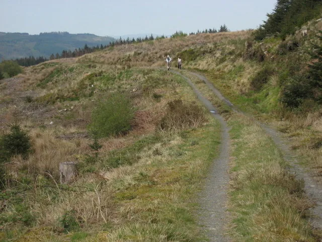
Access note: Forestry work affects Dolen Machno and Dolen Eryri. Follow current closure signs and the community’s signed diversions; the downloadable map does not include them.
Penmachno is a community-run mountain-bike outing in the forests of Eryri, with natural-feeling singletrack and a proper sense of being away from the services of a large visitor centre. Dolen Machno and Dolen Eryri combine technical riding with forest views. The character is cross-country adventure: you pedal the climbs, manage your own supplies and make decisions about distance while already on the hill.
The trails are maintained by volunteers through Menter Bro Machno and funded by riders’ donations. Both loops are red grade, so the shorter-looking option is not an easy beginner circuit. Expect variable surfaces, climbing and features that need confident off-road handling. A thoughtfully paced ride suits this place better than a plan based only on descent speed, particularly when forestry diversions change the familiar sequence of sections.
Penmachno Trails mountain bike trails and grades
Dolen Machno
Red · 18.6 km · 560 m
The main loop carries the bigger climbs and faster descents, with technical singletrack and tight switchbacks. NRW publishes 18.6 kilometres; the community site rounds this to 19. Its climbing is substantial enough to shape your day, especially if you are considering the additional loop rather than heading straight back.
The additional loop joins around the halfway point of Dolen Machno. Sweeping singletrack, boardwalk and pitched-stone riding are its distinctive ingredients. The 11.4 kilometres describes the extension, not a short ride from the main trailhead: combining both loops makes the published 30-kilometre outing. Leave energy for the remaining Machno return.
A first-time visitor who already rides red trails should plan around Dolen Machno and make the extension decision at its junction. This gives you a clear initial objective without committing to the full distance before feeling the climbs and surfaces. Complete beginners should develop their skills on easier graded trails elsewhere before making Penmachno their first singletrack experience: both named routes demand more than basic cycling confidence.
Experienced riders can aim for both loops when time, conditions and fitness allow. Treat Eryri as an additional commitment rather than a free bonus: its boardwalk and stone sections still require concentration, and you must return through the main loop. The trail card marks some features as being at the top of their grade; inspect unfamiliar obstacles before riding them, especially late in the outing.
Where is Penmachno Trails?
From the A5 take the B4406 into Penmachno, cross the village bridge and bear left past The Eagles pub. Continue about half a mile to the forest-track entrance on the right. Official directions →
From the A5 take the B4406 into Penmachno, cross the village bridge and bear left past The Eagles pub. Continue about half a mile to the forest-track entrance on the right. Use the official location pin or grid reference SH 786 498 rather than a broad-area postcode. Park carefully at the entrance and keep the forest track clear for operational access.
Parking is free and overnight parking is prohibited. Betws-y-coed is the railway approach identified by NRW, but it is not a trailhead station: arrange the onward connection before travelling with a bike. Allow time for arrival, checking the information panel and preparing your supplies. An early start is useful for the full route, particularly if your group will pause frequently at unfamiliar technical features.
This is an unstaffed forest start rather than a serviced trail-centre courtyard. The community site directs riders to the village Londis for supplies, including some biking items, and to the village public toilets, where a small contactless-payment fee applies. Buy what you need before heading into the forest; finding a shop on the road approach does not make it a resupply point halfway round the ride.
Mobile reception can be little or absent on the trails. Carry an offline map and be able to identify the named section or nearest numbered waymarker if you need assistance. The official trail card uses those markers in its emergency instructions. Share your intended route and return time before riding alone, and carry the means to deal with an ordinary puncture without depending on a call from the hillside.
Parking at the forest trail entrance is free; overnight parking is prohibited. Read the community trail-condition page for the current diversion before travelling.
NRW describes the trails as available throughout the year, subject to weather and forestry closures. That access policy is separate from riding conditions. The exposed parts can become demanding when wind and rain arrive; pack a layer even when the village feels mild. Wet boardwalk and pitched stone justify conservative braking and line choices. In shorter daylight, favour completing Machno with a comfortable margin over adding Eryri simply because you have reached its junction.
The Eagles in Penmachno is the natural village pub stop and also offers bunkhouse accommodation. Its own information says food is available on Friday and Saturday evenings and asks larger groups to ring ahead. Arrange a meal before your ride rather than assuming a kitchen will be open whenever you finish. The pub’s connection to village life complements the trails’ volunteer character: spending locally and donating to maintenance both support the place you have come to enjoy.
For a separate outing, Conwy Falls Forest Park has woodland paths and viewpoints around the River Conwy’s gorge and waterfall. The operator describes ten acres of ancient native woodland, making it a distinct walking destination rather than another mountain-bike route. Leave the bikes aside for that visit and use appropriate footwear after rain. Its café is a useful nearby option when building a mixed riding-and-walking day around Penmachno.
Some links are affiliate links — if you book, we may earn a small commission at no extra cost to you.
Displayed distances are straight-line estimates using OpenStreetMap contributors (ODbL), not road journeys. Ask the property about secure bike storage and wet-kit arrangements before booking.
RIDE PREPARATION
Kit for this ride
Consider what suits the route, forecast and your own experience.
Is Dolen Eryri an 11-kilometre ride from the main car park?
Its published 11.4 kilometres is the additional loop reached partway around Dolen Machno. Riding both produces the 30-kilometre route. Plan the connection and return distance, rather than treating the extension figure as the whole day from the forest entrance.
Which sections are currently diverted or closed?
The community notice lists Igam-Ogam, Bendigedig and Man a Man a Mwnci on Machno; Pedlo Cyflym, Dringfa Fach, Fedw Deg and Hanner a Hanner on Eryri. The final parts of Bendigedig and Hanner a Hanner are accessible from the new forest road using signed diversions.
Does the downloadable map show those diversions?
The community specifically says its map does not include current closures or diversions. Use it to understand the normal layout, then follow the live signs and information panel rather than trying to force the mapped line through a closed section.
Are Penmachno’s trails suitable for a first mountain-bike ride?
Both are red grade, with variable technical surfaces and demanding climbs. Riders need proficient off-road skills and stamina. Being able to pedal the distance on a road or towpath does not establish readiness for the boardwalk, rocks and switchbacks here.
How can I contribute to trail maintenance?
Menter Bro Machno funds the volunteer-maintained trails through donations. NRW identifies donation options at the trailhead and through the community website. Build a contribution into your visit if you can, alongside considerate parking and respect for forestry restrictions.
Build mountain-bike endurance, strength and confidence with practical food, hydration and recovery planning, including an individual return after injury.
Official links
Trail conditions change — check the official page before you travel.