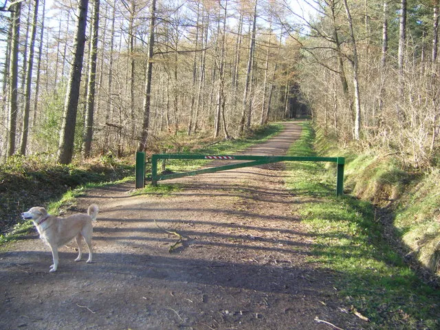
Chopwell Wood offers a technical mountain-bike descent close to Gateshead, within a wider woodland used by walkers, runners and horse riders. Powerline is the clear published riding choice, while the surrounding paths demand a different pace and attitude. Plan a visit around that distinction: a dedicated mountain-bike trail and a shared forest approach are not interchangeable places to practise riding fast.
This is also a relatively self-contained visit. Forestry England describes the site as unmanned, so organise your ride, meeting point and supplies before arriving. A shorter session can work well for a confident local rider, but a newcomer should leave time to understand the layout and the return. If your companions prefer walking, choose their route separately and agree when to meet back at the car park rather than expecting them to follow the bike descent.
Chopwell Wood mountain bike trails and grades
Powerline mountain bike trail
Red · 4 km
A fast, technical trail from the main car park down beneath the high-voltage powerline towards the River Derwent. Forestry England describes the red grade as suitable for proficient mountain bikers with good off-road skills.
Treat Powerline as the main riding commitment, rather than an introductory route simply because its published length is short. On a first visit, identify the start and understand how you will return before dropping away from the car park. Leave space between riders and make the opening descent a measured look at the trail. A four-kilometre technical ride can still be an unsuitable first mountain-bike outing for someone whose experience is limited to smooth paths.
Experienced riders can build a focused session around learning this descent, but should distinguish the maintained red route from informal lines seen elsewhere in the wood. Friends of Chopwell Wood says the former optional black section is no longer maintained. Do not use that older black classification as a current recommendation. On the shared paths used to get around the forest, ride with enough margin to respond to a walker, dog or horse around the next corner; those approaches are part of the visit too.
Where is Chopwell Wood?
Chopwell Wood is reached from High Spen / Rowlands Gill. Use NE39 1LT alongside the official entrance directions. Official directions →
Use NE39 1LT for the forest near Rowlands Gill. The entrance is in High Spen on the B6315; Forestry England warns that the wood is not signposted until that entrance. Approaches to the B6315 are from the A694 at Rowlands Gill or the A695 at Greenside. Parking in the main forest car park is free. Mark that location in your navigation before setting off on the trail, especially if the rest of your group will return there independently.
The nearest stop for the main entrance is on Hookergate Lane in High Spen, with the forest access road and a waymarked path leading towards the car park. Forestry England describes bus connections with Newcastle and the Metrocentre. Check the current operator journey planner for your actual service and return rather than relying on an old timetable. For a non-riding companion, arriving at the entrance is still different from arriving at your agreed meeting place inside the wood.
There are no public toilets and the site has no resident staff. Toilets associated with pre-booked Forestry England activities are a separate arrangement, so do not count on them for an ordinary riding visit. Sort out water, food and a toilet stop before arriving, particularly with children or a longer journey home.
The access information describes benches but no sheltered seating. A packed lunch can make the day easy to organise, though a wet forecast is a reason to choose a shorter stop rather than expecting an indoor refuge. The Welcome trail provides a walking option for wheelchair users; it is not the Powerline mountain-bike route. Ask companions to use the walking information that suits their needs, with a specific reunion time instead of a vague plan to wait until the bikes return.
Forestry England explicitly says the wood never closes and the main car park has 24-hour access, but neither the access road nor the car park is lit after dark. That is a useful distinction when planning an evening session: open access does not supply visibility. For a first visit, daylight makes it easier to understand both the forest layout and the technical trail. In wetter conditions, reduce the ambition of the first descent and keep the return within the energy and daylight you have left.
Rowlands Gill is a practical reference point for the day, and nearby Gibside offers a concrete food stop if you are making a separate National Trust visit. Its Market Place Café serves sandwiches, cakes and daily specials throughout the week. Plan that as part of a Gibside outing, including its admission arrangements and opening times, rather than assuming a café visit works like an unrestricted roadside stop. It is a useful alternative to eating at the car park when companions also want to explore the grounds.
Gibside’s Georgian landscape garden makes a worthwhile non-riding destination in its own right, with walking, landmarks and the Red Kite adventure play area. Another option within Chopwell is the permanent beginner orienteering course: Forestry England directs visitors to Friends of Chopwell Wood to purchase the map. That offers non-riders an actual navigation activity and gives a mixed group two distinct ways to spend time in the same woodland.
Some links are affiliate links — if you book, we may earn a small commission at no extra cost to you.
Displayed distances are straight-line estimates using OpenStreetMap contributors (ODbL), not road journeys. Ask the property about secure bike storage and wet-kit arrangements before booking.
RIDE PREPARATION
Kit for this ride
Consider what suits the route, forecast and your own experience.
It is officially red, fast and technical. Forestry England recommends proficient riders with good off-road skills; its four-kilometre length should not be mistaken for beginner suitability.
Is the old black option still maintained?
Friends of Chopwell Wood says the former optional black section is no longer maintained. Use the current published red route and respect signs rather than planning around an older black-trail description.
Can I park without paying?
Yes. Forestry England publishes free parking at Chopwell Wood. The main car park has 24-hour access, with no lighting on the road or in the car park after dark.
Are there public toilets at the trailhead?
No. The official access information explicitly says there are no public toilets. Facilities for pre-booked Forestry England activities do not provide general visitor access.
Can a walking companion follow the same descent?
Use a separate walking route. The woodland friends’ walking guidance identifies Powerline as a mountain-bike-only trail, while other woodland paths have multiple users.
Develop braking, cornering, climbing and technical riding through deliberate practice, with sensible progression for roots, rocks, steeps, wheel lifts and jumps.