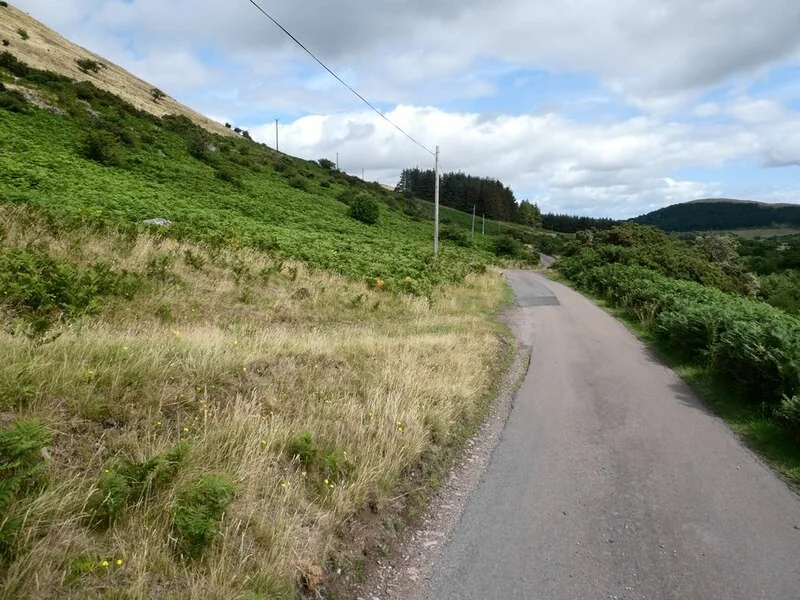
Northumberland gives mountain bikers spacious cross-country riding, with the Cheviots offering a particularly rewarding mix of grassy hills, stone tracks and quiet valleys. The National Park identifies Alwinton as a mountain-bike base and publishes the Copper Snout horse ride on bridleways and other authorised links. College Valley gives another way into the hills, while the wider Sandstone Way turns a Northumberland visit into a multi-day cycling journey.
Choose the exact route before choosing a base: Wooler, Alwinton and the Sandstone Way’s southern stages serve different days. This is shared countryside, not a single colour-graded network. Carry Explorer OL16 for the Cheviot riding and use the published cycling or bridleway itinerary. High walking paths, including sections of the Border Ridge, cannot be assumed rideable merely because they appear beside an attractive valley.
Northumberland & the Cheviots: classic mountain bike routes
Copper Snout: Clennell Street and Pass Peth
Strenuous · 17.7km
The National Park’s horse-riding leaflet publishes an off-road circuit from Clennell using stone and grass tracks, bridleways and road connections. Clennell Street leads towards Wholehope; the return includes Shillmoor and Pass Peth before Alwinton and Clennell. The authority identifies these valley horse routes as suitable for mountain bikers. Follow the exact authorised links, including the Ministry of Defence permission described in the leaflet, and allow for steep ground and water crossings.
The National Park’s College Valley and Yetholm cycling itinerary is on roads, giving a lower-key valley day with the Cheviot landscape around you. College Valley welcomes cyclists; motor-vehicle access beyond Hethpool’s free car park is limited by permits. Keep this road-based itinerary separate from the walking routes on the surrounding hills. It can suit a recovery day or a mixed trip, without promising a technical descent or a fully traffic-free family loop.
This published mountain-bike route links Berwick-upon-Tweed and Hexham across the wider county, passing through a changing landscape of sandstone features, villages and countryside. It is an itinerary for several days or carefully selected stages, not a short Cheviot loop. Arrange accommodation and the return journey before riding the full route. Use the current route information to divide the day sensibly; joining a stage from a town still requires a legal and suitable connection.
The Copper Snout leaflet maps the 17.7 km strenuous ride from Clennell Farm, including its permission-based parking arrangements; it is not a map of every Cheviot ride.
For a group with natural-riding experience, choose Copper Snout in a forecast that suits an exposed hill day. Read the whole leaflet, including its gates, water crossings and return options, before reaching the first climb. Keep the pace comfortable while learning how the group handles stone and grass. Descend ready to stop for a walker, horse or agricultural vehicle; these tracks remain working countryside.
For a less demanding first outing, use the published College Valley road ride or a contained valley section with an agreed turnaround. Experienced riders planning the Sandstone Way should build a proper stage plan, including where to buy food and what happens after a mechanical problem. Carry tools, spare clothing and navigation that works offline. A quieter landscape rewards self-sufficiency; it does not make a rushed late return easier.
Where is Northumberland & the Cheviots?
The map pin marks Alwinton National Park car park, using the official grid reference NT919063. The authority currently lists £2 for up to two hours or £3 all day, toilets and no overnight parking. Official directions →
The map pin marks Alwinton National Park car park, using the official grid reference NT919063. The authority currently lists £2 for up to two hours or £3 all day, toilets and no overnight parking. This is a useful visitor base in Upper Coquetdale. Copper Snout’s leaflet starts separately at Clennell Farm, with parking described as permission-based, so establish the current arrangement before leaving a vehicle there.
For College Valley, use the Hethpool parking and current valley directions. Motor permits do not restrict ordinary responsible bicycle access, but visitors still need to follow local signs. Wooler provides a northern overnight base; Rothbury is useful for Upper Coquetdale. Rail access to the wider county can support a multi-day trip, but the last connection and bicycle carriage need organising with the operator.
Nearby planning base. Alwinton National Park car park is a regional planning base; Copper Snout starts at Clennell. Official coordinate source
Facilities
Alwinton’s National Park car park has toilets, and the village’s Rose and Thistle is identified as its main social and refreshment base. Copper Snout’s leaflet names further services in Rothbury and pubs in the valley villages. Do not assume a remote ride passes an open shop at lunchtime. Start with food, drinking water and a repair kit, then use any planned refreshment stop as a welcome addition.
There is no one visitor desk, hire fleet or uplift covering the Cheviots. Arrange any bicycle hire or guiding directly, including the support provided if the route changes. Accommodation in Wooler and Rothbury offers practical overnight choices, but bicycle storage must be agreed with the property. For a mixed party, choose separate walking and cycling itineraries and a definite meeting point instead of sending both groups along the same unexamined line.
Alwinton parking is £2 up to two hours or £3 all day; overnight parking is prohibited. There is no single opening timetable for the regional bridleway network.
The Cheviots require a conservative decision about wind, visibility and wet ground. Stone and grassy tracks behave differently after rain, and water crossings can become a reason to turn back. Copper Snout’s instructions include steep-sided burns; dismount where needed and never force a crossing that feels unsafe. Keep the existing path narrow, leave gates as instructed and avoid creating bypasses across the hillside.
Parts of Northumberland are military training land. Use the Ministry of Defence’s current public-access guidance and obey on-site signs, red flags, red lights and instructions. A published recreational route cannot override a live restriction. Plan an alternative outside affected land when access is unavailable, and do not rely on an old leaflet or a generic firing calendar to establish that an individual track is safe at that moment.
Camping and places to stay near Northumberland & the Cheviots
A base in Wooler / Rothbury
Wooler works well for College Valley and the northern Cheviots, with No. 1 Hotel and the Black Bull offering overnight rooms. Rothbury’s Queens Head and Turks Head suit a different base for Coquetdale, while Eglingham offers another village option. Match the stay to the chosen departure point. The National Park identifies Alwinton car park as a dark-sky site, making a separate stargazing visit a possible non-riding activity when weather and travel arrangements suit.
Some links are affiliate links — if you book, we may earn a small commission at no extra cost to you.
Displayed distances are straight-line estimates using OpenStreetMap contributors (ODbL), not road journeys. Ask the property about secure bike storage and wet-kit arrangements before booking.
RIDE PREPARATION
Kit for this ride
Consider what suits the route, forecast and your own experience.
Are the Cheviots suitable for beginner mountain bikers?
Choose a specific valley outing or the road-based College Valley itinerary. Copper Snout includes steep natural ground and water crossings, so it needs more off-road experience.
Can mountain bikers use the Copper Snout ride?
The National Park identifies the Coquet Valley horse-riding routes around Alwinton as suitable for mountain bikers. Its Copper Snout leaflet publishes the authorised bridleway and track connections.
Is College Valley a downhill trail network?
No. The official College Valley and Yetholm cycling itinerary is road-based. The valley welcomes cyclists, but walking routes above it are not automatically bicycle routes.
Which OS maps cover the Cheviots?
Explorer OL16, The Cheviot Hills, covers Copper Snout and the northern hill riding. Wider Sandstone Way stages require additional route mapping for the selected section.
Can I cross Otterburn training land whenever I want?
No. Follow current MOD access guidance and on-site safety signals. Temporary military restrictions take precedence over a saved recreational route.