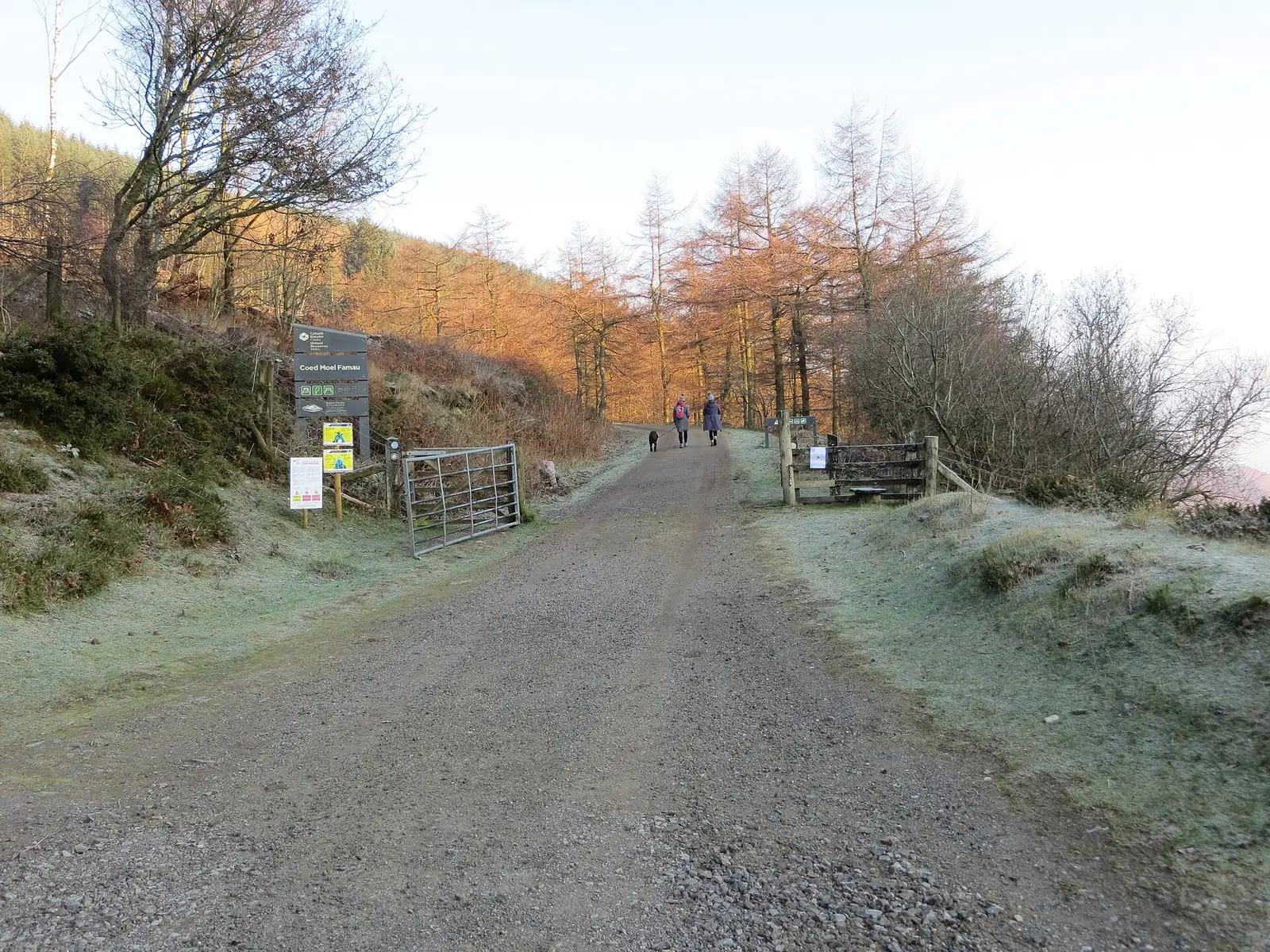
Coed Moel Famau gives a forest ride a more expansive setting on the lower slopes of the Clwydian Range. The named mountain-bike circuit climbs towards the edge of the trees, opening views eastwards before dropping back into woodland. It is a rewarding choice for someone with basic off-road experience who wants a complete outing with climbing, descending and changing scenery, rather than a short first experiment on a bike.
The wider destination also attracts walkers and families heading into the forest or towards the Jubilee Tower. Plan your ride around the signed mountain-bike route and expect company on shared sections. A companion can choose a walk or picnic while you cycle, but arrange the reunion at the correct car park. The blue riding loop and the walking route to the summit provide different days out; choose deliberately rather than following whichever waymarker appears first.
Coed Moel Famau mountain bike trails and grades
Ffrith Mountain Circular
Blue (Moderate) · 12.4 km · 120 m
NRW’s current cycling description combines forest riding with public bridleway sections. A steady climb reaches views at the forest edge, followed by a descent, a stream crossing and a return into the trees. A further forest-road climb comes before the finish. Save some energy after the first descent: the outing continues beyond that early reward. Walkers can also use this circuit.
The blue circuit uses forest riding and shared bridleway, with a climb to the forest edge, a stream crossing and a return climb. This cycling leaflet is more useful than following walking signs to the Jubilee Tower.
For your first visit, allow a generous part of the day for the full circuit. The land manager suggests two to three and a half hours for cycling, which leaves scope for a measured pace and breaks. Start with water and a snack, then settle into a sustainable climbing effort. If you are bringing children, make the decision around their off-road control and ability to keep going for the whole ride, not their enthusiasm in the car park.
An experienced rider can enjoy linking the different parts into a smooth ride, carrying confidence from the wooded climb to the more open viewpoint and back downhill. Keep speed appropriate on the shared bridleway and inspect the stream crossing before committing. The regional cycling guide identifies the lower car park as the start; use the current entrance panel and waymarkers to orient yourself instead of improvising a route towards the highest visible hill.
Where is Coed Moel Famau?
From Mold, take the A494 towards Ruthin and turn right after Loggerheads Country Park at the brown Moel Famau Country Park sign. The Coed Moel Famau car park is about a mile along, on the right. Official directions →
From Mold, take the A494 towards Ruthin and turn right after Loggerheads Country Park at the brown Moel Famau Country Park sign. The Coed Moel Famau car park is about a mile along, on the right. Use the NRW location pin or grid reference SJ 171 610: the postcode CH7 5SH covers a wider area. This is the forest start, so make that clear when meeting friends.
The car park uses number-plate recognition, with payment by card or contactless at the exit barrier or pay station when leaving. Include time spent changing, picnicking and waiting for companions in your parking plan. Overnight parking is prohibited. NRW identifies Buckley as the nearest mainline railway station and points visitors to Traveline Cymru for onward travel; work out that connection independently rather than assuming a direct train-to-trail transfer.
There are picnic tables around the car park, toilets including accessible facilities and Blue Badge parking. The published car-park and toilet hours are 8am–6pm from October to March, extending to 9pm from April to September. Plan the ride and the final break inside that window. The location is unstaffed, so bring the bike, tools and supplies you need instead of relying on help at the trailhead.
For a family group, the wider woodland offers several walking choices. The Forest Tracker Trail uses animal tracks and sculptures to encourage younger visitors to look around, while the arboretum provides a shorter tree-focused stroll. Choose a separate walking plan for companions and a clear meeting time. A picnic at the start can be a useful shared part of the day even when everyone chooses a different activity afterwards.
The car park and toilets open 8am–6pm October–March and 8am–9pm April–September. ANPR parking is paid by card or contactless on departure; overnight parking is not allowed.
Forest cover and the viewpoint at the edge of the trees give this ride different exposures. Keep a layer handy for a stop with a view, even after the climb has warmed you up. Wet weather also makes the stream crossing a place to reassess your line and footing; walking across can be the sensible choice. Shorter winter access hours favour an earlier start. Year-round riding remains subject to weather or forestry restrictions, as on other NRW trails.
We Three Loggerheads, on Ruthin Road beside Loggerheads Country Park, is a convenient pub and restaurant for a meal around the ride. The restored coaching inn has separate published bar and food hours, with food service ending earlier on some days. Arrange the meal around the kitchen’s hours, particularly after a weekday afternoon circuit. Its location also works for companions who want to visit the country park while the cyclists are in the forest.
Loggerheads Country Park makes a distinct non-riding visit with a wooded river valley, limestone cliffs and walking choices. The National Landscape team describes a short accessible riverside circuit and a longer route through the woods to the cliffs. Choose whichever fits the group’s energy after cycling, or let non-riders explore before your meal together. These are country-park walks to enjoy on foot, with their own access and parking arrangements.
Some links are affiliate links — if you book, we may earn a small commission at no extra cost to you.
Displayed distances are straight-line estimates using OpenStreetMap contributors (ODbL), not road journeys. Ask the property about secure bike storage and wet-kit arrangements before booking.
RIDE PREPARATION
Kit for this ride
Consider what suits the route, forecast and your own experience.
NRW grades the Ffrith Mountain Circular blue for mountain biking. Its walking listing uses strenuous, which is a separate walking assessment. Use the cycling grade when choosing a ride.
Does the blue route climb to the Jubilee Tower?
The described cycling loop climbs to the edge of the forest and returns through woodland. The Jubilee Tower Circular is listed separately as a walking route; it should not be treated as the signed blue mountain-bike circuit.
Can I pay for parking with cash?
No. NRW specifies card or contactless payment for the number-plate-recognition car park. Pay when leaving, either at the barrier or through the pay station using your registration.
Are the trails exclusively for mountain bikes?
No. The Ffrith circuit may also be used by walkers, and part follows a public bridleway. Leave space for others and avoid assuming a clear downhill stretch will remain empty.
How late can I return in winter?
The published October–March car-park and toilet hours end at 6pm. Allow time to finish the ride, change and leave before closing rather than arriving back at the final minute.
Develop braking, cornering, climbing and technical riding through deliberate practice, with sensible progression for roots, rocks, steeps, wheel lifts and jumps.
Build mountain-bike endurance, strength and confidence with practical food, hydration and recovery planning, including an individual return after injury.
Official links
Trail conditions change — check the official page before you travel.