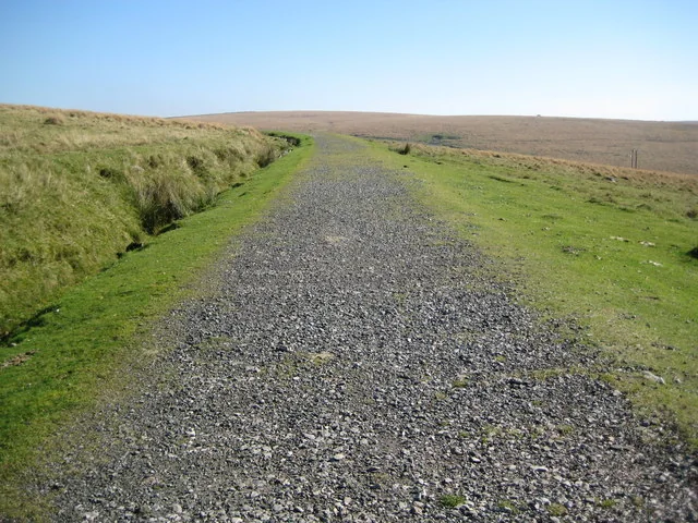
Dartmoor gives mountain bikers granite-country riding with a clear choice of published routes. Granite & Gears follows the old Princetown railway or crosses permitted bridleways to Burrator Reservoir; the Granite Way supplies gentler railway riding on the north-western edge. You can choose an introductory day or a much more demanding moorland circuit without treating the entire landscape as one unrestricted riding area.
The National Park is explicit: cycling on open moorland and common land is permitted only on a designated bridleway or allowed route. Build the ride around its cycling map and current route leaflets. Explorer OL28, Dartmoor, helps you understand the ground, while the authority’s access map resolves the cycling line. A walking path to an attractive tor is not automatically a mountain-bike option.
Dartmoor: classic mountain bike routes
Granite & Gears: Princetown Railway
Intermediate · 10km or 30km
The National Park’s railway leaflet offers two lengths, following much of the former railway and connecting towards Burrator on the longer version. It is mostly traffic-free but includes minor-road riding. Broad railway alignment can make route finding simpler, yet the moorland setting still demands suitable clothing and enough supplies. Download the particular version you intend to ride; the short and long options should not be blended casually at an unfamiliar junction.
This separate cycling circuit uses permitted bridleways and minor roads. Its published directions include Norsworthy Bridge, Sheepstor, the Eylesbarrow tin-mine area and Nun’s Cross. Expect a more involved natural ride than an easy railway outing. Carry the full route instructions alongside a map and identify the legal connections before leaving. The fact that a route crosses the moor does not permit an alternative line across surrounding common land.
The National Park describes this multi-use route as mostly traffic-free, largely following the former railway along Dartmoor’s north-western edge. It is a useful option for a mixed group or a lower-key day after a demanding moorland circuit. Arrange the return or choose a manageable out-and-back. It is a different start from Princetown, so place your accommodation and transport around the day you actually want to ride.
The leaflet maps the former Princetown railway cycling options. Wider moorland links must remain on permitted routes, bridleways or byways; open moorland is not general cycling access.
For an off-road rider visiting the central moor for the first time, choose the shorter Princetown railway itinerary in a suitable forecast. Establish where the railway route begins and where its shorter version returns. Pace the outward leg so that a headwind or a slower companion does not make the way home unpleasant. Stop at junctions before following someone onto an unplanned path.
Experienced riders can choose the 20km Burrator bridleway circuit when ready for its harder natural terrain. Read the stages before departure and carry spares for a puncture or a basic mechanical problem. Agree a turnaround or alternative permitted return where possible. For a family needing a gentler introduction, the Granite Way can be the better fit; a moorland route’s modest kilometre total says little about the effort required.
Where is Dartmoor?
The map pin marks Princetown’s National Park car park, given by the authority as grid reference SX589734. It is a planning base for central Dartmoor, not a universal trail entrance. Official directions →
The map pin marks Princetown’s National Park car park, given by the authority as grid reference SX589734. It is a planning base for central Dartmoor, not a universal trail entrance. Use the National Park’s current parking instructions and displayed charge when arriving. Keep the bicycle preparation out of the way of other vehicles, and avoid blocking gateways while deciding where to begin.
Princetown is reached using the B3212 and B3357 connections described by the National Park. Allow a realistic journey across the moor, with livestock, narrow roads and changing visibility in mind. For rail-based Granite Way riding, organise bicycle carriage to Okehampton with the operator. Public-transport arrival and the central moor’s last connection need a separate plan; a railway station elsewhere in Devon is not a ready-made link to every trail.
Nearby planning base. Princetown National Park car park is a regional planning base. Official coordinate source
Facilities
Princetown offers an established visitor base, and the cycling leaflets identify the National Park Visitor Centre for route information. Use the village before heading onto a more remote circuit. Carry drinking water and a meal or substantial snacks, since a route heading towards Burrator is not a guarantee of an open café at the point you need one. Any meal stop should remain optional to finishing the ride safely.
Arrange bicycle hire and storage directly with the relevant business. This riding-region page does not promise a staffed trail-centre workshop, uplift or a single network-wide set of facilities. Bring the tools that fit your bicycle and know how to use them. If travelling with non-riders, agree separate permitted walking routes and a meeting time in the village; neither party should rely on the other’s route directions.
Dartmoor’s exposed sections deserve a weather decision before departure. Wind, mist and rain can transform an otherwise straightforward railway or bridleway outing. Carry a waterproof and spare insulation, with an offline map and a backup means of navigating. Aim to finish with daylight in reserve. A shorter route chosen early in the day is preferable to an improvised escape once the group is cold.
The authority’s cycling code asks riders to keep to existing paths, avoid widening wet ground and ride considerately around wildlife and livestock. Brake early on loose or wet surfaces, give walkers and horses space, and follow temporary restrictions. Do not transfer open-access walking rights to bicycles. Military training affects parts of Dartmoor, so a wider route involving training areas needs its own access information, separate from these published central and edge routes.
Princetown and Two Bridges are useful bases for the central Granite & Gears options. The Ramblers’ Rest and Two Bridges Hotel are named overnight choices; Merrivale and Postbridge offer other stays on the moor. Lydford suits the Granite Way’s western end. Choose the riding start before booking a room, ask about bicycle storage and avoid assuming that a hotel’s nearby walking recommendation is also a cycling route.
Some links are affiliate links — if you book, we may earn a small commission at no extra cost to you.
Displayed distances are straight-line estimates using OpenStreetMap contributors (ODbL), not road journeys. Ask the property about secure bike storage and wet-kit arrangements before booking.
RIDE PREPARATION
Kit for this ride
Consider what suits the route, forecast and your own experience.
No. The National Park restricts cycling on open moorland and common land to designated bridleways and permitted routes. Use its cycling guidance and access map.
How long is the Princetown railway ride?
Granite & Gears offers 10km and 30km versions. Its leaflet describes the riding as Intermediate and mostly traffic-free, with minor-road connections.
Is the Burrator bridleway circuit easy?
The separate 20km Princetown and Burrator leaflet grades it Intermediate to Difficult. It suits riders prepared for a natural route, not an easy family railway outing.
Which OS map covers Dartmoor?
Explorer OL28, Dartmoor, is the main sheet for these central routes. Bring the official cycling itinerary and use the access map to resolve permissions.
Where is a gentler option?
The 18km Granite Way between Okehampton and Lydford is mostly traffic-free. Choose a shorter out-and-back if the full linear route and return exceed your group’s day.