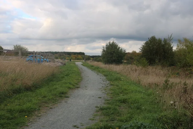
Ingrebourne Hill puts a short, officially described mountain-bike trail within the green space beside Hornchurch Country Park. Forestry England’s Spitfire trail is a 2km moderate route through pine stands and open grassland, with turns, switchbacks and a pump-track section. It is a manageable destination for practising a particular skill or trying a first purpose-built trail without planning a remote forest expedition.
The wider site offers general cycling paths as well as walking and horse-riding routes, so knowing which line you are joining matters. Download Forestry England’s map and use the current signs to separate the mountain-bike course from shared paths. The official visitor page continues to advertise cycling and gives seasonal car-park arrangements, providing a sound basis for planning a visit while leaving the day’s surface conditions to be assessed on arrival.
Ingrebourne Hill mountain bike trails and grades
Spitfire mountain bike trail
Moderate · 2km
Forestry England names this route and describes a mixture of forest road, gravel and loose stone. Its bends and switchbacks offer useful opportunities to work on looking through a turn and controlling speed before entering it. The moderate grade means the rider should be comfortable managing changing surfaces and some technical features; a short distance does not remove that requirement. Begin with one controlled lap and decide what to repeat after seeing the course.
The official cycling page lists 3km of general cycling paths separately from the 2km mountain-bike course. Use these permitted connections for a quieter introduction or to accompany a rider who is not ready for Spitfire. The figure describes the available paths, not a single named loop to add automatically to the MTB distance. Consult the map and signs before making a route through the site.
The map separates Spitfire’s two-kilometre MTB course from general cycling and walking routes. Its older gate timetable is superseded by current entrance signs.
Set the first session around the course’s compact scale: warm up on a permitted cycling path, complete one Spitfire lap and stop to discuss how it felt. A confident companion should allow the newer rider to set the pace and choose whether to repeat. Agree a visible meeting place away from the riding line so nobody has to stop unpredictably in a bend.
Prepare working brakes and suitable tyres before joining the trail. A helmet, drinking water and the equipment needed for a basic puncture repair make sense even when the car is nearby. Ride within the room you can see, particularly where loose stone changes grip. Walking an uncertain feature is a sensible choice; move clear of approaching riders before stopping to inspect it.
The pump-track section offers a different kind of practice from climbing and descending. Watch how riders use it before entering, leave a gap and concentrate on smooth weight shifts before adding speed. Return to a familiar section when practising a new skill, then finish while you still have good control. Repeated laps are useful only while concentration remains high enough to learn from them.
Where is Ingrebourne Hill?
Use Rainham Road, RM13 8ST, off the A1306 opposite Travis Perkins. The car park is free, with two accessible spaces. Official directions →
Forestry England gives Rainham Road, Essex, RM13 8ST as the arrival address and says the entrance is just off the A1306, opposite Travis Perkins. Its published location is 51.5260227, 0.1924926, with grid reference TQ535 838. Use the official entrance directions for the last part of the journey, especially if a phone suggests access from a different residential street.
The car park is free, and the visitor page records two accessible parking spaces. Its opening times are seasonal: read the gate signage when you arrive and plan to be out before closure. The downloadable map contains older opening information, so the current visitor page and displayed gate hours take priority. Unload within a parking space without blocking another visitor’s route to the paths.
Approximate trail-area pin. Forestry England publishes these coordinates with current arrival information. Planning point at Rainham Road, not course start. Official coordinate source
Facilities
The official visitor information confirms a picnic area, an easy-access trail and dog access. Pack food and water if the ride forms part of a longer outing. The retrieved Forestry England pages do not establish an on-site café, bike-hire desk, workshop or toilets, so make those arrangements separately if they are essential to your group.
The trail map helps explain the setting beside the river, lake and neighbouring country park. Keep bicycles on the cycling routes and away from sensitive margins. A path used for walking or a marked horse route should not be treated as an extension of Spitfire simply because it looks rideable. Give other users space and keep breaks away from junctions where people need to pass.
This is a useful short daylight outing when a longer journey is impractical, but the visit still depends on weather and access conditions. Look at Forestry England’s current page before leaving and read any trail notices on arrival. A free-access course is not an assurance that every feature remains usable after rain, maintenance or damage.
In autumn, allow for less daylight and carry a warm layer for breaks in the open grassland. After wet weather, adapt the pace to the surface you find instead of expecting each lap to feel the same. If a section is closed, follow the signed alternative or end that part of the ride. Nearby green space does not justify creating a new bypass across grass or vegetation.
Rainham and Hornchurch are the most useful starting localities for an accommodation search. Consider how you will reach Rainham Road with bikes, and whether the stay is primarily a riding trip or part of a wider London visit. A more distant hotel with good rail access can work for other plans, but it may complicate the final bike journey compared with a local base.
Some links are affiliate links — if you book, we may earn a small commission at no extra cost to you.
Displayed distances are straight-line estimates using OpenStreetMap contributors (ODbL), not road journeys. Ask the property about secure bike storage and wet-kit arrangements before booking.
RIDE PREPARATION
Kit for this ride
Consider what suits the route, forecast and your own experience.
Spitfire is Forestry England’s named 2km moderate mountain-bike trail. The landmanager describes turns, switchbacks, a pump track and variable forest-road, gravel and loose-stone surfaces.
Is Spitfire suitable for a complete beginner?
Its official grade is moderate. Start with the general cycling paths if braking and steering off-road are still unfamiliar, then choose the trail only when its signs and features fit the rider’s ability.
How much is parking?
Forestry England currently lists no parking charge. Car-park gate times vary seasonally, so use the signs at the entrance for the day’s closing time.
Are all the paths bike trails?
No. The site has walking, cycling and horse routes. Follow the official map and current signs; the general cycling network and Spitfire course are separate from pedestrian-only paths.
Can I hire a bike at Ingrebourne Hill?
The retrieved official pages do not confirm on-site bike hire. Bring a suitable bike or arrange hire elsewhere with explicit permission to use it on the mountain-bike course.
Develop braking, cornering, climbing and technical riding through deliberate practice, with sensible progression for roots, rocks, steeps, wheel lifts and jumps.
Plan your first UK mountain-bike ride, understand grades and trail language, check your bike and build confidence before tackling harder or more remote routes.