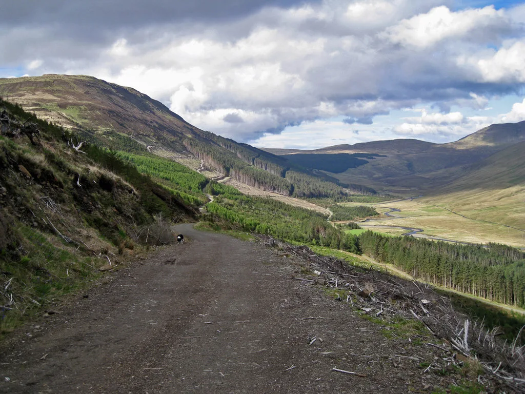
Access note: Glen Brittle has harvesting and timber haulage in progress. Follow FLS signs and instructions; use another route where forest roads are closed.
Skye offers forest-road riding beneath the Cuillin and quieter coastal tracks around Broadford, with a much bigger mountain landscape beyond them. Glen Brittle’s working forest provides a named circuit over Bealach Brittle, while Broadford’s unwaymarked forest roads offer a more contained starting point. A mountain bike lets you reach views away from the main visitor stops, but this is self-directed countryside riding, with no single trail-centre reception or universal set of graded loops.
Plan around the part of the island you intend to ride. OS Explorer 411, Skye – Cuillin Hills, covers the central mountain area; Explorer 412, Skye – Sleat, covers the southern end including Broadford. Scotland’s access rights include responsible cycling, so English bridleway restrictions are not the framework here. Respect sensitive ground, other visitors and forestry closures. A mountain path being open to responsible access does not make it a maintained mountain-bike descent or a suitable beginner route.
Isle of Skye: classic mountain bike routes
Glen Brittle forest roads over Bealach Brittle
Not colour-graded
FLS describes a circuit of forest roads over Bealach Brittle, with views towards the Cuillin Ridge and Loch Eynort. Use the land manager’s route card to locate the forest-road connections and decide your direction before setting off. This is the named forest circuit, not an instruction to ride every walking path around the Fairy Pools. The forest is currently being harvested, so a closed road may require a different plan.
FLS welcomes exploration of this unwaymarked forest, with views over nearby islands and Camus na Sgianadin. Choose the wider forest-road network for a short first outing and establish your return at each junction. The shoreline paths described on the visitor page are separate terrain; do not assume every coastal section is practical to cycle. Turn back while the way remains clear and comfortable for everyone.
The council’s published core-path plan identifies this mountain connection. Its current access portal provides the interactive core-path map and access advice; the previous standalone PDF link no longer works. This remains an ungraded corridor for experienced visitors, with no promise that every section is rideable. Study terrain and weather, expect to dismount and choose an achievable turnaround. The forest-road options provide the better introduction.
The FLS route card maps Glen Brittle forest and the Eynort Loop. It does not cover the full Sligachan hill-path corridor or Broadford; use the council access map and the appropriate OS sheet for wider rides. Forest closures and signs take priority.
Begin on Broadford’s forest roads if the group is new to natural riding. Save the route card and mark where you joined the network. Ride a short outward leg, pause to assess everyone’s comfort, then return by the known line. This gives time to settle into the island’s surfaces and weather without an ambitious crossing dominating the first afternoon.
For experienced riders, the Bealach Brittle forest-road circuit is a useful next objective when the current operational access allows it. Establish which entrance you are using and where the loop returns before starting. Carry a tube or repair system, pump, tools, food and a warm layer. Keep the group together at uncertain turns and let the least confident rider set the descent pace.
Where is Isle of Skye?
Glen Brittle forest has its own published FLS entrance and map pin. Broadford supplies a separate forest-road option; use the chosen start’s directions, not a generic Skye destination. Official directions →
Skye can be reached by the road bridge or CalMac’s Mallaig–Armadale ferry. Use the operator’s current information for sailings and bicycle arrangements; the southern arrival point may be a substantial onward journey from your chosen start. Plan accommodation and riding as one itinerary, allowing room for disruption and a slower travel day. Confirm carriage with each rail or bus operator before relying on public transport with a full-size bike.
FLS provides two Glen Brittle approaches: its own car park in Glen Eynort and the community-owned car park near the Fairy Pools in Glenbrittle. They serve different sides of the forest. The planning pin follows the FLS map destination for Glen Eynort, not a summit or an interchangeable Fairy Pools parking address. Follow the official directions and current parking instructions, leaving access for timber traffic and neighbouring properties clear.
Approximate trail-area pin. Glen Eynort forest entrance is one island planning point. Official coordinate source
Facilities
FLS lists parking at Glen Brittle and identifies the Glen Eynort location as a kayak launch as well as a forest entrance. This is not a staffed cycling centre, so arrive with water, food and essential spares. A nearby tourism attraction or a busy car park does not guarantee toilets, hire or a workshop at your riding start. Choose services in a village before entering the forest.
Broadford and Portree are useful places to organise food and overnight accommodation. Arrange any bike rental or repair with the actual business and explain whether you need a bike for forest roads or rough mountain terrain. Ask your hotel about secure storage and drying space. Keep wet kit contained, and agree how you will clean the bike without using hotel facilities inappropriately.
FLS currently reports harvesting and timber haulage in Glen Brittle. Follow warning signs and instructions from machine operators; the forest-road itinerary may need to change. Do not ride behind barriers or assume the absence of machinery means a work site is safe. Broadford’s visitor page provides a separate lower-level alternative, but use its own local notice information before departing.
Wind, low cloud and heavy rain matter more as the route becomes exposed or remote. Shorten the day early when the forecast is poor and keep enough daylight to find your return. On soft ground, avoid widening a path by riding around wet patches. Slow before blind bends, give walkers space and dismount when passing is awkward. Responsible access includes changing the plan when your ride would damage the ground.
Broadford Hotel offers a southern-island base for Broadford forest and bridge access; Duisdale House Hotel is another real overnight option farther south at Isleornsay. Sligachan Hotel places you near the central mountain junction, while Cuillin Hills Hotel and Marmalade provide Portree stays. These are accommodation choices across the island, not five hotels beside one trailhead. Pick the locality that fits your main riding days.
Allow a non-riding day or afternoon for a shoreline stroll, village meal or island sightseeing. Do not schedule every day as the longest possible ride: travel and weather can make a flexible forest outing the most enjoyable part of the trip.
Some links are affiliate links — if you book, we may earn a small commission at no extra cost to you.
Displayed distances are straight-line estimates using OpenStreetMap contributors (ODbL), not road journeys. Ask the property about secure bike storage and wet-kit arrangements before booking.
RIDE PREPARATION
Kit for this ride
Consider what suits the route, forecast and your own experience.
The forest and natural routes described here are not colour-graded. They are countryside roads and paths, so use the land manager’s descriptions and map to assess the riding.
Where should a first-time visitor start?
Broadford’s wider forest roads provide a contained option. Keep the first outing short, establish the return at every junction and do not assume all shoreline paths are suitable to cycle.
Can I ride Glen Brittle during forestry work?
Harvesting and haulage are currently published by FLS. Follow barriers and operator instructions; only ride the parts that remain available and choose another outing if your intended connection is closed.
Which OS maps cover these rides?
Explorer 411 covers the Cuillin Hills area; Explorer 412 covers Sleat and Broadford. Select the sheet for your route, with an offline copy and the relevant land-manager route card.
Is the Sligachan mountain connection a maintained bike trail?
No such promise is made by the council core-path map. It is an ungraded hill-path corridor; experienced visitors must assess conditions, access responsibilities and sections requiring dismounting.