Access note: Glenashdale Falls walking trail has a long-term storm-damage diversion; safe access to the Iron Age fort is unavailable. Follow FLS notices and signs.
Arran gives a mountain-bike holiday a proper island rhythm: arrive by ferry, settle into a village and choose between forest-road mileage and demanding natural singletrack. Brodick is the starting point for the published Castle, Glencloy and Clauchlands routes, while the south of the island offers the Dyemill to Kilmory forest crossing. The riding is spread across the island, so a few nights lets you explore different starts without making every outing a race back to the ferry.
This is a natural riding region, with separate community facilities and many shared countryside tracks. VisitArran publishes route descriptions from easy/moderate outings to hard technical rides; these are descriptive categories, not national trail-centre colour grades. Use OS Explorer 361, Isle of Arran, alongside the route maps. Scotland’s responsible access rights apply to cycling, but fragile ground, busy paths and working forestry still need thoughtful decisions. Pick the riding that suits your group before choosing a hotel.
Isle of Arran: classic mountain bike routes
Castle Route
Easy/moderate, published descriptive grade · 10 km
VisitArran’s Brodick circuit combines hilly forest roads, tracks and rougher paths. Its easy/moderate description assumes reasonable fitness; it does not mean a flat promenade ride. Download the actual route map and follow its line through the forest.
Easy/moderate, published descriptive grade · 10 km
Another published Brodick loop, using forest roads, tracks and rough trails through the Glencloy area. It suits novices with good fitness who want a contained natural outing. Compare its map with the Castle circuit before setting off; the same starting village does not make their turns interchangeable.
Hard/technical, published descriptive grade · 18 km
VisitArran reserves this hilly mixture of forest roads and technical singletrack for experienced mountain bikers. Make it the progression ride after your group has settled into Arran’s natural surfaces. Carry tools and navigation, and leave a margin for pushing awkward sections.
Forestry and Land Scotland publishes a forest-road crossing from Dyemill near Lamlash to the Aucheleffan entrance east of Kilmory, with access also possible from Whiting Bay. Expect loose surfaces and steep climbs. The published forest leg is not a complete return circuit: returning via the Ross adds a minor-road section with another steep climb. Plan that return or arrange collection in advance.
Use Castle Route, Glencloy Route, Clauchlands Route as distinct route choices, matching each grade and climbing commitment to the group. Follow current signs and closures, even where an older map shows a continuous connection.
Start with the Castle or Glencloy route from Brodick if everyone is comfortable climbing and riding rough tracks. Download its map while you have a reliable connection, identify a sensible turnaround and agree a pace that leaves the least experienced rider fresh for the descent. Keep the first afternoon short enough to settle into your accommodation and organise the following day.
For stronger riders, Clauchlands provides a named technical option without committing immediately to a long island crossing. VisitArran also publishes the harder 25 km Laggan route from Sannox; use its own map if that is your next objective. Carry food, water, a repair kit and a spare layer on all remote outings.
Where is Isle of Arran?
For Dyemill and the forest crossing, start near Lamlash using the FLS visitor directions. Other island routes have separate Brodick and northern starts; organise the ferry around the selected route. Official directions →
Use CalMac’s current Arran travel information for the ferry departure port, sailing and bicycle reservation arrangements. Do not build the trip around an old printed timetable. Book the outward and return journey with time for packing and reaching the terminal; ferry disruption can affect an otherwise straightforward riding weekend. On arrival in Brodick, let the disembarking traffic clear before joining the island road.
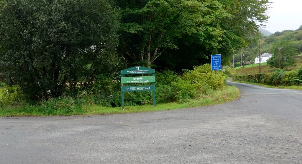
For Dyemill, FLS directs visitors south from Brodick towards Lamlash, then onto the Kilmory road at Monamore Bridge. The forest car park is on the left; the nearest published postcode is KA 27 8 AR. Its nearest bus stop is in Lamlash, about a mile away. Arrange any bus bicycle carriage directly with the operator. The map pin marks this forest start, not the whole island or every route entrance.
Approximate trail-area pin. Dyemill forest car park is one island route start. Official coordinate source
Facilities
Dyemill has designated parking, but FLS places the nearest public toilets and places to eat in Lamlash. Bring your ride supplies before entering the forest. Brodick and Lamlash provide practical village bases for meals and accommodation, while services are less predictable once you are committed to a forest crossing. Do not assume that a marked woodland entrance includes a staffed café or repair workshop.
Dyemill’s community mountain-bike trails are a separate riding option listed by VisitArran, with their own map and technical character. Use that map and the current local guidance when visiting them. This regional entry does not promise uplift or hire at every start. Arrange rental, repairs and storage with the actual provider, and explain the sort of riding you intend to do when booking a bike.
Island weather can turn an exposed outing into a much colder day than the village start suggests. Choose a shorter forest route when wind or low cloud makes the larger plan uncomfortable, and leave enough daylight for navigating the return. Wet roots and loose forest-road descents reward early braking and a steady pace. Avoid cutting corners or making a parallel line through soft ground.
FLS currently reports a long-term storm-damage diversion on the Glenashdale Falls walking trail, with safe access to its Iron Age fort unavailable. That notice is separate from the published Dyemill to Kilmory cycle route. Follow the current diversion signs if taking an off-bike waterfall outing, and obey any forestry barriers on your ride. A route download never overrides a closed section or a working timber operation.
Brodick works well for the northern published loops and ferry arrival; The Douglas Hotel and Auchrannie Resort are real overnight options there. Lamlash places you closer to Dyemill, with Glenisle and Lamlash Bay Hotel available as alternative bases. The Lagg offers a southern-island stay. Choose the village around your intended riding days, not solely the view from a room.
Ask accommodation staff about bicycle storage, drying space and meal times before reserving. Those arrangements matter more than assuming a hotel automatically welcomes muddy bikes indoors. For a rest day, visit Brodick Castle’s grounds or take a village shoreline stroll, keeping walking and cycling plans distinct.
Some links are affiliate links — if you book, we may earn a small commission at no extra cost to you.
Displayed distances are straight-line estimates using OpenStreetMap contributors (ODbL), not road journeys. Ask the property about secure bike storage and wet-kit arrangements before booking.
RIDE PREPARATION
Kit for this ride
Consider what suits the route, forecast and your own experience.
The published Castle and Glencloy routes are described as easy/moderate and achievable by novices with good fitness. They still involve hills and rough tracks. Choose a contained route and allow time to dismount where necessary.
How long is the Dyemill to Kilmory ride?
FLS publishes 15 km for the forest crossing. A return along the Ross road makes a longer circuit, so do not use the crossing distance as the total for an out-and-back or road-return day.
Are Arran’s natural routes colour-graded?
The named routes use descriptive difficulty categories. This region is not colour-graded; the island route maps and their terrain descriptions are the useful starting point.
Does the Glenashdale Falls diversion close all cycling?
No blanket island cycling closure is published in that notice. It concerns the walking trail and Iron Age fort access. Follow the current signed diversion and any separate forestry restrictions.
Which map should I carry?
OS Explorer 361 covers the Isle of Arran. Combine it with the chosen published route map and an offline navigation copy; a general island map alone does not identify every technical riding line.