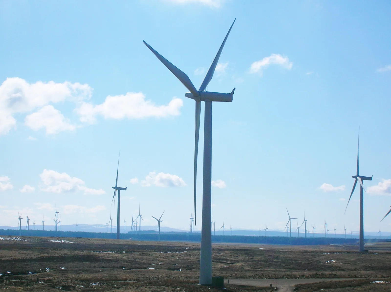
Whitelee Windfarm offers a large network of compacted-stone tracks south of Glasgow, with a visitor centre that makes a straightforward meeting point for a cycling day. Its official map names the eight-mile Lochgoin Circuit, while ScottishPower’s current cycling page also identifies a dedicated mountain-bike area near the centre. Choose the circuit for a mapped outing across the windfarm, or use the smaller riding area for a session closer to facilities.
The setting is an operational windfarm, so this is not a car-free country-park loop or a sheltered forest trail centre. The open landscape, junctions and changing weather require a proper route plan. Bring the map, identify where the ride returns to the visitor centre and keep enough time in hand for a slower finish. Whitelee is especially useful for riders wanting distance on broad tracks without assuming that distance alone makes the ride easy.
Whitelee Windfarm trails: classic mountain bike routes
Lochgoin Circuit
8 miles
The operator’s downloadable Whitelee map identifies this circuit by name and length. Use that mapped line for planning instead of linking whichever turbine roads look convenient on a phone screen. Take a copy that remains available without a mobile signal and note the junctions as you pass them. The official map does not give the circuit a mountain-bike colour grade or verified ascent, so this guide leaves those figures unstated.
ScottishPower identifies a separate facility developed and managed by East Renfrewshire Council, a short distance from the visitor centre. Its cycling guidance directs riders to entrance signs for individual grades. Start there for current route choices and permissions; this guide does not invent trail names, lengths or colours absent from the retrieved official text. Picnic benches and weather shelters are provided for observers at this riding area.
Start at the visitor centre and choose between a local skills session and the mapped circuit before heading out. Ask about conditions and any working areas, then agree the route and likely return time with the group. The wider network exceeds 130km, but that total is not a suggested day ride. A planned eight-mile circuit provides a clearer starting point than an open-ended search through the junctions.
Keep the first section comfortable enough to assess the surface and wind. Compacted-stone tracks can still require careful braking, particularly on loose patches or a steeper descent. Leave room between riders and reduce speed before overtaking walkers or approaching horses. The operator asks cyclists to remain on tracks; a soft patch beside the road is not a useful shortcut or passing lane.
Carry tools, food and clothing for an exposed outing. If using an e-bike, allow battery capacity for the return. Do not depend on finding a charging stop. Turn back early if weather or energy levels make the original plan uncomfortable.
Where is Whitelee Windfarm trails?
Use the visitor-centre car park near Eaglesham and drive carefully through the narrow access road’s passing places. Return another time if parking is full. The visitor-centre postcode is G76 0QQ. Official directions →
The operator recommends entering through the visitor-centre car park. Its access road is narrow, with designated passing places, and drivers are asked to travel carefully around children and other visitors. Follow the official directions rather than aiming for an arbitrary turbine pin. If the car park is full, the published instruction is to return another time, not to improvise roadside parking.
The centre’s current page lists opening seven days a week from 10am to 5pm, with hot food finishing at 3.30pm and the café closing at 4.30pm. These are visitor-centre service hours, not a guaranteed timetable for the whole windfarm. The same page says there is no designated public-transport route to the centre: Hairmyres station and the Eaglesham bus stop require an onward arrangement.
Nearby planning base. Visitor-centre map configuration publishes latitude55.712516 and longitude4.341371; map code explicitly negates longitude. Visitor base, not all windfarm trails. Official coordinate source
Facilities
ScottishPower’s cycling page advertises cycle storage, showers, a café and exhibitions at the visitor centre. Plan a stop while those services are open, and carry enough drink and food to finish without depending on the café. A storage area at a visitor attraction is not evidence of overnight accommodation for bikes, and it does not establish that a repair service or spare parts will be available.
Maps can be collected at the centre, which is also the sensible place to ask about the current riding network. Beyond the dedicated MTB area, the official safety advice says there are no shelters. Make comfort stops where the group can get clear of vehicle routes and other trail users, and keep the open track available for any authorised maintenance traffic.
Visitor-centre services open daily 10am–5pm; hot food finishes 3:30pm and the café closes 4:30pm. These service hours are separate from the wider tracks.
Whitelee’s weather precautions describe an elevated, exposed site where conditions can change quickly. In cold weather, neither the trails nor the visitor-centre car park are treated for snow and ice. Heavy snowfall is a reason to postpone. If lightning is forecast, the operator advises against entering the windfarm; do not plan to use a turbine as shelter if conditions deteriorate.
Strong gusts and rain can make an outward ride feel very different from its return. Use a warm waterproof layer and leave enough daylight for the entire circuit. The tracks are unlit. Summer sunshine can also be deceptive in a breeze, so carry water and sun protection. Treat a forecast as part of the planning, then adapt to what staff and current conditions indicate on the day.
Camping and places to stay near Whitelee Windfarm trails
A base in Eaglesham or East Kilbride
Eaglesham is a relevant starting point for a nearby stay, with East Kilbride offering a wider choice of hotels and transport connections. Compare the final journey to the visitor centre from each property. A Glasgow base may suit a broader city break, but riders should plan the onward trip with bicycles instead of assuming a train or bus reaches the windfarm entrance.
Some links are affiliate links — if you book, we may earn a small commission at no extra cost to you.
Displayed distances are straight-line estimates using OpenStreetMap contributors (ODbL), not road journeys. Ask the property about secure bike storage and wet-kit arrangements before booking.
RIDE PREPARATION
Kit for this ride
Consider what suits the route, forecast and your own experience.
The official Whitelee map labels the Lochgoin Circuit at eight miles. Download that map and follow its marked line rather than assembling an unfamiliar circuit between turbine roads.
Are there dedicated mountain-bike trails?
Yes. ScottishPower describes a facility managed by East Renfrewshire Council near the visitor centre. Read its entrance signs for the current grades and available lines.
Is the windfarm completely traffic free?
No. The operator says authorised maintenance and management vehicles still use the road network. Stay aware of traffic even when most of the ride is quiet.
Can I reach the centre directly by public transport?
The current visitor-centre page says no designated public-transport route serves it. Hairmyres station and Eaglesham bus services need a separate onward arrangement.
What matters most in poor weather?
The operator warns about exposure, untreated snow and ice, and lightning. Postpone in unsuitable conditions and bring the clothing, route information and supplies needed for an open-landscape outing.
Develop braking, cornering, climbing and technical riding through deliberate practice, with sensible progression for roots, rocks, steeps, wheel lifts and jumps.
Plan your first UK mountain-bike ride, understand grades and trail language, check your bike and build confidence before tackling harder or more remote routes.