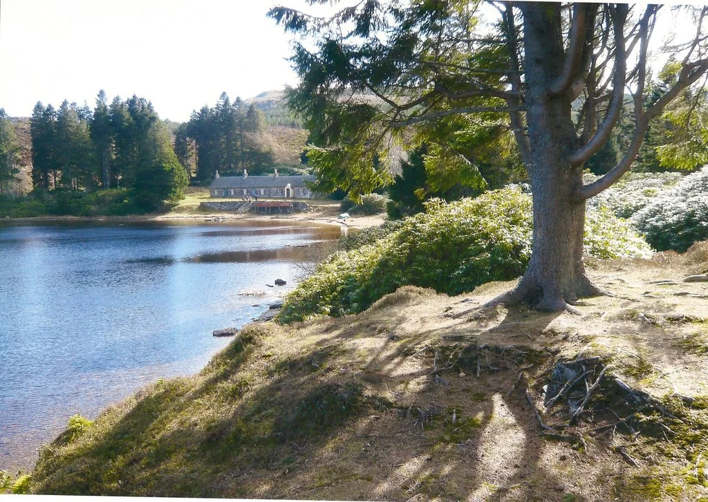
Perthshire makes an excellent multi-night mountain-bike base when you want wooded climbs, lochside tracks and substantial natural days without moving accommodation each morning. Dunkeld gives access to the southern Atholl estate routes around Mill Dam, Rotmell and Loch Ordie, with Craigvinean across the valley. Pitlochry offers a second overnight base further north, allowing a trip to mix forest outings with rest time in town.
Start with the estate’s published cycling itineraries: Raor and Rotmell, Loch Ordie and Tulliemet, and the longer Ordie Oisinneach Grand Tour. These give clear named alternatives with increasing demands. Scotland’s responsible-access rules differ from England’s bridleway system, but that freedom still requires care for other people, wildlife and working land. Choose suitable tracks and follow forestry or estate instructions; access rights do not authorise building or altering trails.
Perthshire — Pitlochry and Dunkeld: classic mountain bike routes
Raor and Rotmell
9 miles
Atholl Estates publishes this cycling circuit from Cally car park near Dunkeld, passing Mill Dam, Rotmell and Dowally Lochs before returning towards Polney Loch. The estate describes a scenic ride with climbs and descents but little very rough or technical ground. Follow its cycling directions through the named junctions and road return. This is a useful first estate circuit for riders comfortable pedalling hills, with enough variety to establish how a group handles the local tracks.
This longer published cycle itinerary continues beyond Raor to Loch Ordie, then reaches rougher ground before Tulliemet. The estate’s directions offer a shorter road return or a further track-based return towards Dunkeld. Read the options before setting out and agree the branch that fits the day. A lochside photograph can make the ride appear gentle, while the complete itinerary includes more demanding country beyond the water.
The estate’s most demanding named cycling option continues beyond Loch Ordie towards Loch Oisinneach, crossing rough and often wet tracks before joining the Tulliemet return choices. It is a natural day for experienced riders with navigation and repair skills, not an invitation to chase speed. Carry the full itinerary and maps, allow for gates and slower terrain, and use the return option that leaves the group comfortable at the finish.
Use the cycling itineraries in the Atholl booklet and their Cally car-park start, distinct from Craigvinean. The booklet also contains walking itineraries.
Choose Raor and Rotmell for a first estate ride and begin with time to spare. Let the early climbs establish a pace the whole group can sustain. Stop together at junctions and identify the next track before descending. Carry a tyre repair, water and food, even when the ride ends close to town. The named route is a plan for a pleasant day, not a target to finish at somebody else’s speed.
For experienced riders, Loch Ordie and Tulliemet provides a sensible next step before the Grand Tour. The latter deserves a dry-ground and weather decision, with enough daylight for a slower return. If the group is finding the track difficult, use the published return choice instead of pushing deeper into remote ground. Make the ride fit the day’s condition and the least comfortable rider.
Where is Perthshire — Pitlochry and Dunkeld?
The estate routes depart from Cally car park, off the Blairgowrie road near Dunkeld; use the estate map and current local directions for that start. The map pin on this regional page instead marks Craigvinean’s Forestry and Land Scotland car park as a nearby orientation base. Official directions →
The estate routes depart from Cally car park, off the Blairgowrie road near Dunkeld; use the estate map and current local directions for that start. The map pin on this regional page instead marks Craigvinean’s Forestry and Land Scotland car park as a nearby orientation base. These are separate entrances on different sides of the valley, so do not navigate to one expecting the other itinerary to begin there.
FLS directs Craigvinean visitors off the A9 at The Hermitage turn, then to its car park after 250 metres, and lists PH8 0JR as the nearest postcode. That car park is free; the neighbouring National Trust for Scotland Hermitage parking is a separate paid option. Rail arrival to Dunkeld or Pitlochry can support a car-free stay, with bicycle carriage and the road connection organised through the train operator.
Nearby planning base. Craigvinean car park is a regional planning base. The estate circuits use the separate Cally start. Official coordinate source
Facilities
FLS lists parking, trails and viewpoints at Craigvinean, with the nearest public toilets, shops and food in Dunkeld. There is no promise of a staffed mountain-bike centre or café at every forest entrance. Start supplied, including the tools that fit your own bicycle. Town facilities can make a longer stay comfortable while the actual riding day remains self-supported.
Progression Bikes in Dunkeld is identified by the local tourism association for bicycle hire and riding services. Arrange equipment or guiding directly and explain the intended route. Do not apply a business’s downhill or uplift service to every estate circuit: the published Atholl rides are pedalled countryside itineraries. Accommodation storage also needs a direct agreement, especially when travelling with several bikes or a wet kit bag.
The estate describes the Grand Tour tracks as rough and often wet. Choose a less vulnerable route when prolonged rain makes the moorland ground soft, and avoid widening passages or skidding through corners. Forestry operations can affect access at any time. Respect closure signs even when machinery is not visible; a track beyond a barrier may remain unsafe between work periods.
Atholl’s current access guidance welcomes responsible visitors and gives seasonal stalking advice, including its Hillphone service for routes affected by estate activity. Obtain advice relevant to the actual day and area; a generic autumn date is not a blanket closure of every low-level ride. NatureScot’s Access Code extends to cycling, while asking riders to use suitable paths and tracks in woods to minimise damage. Leave gates properly and pass other visitors slowly.
Camping and places to stay near Perthshire — Pitlochry and Dunkeld
A base in Dunkeld / Pitlochry
Dunkeld is the most direct base for the Cally estate routes, with the Atholl Arms, Royal Dunkeld and Dunkeld House Hotel offering overnight rooms. Pitlochry provides another evening base, including Fisher’s Hotel and the Atholl Palace. Ask about bicycle storage before booking. For a non-riding afternoon, explore Dunkeld’s riverside town or arrange a separate walking visit to the Hermitage; keep walking itinerary instructions distinct from the bicycle route.
Some links are affiliate links — if you book, we may earn a small commission at no extra cost to you.
Displayed distances are straight-line estimates using OpenStreetMap contributors (ODbL), not road journeys. Ask the property about secure bike storage and wet-kit arrangements before booking.
RIDE PREPARATION
Kit for this ride
Consider what suits the route, forecast and your own experience.
Is Perthshire suitable for beginner mountain bikers?
Choose a defined route for the group. Atholl describes Raor and Rotmell as relatively non-technical, but it still has climbs; the longer moorland cycling itineraries need more experience.
Which route visits Loch Ordie?
Atholl’s 16-mile Loch Ordie and Tulliemet cycling itinerary reaches the loch and continues into rougher country, with two published return choices.
Does Scotland use England’s bridleway cycling rules?
No. Scottish responsible-access rights include cycling on most land, subject to the Access Code, exclusions and safety instructions. Suitable tracks and considerate behaviour remain essential.
Which OS Explorer sheets should I bring?
Explorer 379, Dunkeld, Aberfeldy & Glen Almond, covers the Dunkeld area. OL49, Pitlochry & Loch Tummel, supports the northern part of a trip. Match the sheets to the actual ride.
Can I leave a campervan overnight at Cally?
Atholl Estates says overnight parking of cars, campervans and caravans is not permitted at Cally, Glen Tilt or Logierait car parks. Arrange a proper overnight stay.