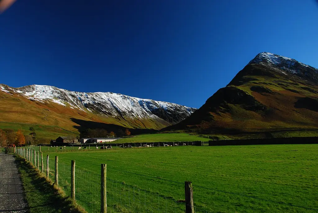
Ride the Borrowdale Bash from Keswick for a classic circuit of valley trails and rocky descents, cross Walna Scar Road above Coniston, or follow Windermere’s gentler west-shore track from Claife to Wray. These are distinct natural rides across a working mountain landscape, with public bridleways, a restricted byway and permitted lakeside cycling. Pick the route and town base that suit your group.
Borrowdale Bash is a published mountain-bike itinerary with return options; Walna Scar is a recorded bicycle-legal crossing into another valley. Plan each complete ride, allowing for navigation, road links and pushing. Whinlatter and Grizedale remain separate purpose-built alternatives for signed progression sessions. On shared fell routes, choose a distance and mountain exposure that work for the least confident rider.
Lake District fells: classic mountain bike routes
Borrowdale Bash
34 km circular route · 885 m
Cycling UK publishes this mountain-bike circuit from Keswick for regular cyclists, with traffic expected. Its lower-level setting and bailout opportunities make it a practical starting point for experienced trail riders moving onto natural routes. Download the published route before leaving and identify the road sections as well as the off-road links. The distance and ascent describe that particular circuit, not every ride marketed under the Borrowdale Bash name.
The Planning Inspectorate records the route beyond the fell gate above Coniston as a restricted byway with public bicycle access, continuing towards Seathwaite in the next valley. Use the mapped byway itself; this evidence does not grant cycling access to neighbouring summit footpaths. Plan the return before crossing into another valley. An out-and-back can simplify the itinerary, but it still requires enough strength and daylight to reverse the climb. Use Explorer OL6 for the Coniston crossing; no trail-centre colour grade is assigned here.
For a lower-level alternative, the National Trust identifies the west-shore lakeside track as suitable for mountain bikes. It links Claife Viewing Station with Wray and provides lake views without committing to a fell crossing. Return along the same permitted track for a simple outing. This is shared countryside riding, not an exclusive bike trail: reduce speed around families, dogs and narrow passing points. It is a different starting area from the Keswick and Coniston routes.
Cycling UK maps Borrowdale Bash from Keswick. Walna Scar and the Windermere west-shore track have separate starts and access arrangements; select the map for your actual route, not a generic national-park pin.
Follow one published itinerary in full. Cycling UK names OS Explorer OL4, The English Lakes — North-western area, for Borrowdale Bash. The wider fells use OL5 North-eastern, OL6 South-western and OL7 South-eastern; obtain the sheet or sheets covering your complete ride. Mark shorter returns on the map and keep a copy offline. A downloaded line cannot explain every gate or temporary notice.
For Walna Scar, plan the crossing and return together. Leave time for pushing, breaks and reversing the climb if weather deteriorates. Stay on the recorded byway; neighbouring summit footpaths are separate routes. Agree a turnaround point before setting off.
Where is Lake District fells?
Choose Keswick for the Borrowdale circuit, Coniston for Walna Scar, or the west shore of Windermere for Claife to Wray. Official directions →
Choose Keswick for the Borrowdale circuit, Coniston for Walna Scar, or the west shore of Windermere for Claife to Wray. These are distinct bases: navigating to a generic Lake District pin will not deliver you to the correct trailhead. The National Park parking directory lists town and countryside car parks. Use the operator's payment instructions and keep access clear for residents, livestock movements and emergency vehicles.
A car-free trip needs a separate plan for carrying the bike. Penrith is the rail gateway used in Cycling UK's Keswick travel information; an onward bus connection does not automatically include bicycle carriage. Ask the relevant operator about your particular cycle and service. For the Windermere option, the National Trust says bicycles can travel on the ferry from Bowness to Ferry House. Confirm operation before making the return journey dependent on it.
Nearby planning base. This marker identifies a nearby riding base, not a trail entrance. Official coordinate source
Facilities
There is no common reception, uplift booking or repair desk for this regional guide. Organise supplies in your chosen base and carry the tools needed for your own bike. Pack a pump, appropriate puncture repair equipment, food, water and warm waterproof layers. Assess brakes and tyre condition before a long descent; a repair that is inconvenient near town can become a much bigger problem between valleys.
On the Windermere west shore, the National Trust lists an independently run café and parking at Claife. Its current notice says Ferry House toilets are closed, with a portaloo available at the café. Treat those as facilities at that particular starting area, not services available across the fells. Establish meal and toilet arrangements for your own route before departure.
Build mountain plans around the forecast for the ground you intend to cross, not just the temperature in your accommodation. Strong wind, poor visibility and limited daylight can change a sensible route choice. Carry an offline map and enough battery for the whole outing. A low-level ride or a day off the bike is a useful option when the mountain conditions exceed the group's experience.
Stay on the established route and avoid cutting fresh lines beside wet sections. Slow well before meeting walkers or horses, leave room for livestock and shut gates as you found them. The National Park explains that bridleways and restricted byways allow cycling, while public footpaths are for people on foot. Open mountain scenery does not remove those distinctions.
Camping and places to stay near Lake District fells
A base in Keswick / Coniston
Keswick offers the most direct town base for the published Borrowdale circuit. Cycling UK identifies accommodation, bike shops and places to eat there, making it possible to organise a weekend around one riding area. Book storage arrangements explicitly and keep a dry change of clothes available for the return. Coniston is the practical alternative when Walna Scar is the main objective.
For a mixed party, the west-shore ride can be combined with a separate visit to Claife Viewing Station. Agree a meeting place and a latest return time before splitting up. Companions who walk may use a different path network from cyclists, so do not assume the same scenic itinerary suits everyone. Plan attractions and food around their actual opening arrangements.
Some links are affiliate links — if you book, we may earn a small commission at no extra cost to you.
Displayed distances are straight-line estimates using OpenStreetMap contributors (ODbL), not road journeys. Ask the property about secure bike storage and wet-kit arrangements before booking.
RIDE PREPARATION
Kit for this ride
Consider what suits the route, forecast and your own experience.
This guide does not assign trail-centre colours to natural routes. Use the published itinerary, terrain description, weather and your own mountain experience to decide whether a ride is suitable.
Can I ride every path on open access land?
No. The National Park distinguishes footpaths, bridleways, restricted byways and permitted paths. Follow rights of way that allow cycling or an explicit permission; a visible track alone is insufficient.
Is the Borrowdale Bash one fixed distance?
Cycling UK's published circuit is 34 km with 885 m ascent. Other variants exist, so use those figures only for the linked itinerary and plan any changes separately.
Is Walna Scar Road legal for bicycles?
The Planning Inspectorate's decision records public bicycle access on the restricted byway beyond the fell gate. Stay on that route and respect temporary restrictions and notices encountered during the visit.
What is a gentler option away from trail centres?
The National Trust's Claife-to-Wray west-shore track offers a lower-level mountain-bike outing. It remains a shared route, so allow time for polite passing and choose a distance that suits the whole group.