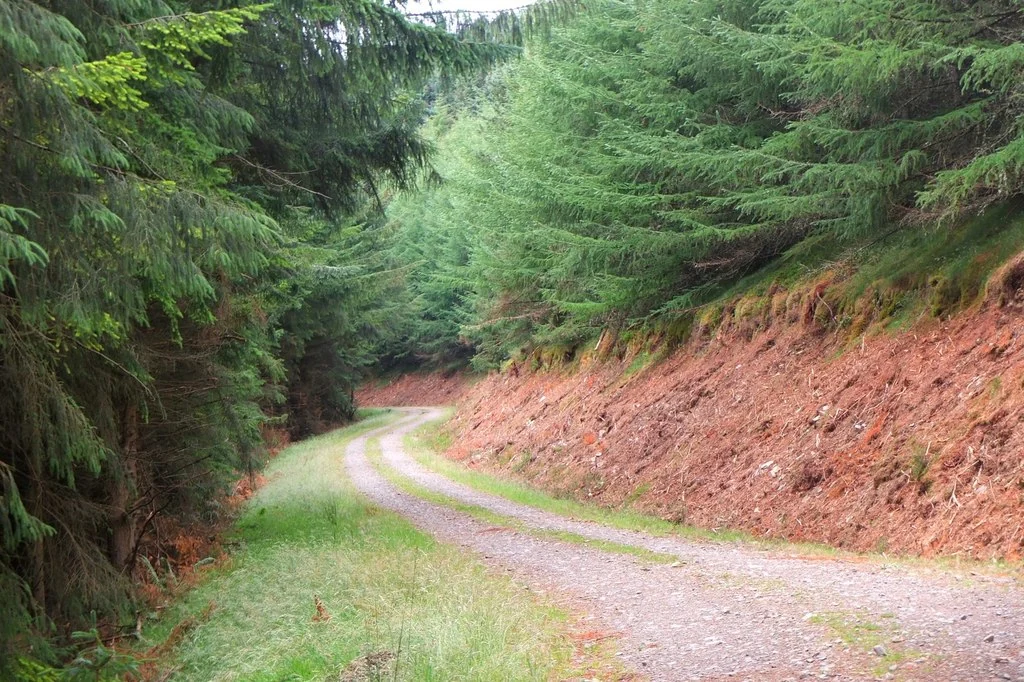
The Golfie is Caberston Forest on the north side of Innerleithen, where community-managed enduro trails turn a forested hillside into one of the Tweed Valley’s most demanding riding destinations. The attraction is technical descending earned by a pedal up: this is a very different day from the accessible green and blue circuits at Glentress. Experienced riders come for repeated descents and careful line choice, with the town close enough to serve as a proper trip base.
The Tweed Valley Trails Association works with Forestry and Land Scotland under an agreement covering adopted trails. That is an important distinction in a forest with many riding lines: a route appearing in an app does not mean the association manages it. This guide concentrates on the adopted network named by TVTA, and uses the national cycling development body’s first-visit advice. It does not turn every informal line into a recommended trail.
The Golfie (Caberston Forest) mountain bike trails and grades
NYNY
Developing Mountain Biking in Scotland recommends this as the opening test for a Golfie visit. Its advice places Caberston’s riding firmly with very experienced riders. Use it to judge the terrain and your control today, with no pressure to continue if the first unfamiliar features make you uncomfortable.
The national body highlights the refreshed Flat White as a main attraction, and TVTA lists it among its adopted trails. Give the first descent time to register: the name does not describe the difficulty. Features can change through maintenance, so an older memory of the line should not determine your approach.
TVTA explicitly includes 3G in its managed network. Work it into a route only after you have orientated yourself and chosen a descent that matches your established skills. Repeated climbs and descents can accumulate quickly; agree the next meeting point before the group separates and keep enough energy for a controlled final run.
The association includes this climbing path in its adopted network. Treat the ascent as part of the day, with a pace everyone can sustain and room for other forest users. Use current signs and the route map to join the intended descent, rather than improvising a connection through an unfamiliar plantation.
An experienced first-time visitor can use NYNY to establish whether Golfie riding fits their skills, following DMBinS’s recommendation. Arrive with a bike prepared for technical ground, reliable brakes and protective equipment appropriate to the features you intend to ride. Begin calmly, keep a clear gap and stop fully off the trail when discussing the line.
Flat White makes a strong second choice after that first assessment. TVTA’s wider adopted list includes Big Baw, Community Service, Feed The Pony, Final Fling and New Wolf/Loam Wolf/Lone Wolf, alongside the routes above. Use the current association information for the precise adopted section and any work notice; similar or linked names do not extend the management agreement automatically.
For a group whose experience is uncertain, spend the opening day at Glentress’s graded routes and decide about Caberston afterwards. A rider who is comfortable on a broad red cross-country loop has not automatically learnt the movements or judgement needed for the Golfie’s enduro terrain.
Where is The Golfie (Caberston Forest)?
Use Leithen Road in Innerleithen, about 500 metres from High Street. EH44 6HE is the nearest postcode. FLS says there is no forest car park; use town parking or Innerleithen Forest and allow for the connection. Official directions →
FLS places the forest approach on Leithen Road, about 500 metres from its junction with the High Street in Innerleithen. The land manager also suggests parking at Innerleithen Forest and riding into town to Caberston. Use designated parking and allow for that connection; do not assume a small residential entrance can accommodate a large visiting group.
Innerleithen’s road and bus connections make it the practical meeting point. Follow the carriageway and cycle connections appropriately, leaving pavements for pedestrians. DMBinS specifically highlights pavement riding as a complaint from residents. Leave driveways and passing space clear, and keep muddy kit or bicycles away from shop entrances while the group buys supplies.
Nearby planning base. Forest visitor base on Leithen Road. Use TVTA’s information to choose the approach to its adopted descents. Official coordinate source
Facilities
Caberston is a working forest, with the technical trail network maintained through community effort. Pack water, food and repair supplies before climbing. Do not assume the presence of a renowned riding network means a staffed bike-park base, a toilet block at the trail entrance or an uplift service. A planned return to town works better than discovering missing essentials on the hill.
Innerleithen provides places to eat, accommodation and cycle services. Arrange workshop help or a suitable hire bike directly before the riding day. Supporting TVTA through a donation or membership contributes to inspections, maintenance and organised dig days. Avoid unauthorised building, changing features or cutting new shortcuts: the agreement concerns stewardship of the adopted lines.
Wet roots, changing surfaces and tired hands can make a familiar descent more demanding. Set the plan around daylight and the forecast, with a spare warm layer for pauses. Reduce the number of laps when concentration fades. Inspect a changed feature from a safe position and use a clear regrouping plan if members choose different descents.
Forestry operations and trail work can interrupt access. Follow closure signs and the latest land-manager and association notices without entering a work area to recover an old route. Keep emergency equipment with the group and know which forest access point you will use when describing your location. Mobile reception should never be the only part of the return plan.
Camping and places to stay near The Golfie (Caberston Forest)
A base in Innerleithen
Innerleithen is the closest town base for the Golfie, with Peebles offering a wider alternative farther along the valley. Choose accommodation that fits a multi-day trip and ask directly about secure bike storage, washing muddy kit and battery charging. Carrying a lock and agreeing the storage space before arrival is more useful than relying on a general claim that a property welcomes cyclists.
The Traquair Arms offers a town-side food and accommodation option, while Traquair House provides a non-riding visit with its historic house and grounds. Keep that visit distinct from a ride through the forest. A two-day stay can pair Golfie enduro with Glentress or Innerleithen’s separate official network, giving the group a different type of riding without another long journey.
Some links are affiliate links — if you book, we may earn a small commission at no extra cost to you.
Displayed distances are straight-line estimates using OpenStreetMap contributors (ODbL), not road journeys. Ask the property about secure bike storage and wet-kit arrangements before booking.
RIDE PREPARATION
Kit for this ride
Consider what suits the route, forecast and your own experience.
DMBinS describes Caberston’s enduro riding as aimed at very experienced riders. A first visit should begin with an honest assessment of skills. Glentress’s graded beginner routes are a more useful starting point for learning than an ambitious Golfie descent.
Which trails does TVTA manage?
Its published adopted list names 3G, Big Baw, Community Service, Feed The Pony, Final Fling, Flat White, New Wolf/Loam Wolf/Lone Wolf, NYNY and the Reservoir Climb. Use the association’s current notices for the specific sections and temporary work closures.
Where should I park?
FLS suggests parking at Innerleithen Forest and making your way into town. Follow the designated car-park signs and current charges. Do not block the Leithen Road forest approach or residential access while unloading or meeting other riders.
Does the Golfie have uplift?
This guide’s riding plan uses the adopted climbing path and self-powered ascents. Caberston’s community trails should not be treated as a ticketed uplift bike park. Any separately booked service must have permission and operating arrangements for the exact place you intend to ride.
Are the routes a normal colour-graded centre?
FLS does not present the adopted enduro network as a waymarked colour-graded trail-centre circuit. Choose from the official descriptions, association information and your technical experience. Avoid translating a third-party app rating into a land-manager trail grade.