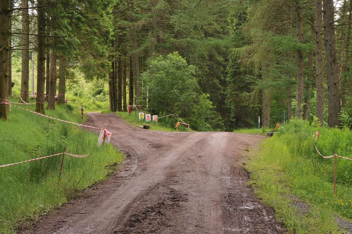
Access note: Green, blue and Ae Line routes are currently diverted. Forestry work affects the Ae Line around Rab’s Slippy One and Gub Hill; follow the signed alternatives.
Ae combines a proper forest cross-country day with a separate downhill proposition north of Dumfries. The Water of Ae gives the gentler rides their focus, while the Ae Line adds a much longer rocky circuit with jumps. The distinction is useful for planning: a family forest outing, a red-grade pedal and repeated gravity runs require different expectations even though they share the same destination.
The place is also a working forest, with a village originally built to house forestry workers. Think of Ae as several riding choices within that landscape, rather than one uniform bike park. Choose the route that fits your companions and arrive with your own food and basic spares. The café has closed, changing the practical shape of a day that older descriptions present as starting and finishing over indoor refreshments.
Ae 7stanes mountain bike trails and grades
Ae Valley Green Route
Green: Easy · 9 km
The easy circuit uses forest road and singletrack beside the Water of Ae, with a short sharp climb. It is the clearest introduction for a family learning to ride together. The route is currently marked diverted.
A longer mix of forest road and singletrack takes you farther into the forest, with views of the Water of Ae. Choose it for a moderate pedal rather than a dedicated downhill session. The route is currently marked diverted.
The substantial cross-country loop includes rocky terrain, jumps, drops and tabletops. Its final descent is a particular reason to choose the circuit, but the climbing and distance deserve equal weight in your plan. The route is currently diverted.
Forestry and Land Scotland grades this short downhill run red and describes easier alternatives around its obstacles. Inspect your chosen line before building speed. A short measured length does not make this a beginner cross-country trail.
Steep rock and an off-camber descent make this the specialist option. It belongs in the plans of experienced downhill riders comfortable with that extreme grade, rather than a first exploration of Ae’s forest routes.
For a first family visit, make Ae Valley the day’s main outing and leave time for breaks beside the river. A green grade helps you choose a less demanding circuit, but its sharp climb still calls for pacing. Groups already comfortable on blue can choose Craigshiels for a longer ride without stepping straight into the Ae Line’s difficult grade.
Experienced cross-country riders should choose the Ae Line as a complete day’s objective. Downhill riders can instead book Adrenalin Uplift and spend their energy on repeated descents. The operator lists a £46 day pass, running on Saturdays, Sundays and public holidays from 9am to 3.30pm, with a lunch break. Select an available date before travelling and use the driver check-in instructions supplied with the booking.
Where is Ae 7stanes?
Ae 7stanes is reached from Ae village. Use DG1 1QB alongside the official entrance directions. Official directions →
From the A701, turn at Ae Bridgend and follow Forest of Ae signs through the village. The nearest postcode is DG1 1QB. The mountain-bike routes start at Naze car park: continue about 1 km beyond the main car-park entrance and take the left signed Ae Valley car park. Following the postcode alone can leave you at the wrong unloading point.
Forestry and Land Scotland lists parking at £2 for up to an hour, £3 for up to three hours and £4 all day; Blue Badge holders park free with the badge displayed. Coins, card and RingGo are accepted. Dumfries is the nearest railway station. Dumfries–Moffat buses stop at Ae Bridgend and Parkgate, each about 3 km from Ae village, so budget for that final connection and confirm bicycle carriage with the operator.
The skills area gives riders another option besides committing to a long loop. Plan refreshments independently: Ae Bike Association reports that the existing café has closed and describes only limited temporary toilet provision. Older route cards show café, bike-hire, wash and shower symbols, but those are not a promise of services operating today. Bring lunch and anything essential to keep your particular bike running.
For a downhill booking, Adrenalin Uplift asks riders to bring the booking QR code and check in with the driver from 8.45am. Download that information before leaving your accommodation. Treat parking payment and uplift booking as separate parts of the day, and arrange a meeting point if some companions are riding cross-country while others use the buses.
The Water of Ae provides a useful focus for a gentler outing, but wet weather still changes the feel of rocky descents. In cold or wet conditions, favour a route that leaves your group a comfortable margin rather than planning every available kilometre. Without an indoor café stop, a dry layer and a planned return to your base become more useful parts of the itinerary.
Windblown-tree clearance at Green Hill South affects the Ae Line near Rab’s Slippy One and Gub Hill. Respect the diversion and any instructions from forestry staff. Saturday mornings also bring a regular 9am running event, so allow extra time around the car parks and be patient with other visitors before setting out on your own ride.
Self-contained campervans and motorhomes can use FLS Stay the Night at Naze car park for £10. This is a one-night parking scheme, not a tent campsite; large vehicles and caravans are unsuitable. Official campsite information →
A base in Dumfries
Dumfries makes a practical base when you want a town evening and a railway connection as well as riding. The Globe Inn on High Street has a restaurant and snug bar; reserve a meal rather than assuming you can arrive straight from the forest in a large group. Its historic Burns rooms also give a separate reason to visit, with tours booked through the venue.
For a non-riding afternoon, the council’s Robert Burns Centre occupies an eighteenth-century watermill beside the River Nith. Admission to the museum is free. The displays explore Burns’s final years in Dumfries, including a model of the town and recordings of his poems and songs. This is a useful alternative when companions want local history instead of another forest lap; check opening times before arranging your return from Ae.
Some links are affiliate links — if you book, we may earn a small commission at no extra cost to you.
Displayed distances are straight-line estimates using OpenStreetMap contributors (ODbL), not road journeys. Ask the property about secure bike storage and wet-kit arrangements before booking.
RIDE PREPARATION
Kit for this ride
Consider what suits the route, forecast and your own experience.
Ae Valley is the green option, with a published length of 9 km. Its mixture of forest road and singletrack includes one short sharp climb, so allow breaks rather than expecting entirely flat cycling.
Is Ae only for downhill riders?
No. Green, blue and red forest loops are separate choices from The Shredder and the extreme Ae Downhill course. Decide whether you want a pedal circuit or gravity runs before choosing equipment and bookings.
Is the café open?
Ae Bike Association reports the café closed and only basic temporary toilet provision available. Bring refreshments instead of relying on older visitor descriptions.
Where do the mountain-bike loops start?
At Naze car park, around 1 km farther along the road than the main car-park entrance. Follow the Ae Valley car park sign for the turn.
Does an uplift pass cover parking?
Plan to pay the forest parking charge separately. The published all-day car rate is £4, while Adrenalin Uplift lists its own £46 day pass.