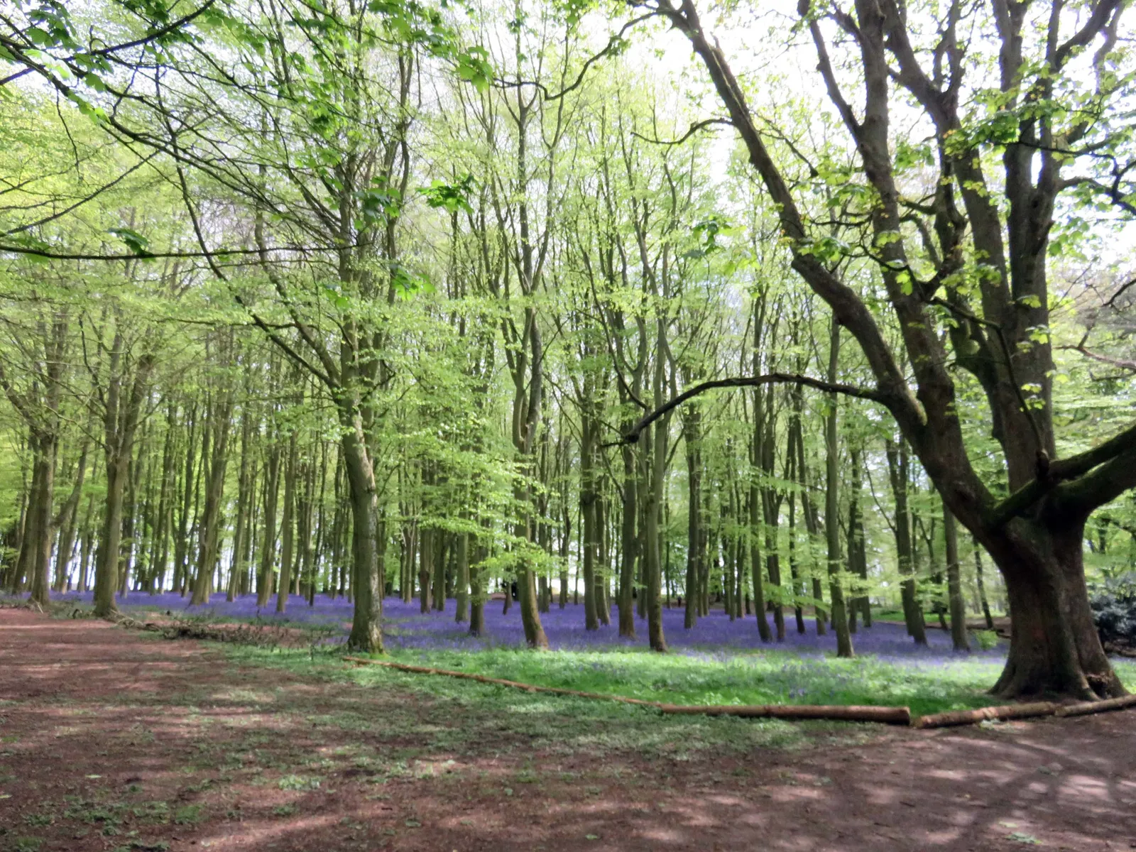
Badbury Clump is a woodland mountain-bike destination near Faringdon in Oxfordshire, on National Trust land within the Buscot and Coleshill Estate. OX Trails works with the Trust to maintain and develop the riding. The attraction is a session of winding singletrack and progressive features, with time to learn a line and return to it. This is a compact practice visit, not a promise of a long waymarked cross-country circuit.
The woodland also attracts walkers and visitors to its Iron Age hillfort and spring bluebells. Riding belongs on the mountain-bike network, with consideration for people using the wider site. Separate the trail session from a woodland walk when planning a mixed group’s day. A rider can enjoy a focused practice outing while companions explore on foot, provided everyone understands the meeting point and the paths they should use.
Badbury Clump mountain bike trails and grades
House
OX Trails recommends House as the most accessible first trail, with rollable features. Use it as a sighting lap to learn the local style and identify other trail entrances. Rollable does not mean risk-free: choose a speed that leaves time to see the exit, brake smoothly and stop clear of the riding line.
The maintainer’s map and managed Trailforks page describe the rest of the network. Expect singletrack with berms, jumps and drops. Select each subsequent line from that current information and the signs on site. Use the current map for individual line names, grades and lengths.
OX Trails publishes the trail map and maintains the linked Trailforks network. Locate House for a first sighting lap, then select further lines from the current map and on-site signs.
Start with House and make the first lap about observation. Notice where trails join, how riders return uphill and where a group can stand without obstructing anyone. If a feature is unfamiliar, inspect it on foot from a safe place. Repeat the same manageable line until braking and cornering feel composed. That gives a new visitor a useful session without any pressure to follow another rider into harder terrain.
For an experienced rider, the benefit of a compact network is deliberate practice. Choose one skill, assess the relevant feature and take a short break between runs. Ask local riders about the layout if needed, while making your own decision about difficulty. The maintainer encourages a pre-ride and repeat approach; a confident-looking rider ahead is not evidence that a landing is suitable for you. Leave a clear gap and stop at the side after finishing.
Where is Badbury Clump?
Use the National Trust Badbury car park on the B4019 between Coleshill and Faringdon, postcode SN7 7NL. Follow local signs on the final approach. Official directions →
The National Trust arrival is Badbury car park on the B4019 between Coleshill and Faringdon, postcode SN7 7NL. The Trust warns that sat-nav becomes unreliable close to the destination, so use local signs for the final approach. OX Trails describes access from the A420 corridor between Oxford and Swindon. Keep your route to the car park distinct from the mountain-bike trail map.
Parking is pay and display: the Trust publishes £2 for up to two hours or £4 for the day. National Trust members must scan their card to obtain a free ticket for display. Payment machines and JustPark are available. Swindon is the listed railway connection, but it is not a station beside the trails; plan the onward journey and bicycle carriage separately. Keep the car park and local access unobstructed.
Approximate trail-area pin. Approximate National Trust arrival pin from its official directions link; use local signs for the final approach. Official coordinate source
Facilities
Bring your own bike, drinking water, snacks and tools for a routine puncture. The National Trust explicitly lists no toilets on site. Arrange a toilet stop before arriving if the group needs one, and do not turn a short trail session into an improvised search for facilities. A small bag with an extra layer also helps when someone is watching or waiting between runs.
This is a community-maintained network, not a staffed resort with equipment collection and an uplift timetable. OX Trails runs maintenance events as formal National Trust volunteers. Respect temporary barriers and give volunteers room to work. Joining an advertised dig day is a separate activity from riding through one. Use the maintainer’s event information to understand when work is planned, and leave every tool, sign and unfinished feature untouched.
Bike hire at Badbury Clump
Bring your own mountain bike, helmet, repair kit and water. Plan equipment before arrival so the session can begin with a sighting lap of House.
The National Trust countryside is open dawn to dusk. The trails are free to ride; parking is £2 up to two hours or £4 all day, with a displayed free ticket for National Trust members.
The countryside opens from dawn to dusk. Plan a shorter session in winter and keep enough light for returning to the car park and packing away. Wet ground changes the feel of roots, turns and take-offs; slow down before the feature and choose easier riding if grip feels uncertain. Woodland shade can make a surface stay damp after nearby roads have dried.
In spring, bluebells are part of Badbury’s appeal and another reason to stay on established paths and trails. Avoid widening the riding line or cutting across flowers when passing a group. Summer vegetation clearing and winter dig days are part of the maintainer’s work, so a familiar trail can still have a temporary restriction. Respect the current signs and choose another activity if a session would damage the ground.
Faringdon gives an overnight trip a nearby town base, while the wider shortlist includes Littleworth, Uffington and Buckland. These are separate accommodation choices, not facilities at the trail entrance. Compare the location with your arrival route and ask the property about bicycles, wet kit and check-in before booking. No secure storage or cyclist-specific service is implied by inclusion.
For a non-riding outing, the Trust’s short woodland walk explores the hillfort and wartime history, and its longer Ancient History and Agriculture walk takes in the wider estate. Keep walking and cycling plans separate: the existence of a walking route does not make it a mountain-bike trail. Agree a meeting time with companions and allow a dry change of clothing before heading into town for food.
Some links are affiliate links — if you book, we may earn a small commission at no extra cost to you.
Displayed distances are straight-line estimates using OpenStreetMap contributors (ODbL), not road journeys. Ask the property about secure bike storage and wet-kit arrangements before booking.
RIDE PREPARATION
Kit for this ride
Consider what suits the route, forecast and your own experience.
OX Trails says the mountain-bike trails are free to ride. National Trust car parking is charged separately, with free parking for members who scan their card and display the ticket.
Which trail should I ride first?
OX Trails recommends House as the most accessible first trail, with rollable features. Inspect the line and choose your own pace before trying other trails.
Are there toilets or bike hire at Badbury?
The National Trust lists no toilets on site. Bring your own bike, water and repair equipment, and arrange a toilet stop before arriving.
Who looks after the mountain-bike trails?
OX Trails develops and maintains the network in collaboration with the National Trust, working as formal Trust volunteers and organising maintenance events.
Develop braking, cornering, climbing and technical riding through deliberate practice, with sensible progression for roots, rocks, steeps, wheel lifts and jumps.