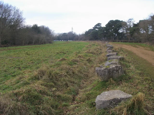
Shotover Country Park gives riders a woodland outing on Oxford’s eastern edge, with an official five-kilometre bridleway route starting at Shotover Plain. Follow the blue arrows for the paths provided for cyclists and horse riders. Valleys, woodland and open ground make the setting varied, while the hilltop looks across southern Oxfordshire. Choose it for an accessible-from-the-city countryside pedal, with the length and pace matched to your companions.
Oxford City Council says the park is open throughout the year free of charge and publishes its own leaflet and map. The riding described here follows that authorised bridleway provision. Other coloured walking routes and informal lines in the woods are different propositions: their presence does not establish cycling access or an official mountain-bike grade. That makes the council map the useful starting point for planning a first visit.
Shotover mountain bike trails and grades
Shotover Plain bridleway route
5 km
The council publishes five kilometres of paths for cyclists and horse riders, beginning from Shotover Plain near the main car park and following blue arrows. Blue marks the permitted route here; it is not a published blue mountain-bike difficulty grade. Carry the park leaflet to identify the connections and allow other shared-path users time and space to pass.
Old Road is the council’s named approach to the principal car park and the start area at the top of Shotover Hill. Use it to organise arrival and the first connection to the bridleway signs. If approaching by bicycle from Oxford, plan the roads before reaching the park and include the climb in the day’s effort. No separate off-road distance or difficulty is asserted for that approach.
Start with the council leaflet and trace the five-kilometre bridleway provision before leaving Shotover Plain. The first visit is a good opportunity to establish how the group handles shared woodland paths, junctions and the return to the start. Choose a pace that allows conversation and stopping clear of the route. There is no need to turn an outing near Oxford into an attempt to follow every path shown on a phone.
Riders seeking a demanding downhill session should make a different destination choice unless a current land-manager permission confirms the specific facility they intend to use. The official offer here is bridleway cycling through a country park. For a mixed group, agree how far to ride and where to regroup before anybody takes a different junction. The route’s published five kilometres describe the park provision, so add your journey from accommodation or a station separately.
Where is Shotover?
Use the main free car park on Old Road, Headington, at the top of Shotover Hill, OX3 8TA. Official directions →
The main car park is on Old Road, Headington, at the top of Shotover Hill; the council gives OX3 8TA and says parking is free. Navigate to the actual entrance and keep the access usable when unloading. Alternative parking at Horspath Sports Ground involves a separate approach into the park. Choose the start that fits your ride and do not assume all surrounding entrances lead directly to the bridleway’s start at Shotover Plain.
The council describes bus stops near the bottom of Old Road and other approaches around Horspath Road or the Slade, each followed by an uphill walk. That can help walking companions arrive independently, but it is not a bike-carriage promise or a shuttle to the riding start. If cycling from Oxford, map the city-road connection as carefully as the woodland section. Leave enough daylight and energy for the complete return journey.
Approximate trail-area pin. Coordinate in council page map_marker_location_91 field. Park planning point, not claimed as exact course start. Official coordinate source
Facilities
Carry the food, water and repair essentials needed for the outing. The council’s country-park page does not establish an on-site mountain-bike hire counter, workshop or trail café, so this guide does not advertise those services. Prepare your own bicycle before arrival and arrange any rental separately with a confirmed provider. A spare tube or compatible puncture solution can avoid turning a short countryside session into a much longer walk.
The map distinguishes maintained paths and the bridleway provision from other lines that develop in the landscape. Keep to the cycling route, use a controlled pace around horses and walkers, and stop where you can be seen without blocking a junction. Shotover is also an important wildlife site, with much of the park designated as an SSSI. Avoid damaging vegetation or widening a wet section; if the surface cannot be ridden responsibly, shorten the outing or choose another day.
Oxford City Council explicitly advises avoiding Shotover during storms because trees and branches can fall in the dense woodland. Make that decision before travelling, with the forecast for the actual riding period and return journey in mind. After rain, slow down to assess grip on each unfamiliar surface and leave extra time for the group. A year-round park invitation does not mean a storm, temporary barrier or unsafe ground can be ignored.
Oxford provides the most flexible accommodation base, allowing the ride to sit within a broader city visit. Headington can suit an approach from the east of the city, while a central stay may be better for companions who plan museums and food. Choose around both journeys and ask the hotel directly about bicycle storage. An accommodation listing establishes a real place to stay; it does not promise secure bike facilities without the property confirming them.
For non-riders or a separate indoor afternoon, the Ashmolean is Oxford’s museum of art and archaeology. General museum entry is free, with separate arrangements for ticketed exhibitions and groups. Use its current visiting information when deciding the day’s timing. Within Shotover itself, companions have their own red, yellow and green waymarked walks and an orienteering option. Those walking colours are separate from the blue-arrow bridleway, so agree the meeting place without sending everyone along the same route.
Some links are affiliate links — if you book, we may earn a small commission at no extra cost to you.
Displayed distances are straight-line estimates using OpenStreetMap contributors (ODbL), not road journeys. Ask the property about secure bike storage and wet-kit arrangements before booking.
RIDE PREPARATION
Kit for this ride
Consider what suits the route, forecast and your own experience.
The council uses blue arrows to identify the bridleway for cyclists and horse riders. It does not publish those arrows as a blue mountain-bike difficulty grade.
Where does the cycling route start?
At Shotover Plain near the main car park. Use the council leaflet and follow the blue-arrow bridleway signs.
Is parking charged?
Oxford City Council says the principal Old Road car park is free. Its published postcode is OX3 8TA.
Can I ride the red, yellow or green walking trails?
The council identifies those colours as waymarked walks. This guide promotes its separate bridleway provision for cycling.
What happens in stormy weather?
The council advises avoiding the park during storms because of falling-tree and branch risk. Choose another day and respect any closure signs.
Develop braking, cornering, climbing and technical riding through deliberate practice, with sensible progression for roots, rocks, steeps, wheel lifts and jumps.