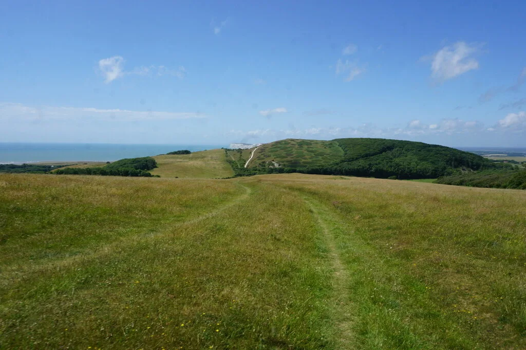
The Isle of Wight offers chalk-ridge mountain biking across West Wight, woodland and farmland links, and easier railway-path riding on the Red Squirrel Trail. The Tennyson Trail’s public byways connect Carisbrooke and Freshwater Bay, giving the western hills a named legal backbone. A multi-night stay lets riders combine a tougher ridge outing with a gentler valley day, leaving time for the island’s beaches and towns without forcing every ride into a ferry-day schedule.
Treat the island as a natural riding region with several starting points. OS Explorer OL 29, Isle of Wight, covers the network; the council’s rights-of-way information distinguishes bridleways and byways from footpaths. The National Landscape describes current access improvements, including the Tennyson Trail, but a walking circuit to Tennyson Monument is not automatically a cycling route. Choose the legal mapped line, then build the accommodation and travel around the part of the island you want to ride.
Isle of Wight: classic mountain bike routes
Tennyson Trail byways: Carisbrooke to Freshwater Bay
Not colour-graded
The council identifies a series of public byways between these two places, including N 123, N 128, N 136 A, N 139, BS 4, BS 10, BS 44, S 26, BS 53 and F 33. Motor-vehicle restrictions protect this corridor; they are not a blanket bicycle closure. Use the council map and current rights-of-way information for the precise line. Plan a return or transport connection before committing to a one-way ridge ride, and avoid extending onto walking-only paths at the western end.
The official tourism page describes a demanding mixed-surface ride using parts of the Tennyson Trail and rural byways. Expect steep gradients and surfaces ranging from mud to slippery chalk. Its older navigation reference is not a substitute for a current legal route map. Select confirmed bridleway and byway sections and assess the group’s ability before planning the full outing. Do not ride an attractive coastal footpath simply because it sits near the published route.
The official island tourism site describes mainly flat former-railway cycle paths with some more challenging bridleway sections. Choose a short railway-path section for a relaxed first outing or a longer mapped version if everyone is comfortable with varied gradients. It is useful for a mixed party, but the whole itinerary is not one uniform traffic-free surface. Identify crossings and the return connection before setting off.
The council map identifies the Tennyson Trail’s byways between Carisbrooke and Freshwater Bay and their motor-vehicle restriction. It is an indicative access map, not a mountain-bike grade map; use separate Red Squirrel Trail information for easier cycling.
Begin with a contained Red Squirrel Trail section if the party includes newer riders, then decide whether to add a hill day later. Save the map offline and agree a turnaround that leaves time for a café or shoreline stop. Set the pace around the least confident rider and slow early at crossings.
Experienced riders can plan a Tennyson byway outing using Explorer OL 29 and the council route map. Mark where you join and leave the corridor, and establish the road or permitted-path return in advance. Carry water, food, repair tools and a spare layer. On an exposed ridge, a short distance can still become a substantial day once climbing, wind and gate stops are included.
Where is Isle of Wight?
Choose Newport/Carisbrooke for the Tennyson Trail’s eastern approach, or the separate start matching your island route. The island has several ferry gateways and no single trail-centre entrance. Official directions →
Choose the ferry crossing around your accommodation and starting area, with bicycle carriage and booking arranged through the actual operator. VisitIsleOfWight links to the island’s ferry information and onward travel options. Allow time for disembarkation, packing and the final road connection; do not plan a long first ride that depends on an exact arrival. An overnight stay gives you room to settle before the main outing.
There is no single trailhead for the whole island. Use designated parking serving the selected ride and follow the current payment and closure information. The regional pin uses the National Trust’s published Compton Bay and Downs visitor coordinate as a West Wight planning anchor, not the start of every Tennyson byway. Avoid coastal footpath shortcuts from the parking area unless cycling permission is specifically established.
Nearby planning base. Compton is a West Wight planning anchor, not every Tennyson Trail entrance. Official coordinate source
Facilities
For the Red Squirrel Trail, the official tourism page identifies Pedallers Café directly on the route and points to other attractions reached by short departures. Use the café’s own current hours when making it a meal stop. On the ridge, bring essentials and do not assume a village name on the map means a shop or café is beside the path.
Arrange hire or repairs with a real island provider before travelling, explaining whether you want a bike for railway paths or rougher chalk-country riding. A rental bike suitable for a gentle cycle path may be the wrong choice for a demanding natural circuit. Ask accommodation staff about storage and drying arrangements, and keep muddy equipment out of rooms unless permission has been agreed.
The Chalk Ridge Extreme description specifically warns of slippery chalk and mud. After rain, reduce speed before corners and keep enough space to stop for another visitor. Choose a shorter valley outing when wind or visibility makes the exposed ridge uncomfortable. Avoid widening soft sections or descending a line whose exit you cannot see; dismounting is a normal part of sensible natural riding.
The National Landscape’s access work includes improvements around Brighstone and the Tennyson corridor, but temporary closures and coastal erosion can still change a day’s plan. Use current council notices and follow barriers on the ground. Keep clear of cliff edges, give horses and walkers space, and allow a generous daylight margin for navigating the return.
The Albion in Freshwater and The George Hotel and Beach Club in Yarmouth provide two western-island overnight options. The Bay Colwell offers holiday accommodation near Freshwater; The Royal Hotel in Ventnor and Fountain Inn in Cowes give alternatives on other sides of the island. These are real stays across different localities, so choose the base by your riding and ferry plans, not an assumption that every island hotel is equally close.
Agree secure bicycle storage and breakfast timing before reserving. For a rest afternoon, take a separate coastal walk, explore a town or relax on a beach where conditions allow. Keep the walking itinerary distinct from the cycling network and avoid adding a hilltop footpath as an improvised ride home. Before departure, leave enough time to clean, pack and reach the ferry without hurrying through unfamiliar roads.
Some links are affiliate links — if you book, we may earn a small commission at no extra cost to you.
Displayed distances are straight-line estimates using OpenStreetMap contributors (ODbL), not road journeys. Ask the property about secure bike storage and wet-kit arrangements before booking.
RIDE PREPARATION
Kit for this ride
Consider what suits the route, forecast and your own experience.
The council identifies public byways between Carisbrooke and Freshwater Bay. Its permanent motor-vehicle restrictions are not a bicycle ban. Follow the mapped cycling-legal line and current local closures.
May I ride any path towards Tennyson Monument?
No general cycling permission comes from a walking-route description. Use bridleways, byways and expressly permitted routes; keep footpaths and archaeological sites out of improvised riding lines.
Is the Red Squirrel Trail suitable for beginners?
Its mainly flat former-railway sections provide an easier option. The complete trail also includes more challenging bridleway sections, so choose a specific version that suits the group.
Are the island’s natural routes colour-graded?
The countryside itineraries described here are not colour-graded. Use the official terrain descriptions and the actual mapped route to judge effort and technical difficulty.
Which map covers the whole island?
OS Explorer OL 29, Isle of Wight, covers the riding region. Combine it with current council rights-of-way information and the selected route’s navigation file.