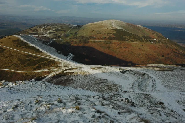
The Malvern Hills give riders sweeping contour paths, woodland climbs and open views in a compact ridge landscape above Great Malvern. The Malvern Hills Trust publishes three signposted mountain-bike circuits: Short, Medium and Long. They follow bridleways and permissive cycle paths, giving a first visitor a practical way into the hills without assembling a route from unrelated walking directions. The longer option reaches Black Hill and Pinnacle Hill; shorter outings stay around the northern hills.
Choose your distance by climbing effort as well as mileage. Even the Short Route includes a substantial ascent, while the Long Route asks for a full cross-country day’s attention to shared paths and repeated climbs. All three start from North Quarry car park. Carry OS Explorer 190, Malvern Hills & Bredon Hill, and the Trust’s route card. Waymarker colours identify the circuits: the Trust explicitly says they are not difficulty grades. These are natural countryside rides, not uplift bike-park runs.
Malvern Hills: classic mountain bike routes
Short Route: North Hill and Table Hill
Not colour-graded · 5.6 km · About 206 m
From North Quarry, the published circuit climbs to Lady Howard de Walden Drive and follows the contour around North Hill and Table Hill before returning downhill. Its green arrows are route identification, not a green mountain-bike grade. The quick initial climb makes a useful test of the group’s legs; take it steadily and enjoy the wider paths without treating them as a closed racecourse.
This northern circuit uses Victorian paths through woodland, passes St Ann’s Well and climbs to the Gold Mine before circling the western side of Worcestershire Beacon. Follow the orange route arrows and the downloaded card. The Trust describes a separate surfaced-path option towards the Beacon, but keep the mapped cycling itinerary clear and do not improvise a descent onto a footpath from the summit area.
The longer circuit follows the Medium Route initially, then leaves it at the Gold Mine to continue south through Berrington Quarry. It climbs towards Black Hill and loops back north, including Pinnacle Hill. Use the full route card so the shared opening does not send you onto the shorter return. Refreshments and facilities at British Camp involve a short road link from Black Hill car park; they are not permission to cycle onto the hillfort.
Use Short Route: North Hill and Table Hill, Medium Route: St Ann’s Well and the Gold Mine, Long Route: Black Hill and Pinnacle Hill as distinct route choices, matching each grade and climbing commitment to the group. Follow current signs and closures, even where an older map shows a continuous connection.
Choose the Short Route for an unfamiliar group, allowing plenty of time for its climb. Set the pace for the least experienced rider and pause where the path widens safely. If the initial effort is already demanding, finish this circuit and save the longer ride for another day.
Confident cross-country riders can use the Medium Route to learn the northern network, then progress to the Long Route on a suitable second day. Save the GPX and paper route card and identify where the longer ride splits at the Gold Mine. Bring water, food, repair tools and a layer for stops.
Where is Malvern Hills?
North Quarry car park is the official common start for the three published routes. Official directions →
North Quarry car park is the official common start for the three published routes. Use the Trust’s current parking information and the route card for the approach, payment and any local restrictions. The directory pin comes from the first point in the Trust’s Short Route GPX, placing it at the published start. Do not use an unrelated summit or a generic Great Malvern postcode as the riding entrance.
Great Malvern and Malvern Link railway stations provide potential car-free approaches, with a road connection to the start. Reserve bicycle space where the train operator requires it, and assess that final road leg before booking. An overnight base can let you leave bags and organise a lighter first outing; agree luggage and bike arrangements directly with the accommodation.
This is a shared hills landscape, not one enclosed cycling centre. The Trust’s route cards identify refreshment options, and its Long Route description points to facilities at British Camp via a short road connection. Great Malvern provides town services before or after the ride. Carry essentials and do not expect a café, water supply or repair stand at every path junction.
The National Landscape team identifies an e-bike trial scheme supported through Malvern Hills Car Clubs. That is a named local initiative, not guaranteed walk-up rental at North Quarry. Arrange any hire in advance with the provider and ask what terrain the bike is intended for.
North Quarry is the common start for the three official cycling circuits. Use the Trust’s current parking instructions; this is a shared landscape with livestock and local path restrictions.
The Trust’s Stockwatch information identifies livestock in temporary fenced compartments, including the northern hills. Follow the current ground signs, shut gates as instructed and give animals space. Ride slowly around walkers and horses, especially on blind corners. The National Landscape explicitly asks cyclists to avoid archaeological monuments including British Camp, Shire Ditch and Midsummer Hill; a scenic ridge does not remove those restrictions.
Expect the open sections to feel colder and windier than the sheltered town start. Choose the shorter circuit when poor visibility or limited daylight reduces your margin. Wet surfaces need earlier braking and extra room around other users. Keep to the permitted line instead of widening muddy sections, and dismount where your tyres would damage the ground or passing safely is difficult. Busy weekends reward an early start and an unhurried pace.
Great Malvern Hotel, Mount Pleasant Hotel and The Abbey offer real town-centre overnight choices. The Cottage in the Wood provides another stay on the eastern side of the hills, while The Malvern Hills Hotel sits by British Camp. Pick the base that suits your chosen start and transport, recognising that a hotel facing a hillfort does not make the hillfort a cycling route.
Ask about secure bicycle storage, wet-kit drying and breakfast timing before reserving. Avoid assuming a room booking includes permission to bring a muddy bike indoors. A non-riding afternoon can include Great Malvern’s shops, a café stop or a separate walk chosen for the party. Keep the walking itinerary separate from the cycling map, then leave time to clean and pack before your onward journey.
Some links are affiliate links — if you book, we may earn a small commission at no extra cost to you.
Displayed distances are straight-line estimates using OpenStreetMap contributors (ODbL), not road journeys. Ask the property about secure bike storage and wet-kit arrangements before booking.
RIDE PREPARATION
Kit for this ride
Consider what suits the route, forecast and your own experience.
Are the green and orange arrows difficulty grades?
No. The Trust says its routes are not graded for difficulty. Green identifies the Short Route and orange the Medium Route; use the distance, ascent and terrain description to choose a ride.
How long are the Malvern mountain-bike routes?
The current Trust page publishes 5.6 km for Short, 8.7 km for Medium and almost 19 km for Long. The ascent figures are about 206 m, about 260 m and 540 m respectively.
Where do the routes start?
All three start at North Quarry car park. Download the selected route card and use the current parking instructions for that entrance.
Can I cycle across British Camp?
The National Landscape tells cyclists not to ride archaeological monuments including British Camp. Stay on the permitted bridleways and cycle paths; nearby refreshments do not change the access rule.
Which OS Explorer map covers the riding?
Explorer 190, Malvern Hills & Bredon Hill, covers these hills. Combine it with the Trust’s current cycling map, route card and an offline copy of the selected GPX.