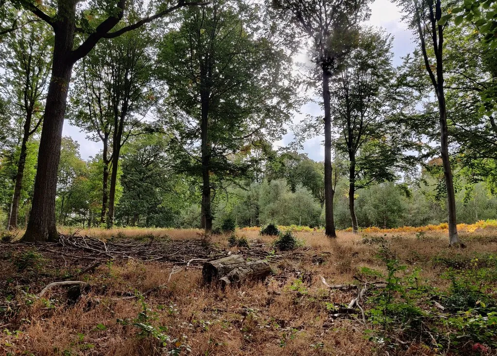
Access note: Small signed areas are restricted for the deer rut from 14 September to 31 October 2026. The visitor forest remains open; follow local signs.
Wyre Forest is a woodland cycling destination west of Bewdley, with a named blue Family cycle trail from the visitor centre at Callow Hill. The 7.7-kilometre circuit descends towards an old railway line, follows it through the woods and climbs back to the visitor area. Its attraction is a manageable forest outing with a proper loop and services at the start, not an uplift day or a collection of downhill tracks.
The forest is also a National Nature Reserve shared with walkers and horse riders. Bring basic off-road skills, give others space and keep the pace appropriate to the section you are on. Families can combine cycling with a picnic, a play-area visit or time at the café, while riders who prefer a quieter outing can use the operator’s advice to visit on a weekday outside school holidays. Bewdley provides a convenient nearby base for making the forest part of a longer break.
Wyre Forest mountain bike trails and grades
Family cycle trail
Blue · 7.7 km / 4.7 miles
The waymarked circuit begins with a descent towards a disused railway line, then follows that corridor before a steady climb back to the visitor centre. Forest roads and natural tracks provide changing surfaces, and parts are shared with walkers and horses. Blue is the published mountain-bike grade, even though the name emphasises family cycling. Expect basic off-road control and allow time for regrouping on the climb.
The land manager’s cycling map also identifies forest-road riding and the National Cycle Route connection. Use that official map to plan a permitted extension, choosing a turn-around and return before leaving the named loop. This is a navigation option for a rider comfortable with shared woodland travel, not another advertised technical circuit. Do not substitute a walking-only path simply because it appears to shorten the route.
Ride the signed Family cycle trail first. Its descent, railway section and return climb give the day a clear structure and make it straightforward to explain the route to a group. Start at a pace you can maintain uphill as well as downhill, and carry a snack if a child is likely to need a break. Seven kilometres of off-road riding still feels different from a smooth school-run path, especially when the ground is wet.
An experienced rider can enjoy the same circuit as a woodland ride or use the official map for a longer forest-road outing. Agree the extension before the group splits and leave a meeting time at the café. Choose distance and quiet surroundings as the reasons to extend the day.
Where is Wyre Forest?
Callow Hill, Bewdley, DY14 9XQ is the Forestry England visitor destination. The entrance is signed from the A456, about three miles west of Bewdley. Official directions →
Callow Hill, Bewdley, DY14 9XQ is the Forestry England visitor destination. The entrance is signed from the A456, about three miles west of Bewdley. The land manager publishes grid reference SO750740 and precise visitor coordinates, which are used for the planning pin. Follow the visitor-centre signs for your final approach and keep the bike secure while unloading beside other arrivals.
Car parking is cashless, with card, digital wallet or RingGo payment. Listed rates are £3.50 for one hour, £5 for two, £7 for four and £8.50 all day; an early-bird tariff of £2.50 applies when you leave before 10.30am. Relevant Forestry England members park free with their registered vehicle. Include café and non-riding time when choosing the likely length of your visit.
The forest also welcomes car-free visitors without an admission charge. Its visitor information lists bus services between Birmingham and Ludlow and between Kidderminster and Tenbury, plus Worcestershire’s on-demand transport option for the North West Zone. Plan from the current timetable and make separate arrangements for bike carriage. A bus that reaches the forest can help a non-riding companion without necessarily solving transport for the whole cycling group.
Approximate trail-area pin. Visitor arrival area. Follow Forestry England’s directions to the car park. Official coordinate source
Facilities
The visitor area has a café, toilets, an accessible toilet, picnic space and a play area. Toilets are behind the café, and the operator lists nine accessible parking spaces. These are useful practical services for a group, but carry water, a puncture repair and a means of inflating tyres on the trail. The return climb can take longer than expected if someone is tired or a mechanical problem interrupts the ride.
Wyre’s natural tracks can become muddy after rain. Reduce speed before a wet turn, leave space around other users and stay on the intended line instead of widening soft edges. The railway corridor does not remove the need for an off-road bike in suitable condition. A waterproof and a warm layer make a slower family outing more comfortable when there are longer stops.
For autumn 2026, Forestry England asks visitors to stay out of signed small areas from 14 September to 31 October during the deer rut. The forest remains open, but these local restrictions matter when planning an extension. Follow the notices and give deer space; wildlife watching is not a reason to enter an excluded area. Drive carefully on the surrounding roads, particularly around dawn and dusk.
The visitor site opens daily except Christmas Day. October hours are 8am–7pm; November through February is 8am–5pm. Leave a margin before the gate closes, especially if your outing includes lunch or a second activity. A shorter signed loop with daylight to spare is a more enjoyable winter plan than arriving at the final climb with the car park about to close.
Bewdley combines riverside accommodation with a choice of pubs and food. The Mug House Inn has rooms, a restaurant and a bar beside the River Severn, while other central options include the Clockhouse, Severn Valley Guest House and Horn and Trumpet. Choose the property around your group’s needs and ask directly about bike storage. A room listing alone does not establish whether a muddy bicycle can be brought inside.
A non-riding day can stay within the forest, using walking trails, the café, play area or a separately booked activity. This keeps the arrival simple for people who do not want another drive. If the group heads into Bewdley for food afterwards, leave the bikes securely stored and carry a dry layer. A relaxed woodland outing works well as the gentler day of a longer mountain-bike trip.
Some links are affiliate links — if you book, we may earn a small commission at no extra cost to you.
Displayed distances are straight-line estimates using OpenStreetMap contributors (ODbL), not road journeys. Ask the property about secure bike storage and wet-kit arrangements before booking.
RIDE PREPARATION
Kit for this ride
Consider what suits the route, forecast and your own experience.
Forestry England lists the Family cycle trail as blue. It is aimed at riders with basic off-road skills, despite the family name. The route uses forest roads and natural tracks and has a return climb.
How long is the Wyre Forest Family cycle trail?
The published length is 7.7 kilometres, or 4.7 miles. The circuit goes down towards the old railway, follows it and then climbs back to the visitor centre.
Are any areas closed in October 2026?
Small signed areas are restricted from 14 September to 31 October for the deer rut. The visitor forest remains open. Respect the signs when riding the family route or planning a forest-road extension.
Are the cycle routes shared with horses?
Yes. Forestry England says sections of the family trail are shared with walkers and horse riders. Slow down, make your presence known calmly and allow room for them to pass.
What does all-day parking cost?
The listed car tariff is £8.50 all day. Shorter stays and an early-bird rate are available, and relevant Forestry England members have free parking. Payment is cashless.
Plan your first UK mountain-bike ride, understand grades and trail language, confirm your bike and build confidence before tackling harder or more remote routes.
Develop braking, cornering, climbing and technical riding through deliberate practice, with sensible progression for roots, rocks, steeps, wheel lifts and jumps.