The Yorkshire Dales make a superb mountain-bike trip when you want limestone lanes, grass tracks and proper cross-country days. The Settle Loop supplies a compact introduction to the southern hills; the Swale Trail follows the northern valley between Reeth and Keld. Both are published cycling routes, with very different demands. Match the start to your group before choosing accommodation: this is a large riding area, not one visitor centre with interchangeable loops.
Longer rides link historic tracks, villages and exposed upland crossings. The National Park publishes routes through its Cycle the Dales service and explains that navigation, climbing and remoteness contribute to difficulty. Use those itineraries as your starting point. A line crossing attractive countryside is not automatically a cycling right of way, and a short distance on paper can contain a substantial climb.
Yorkshire Dales: classic mountain bike routes
Settle Loop
16km · 464m
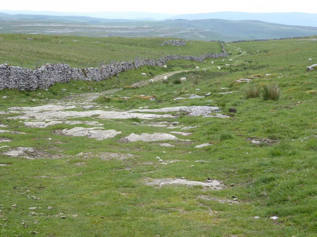
The National Park’s published circuit joins stone tracks, grass and limestone terrain above Settle. The climb begins on tarmac before reaching Stockdale Lane and the undulating Gorbeck Road. It is part of the Pennine Bridleway, so expect walkers and horses alongside riders. This is an excellent first natural circuit for someone already comfortable climbing and descending off-road. Keep enough energy for the return to town; the initial ascent makes the modest distance harder than a flat forest loop.
This valley route mixes unsurfaced tracks and quiet roads, with a gentler middle section between Low Whita and Gunnerside. Reeth and Keld are opposite ends, so riding the whole trail and returning is a much longer day. The upper section becomes hillier and includes a steep passage near Keld where dismounting may suit the group. Choose a turnaround that leaves time for the homeward ride; cafés along the valley are useful stops, not a substitute for carrying food.
The National Park’s extended Settle itinerary brings in Mastiles Lane, Malham and the Stockdale Lane climb. It suits riders ready to make a full day of the southern Dales, with considerably more climbing than the standard Settle Loop. Download the complete route and follow its specified connections. Passing Gordale Scar on a cycling itinerary does not make every nearby walking path rideable. Treat the last climb as part of the day’s budget, not an unpleasant surprise after lunch.
Choose the Settle Loop for a first visit if your group has off-road experience and wants a self-contained circuit from a town. Study the climb and return before leaving, then ride the first ascent at a pace everyone can maintain. Stop together at junctions. You gain more from a controlled first lap than from rushing a rocky descent while trying to follow an unfamiliar wheel.
For families or a mixed party, choose a short Swale Trail outing with an agreed turnaround, especially its gentler middle section. Experienced riders can build towards the Long Loop after learning how their tyres, brakes and energy cope with Dales terrain. Carry puncture repairs, a waterproof, food and an offline map. Plan a realistic return time and tell someone where the group will ride.
Where is Yorkshire Dales?
The map pin marks the published Settle Loop start, not the centre of the entire National Park. Settle’s railway station makes the southern Dales a useful car-free base; arrange bicycle carriage with the train operator and allow time for the town connection. Official directions →
The map pin marks the published Settle Loop start, not the centre of the entire National Park. Settle’s railway station makes the southern Dales a useful car-free base; arrange bicycle carriage with the train operator and allow time for the town connection. If driving, choose signed public parking appropriate to your route. Keep farm gates, passing places and residential entrances clear.
Reeth is the practical starting base for the Swale Trail, while Hawes opens up another part of the northern Dales. Avoid booking a southern stay for repeated northern starts without considering travel. A multi-night visit works best with rides clustered around one valley, or with a deliberate change of base. Save directions and route files before entering countryside where mobile reception may be unreliable.
Nearby planning base. Published Settle Loop start. Use the official route map to plan your departure. Official coordinate source
Facilities
Three Peaks Cycles in Settle is identified by the National Park as a place for hire and mechanical help. For Swaledale, the Swale Trail page points to Dales Bike Centre at Fremington and Stage1 Cycles in Hawes. Arrange hire directly and explain the proposed ride. A hire bicycle still needs to fit the rider and the terrain; reserve suitable equipment ahead of a busy holiday weekend.
Facilities sit in towns and villages, with cafés and pubs along parts of the valley network. There is no continuous line of toilets, water taps or repair stations across the uplands. Start supplied, use village services considerately and keep wrappers in your bag. The regional facility tags refer to these named bases; they do not promise a staffed trailhead or refreshments on every circuit.
Bike hire at Yorkshire Dales
The National Park cycling service names Dales Bike Centre at Fremington and Stage1 Cycles in Hawes for the Swale Trail. Three Peaks Cycles serves Settle for a southern base; arrange the chosen provider directly.
The National Park describes much of the limestone riding as well drained, while recommending avoidance of high peat bog after heavy rain. Make the route fit current ground conditions. Stone can remain slippery even when puddles have gone, and grassy passages may need a gentler approach. Stay on the existing track, avoid locked-wheel braking and give animals and other visitors room to move.
High crossings require a different weather decision from a sheltered valley outing. Wind and low cloud can make navigation and warmth more important than distance. Carry spare layers and allow for an early finish during shorter days. There is no benefit in completing an exposed loop at all costs; a shorter permitted route can still deliver a satisfying ride and a comfortable return.
Settle offers a convenient southern base with places to eat and straightforward access to its namesake loop. The Golden Lion and Falcon Manor are overnight options in town; the Craven Arms is in nearby Giggleswick. For a rest afternoon, explore Settle on foot or use the railway for a separate outing. Ask the accommodation about bicycle storage before committing, especially when travelling with several bikes.
Some links are affiliate links — if you book, we may earn a small commission at no extra cost to you.
Displayed distances are straight-line estimates using OpenStreetMap contributors (ODbL), not road journeys. Ask the property about secure bike storage and wet-kit arrangements before booking.
RIDE PREPARATION
Kit for this ride
Consider what suits the route, forecast and your own experience.
The Swale Trail offers shorter valley outings, but the Settle Loop has a substantial climb. Choose a specific route for the group’s experience, not the difficulty of the whole National Park.
How long is the Settle Loop?
Cycle the Dales publishes 16km and 464m of elevation gain. It combines tarmac, stone tracks, grass and limestone riding above Settle.
Is the Swale Trail a 20km circular route?
No. It runs 20km between Reeth and Keld. Arrange the return or choose an out-and-back section that fits the day.
Which OS maps do I need?
Explorer OL2 covers the southern and western Dales, including the Settle area. OL30 covers the northern and central area. Select the sheet for the actual itinerary.
May I ride every path?
Use published cycling routes, public bridleways and byways, or confirmed permissions. Public footpaths and open-access shading do not give a general cycling entitlement.